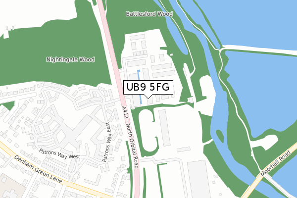
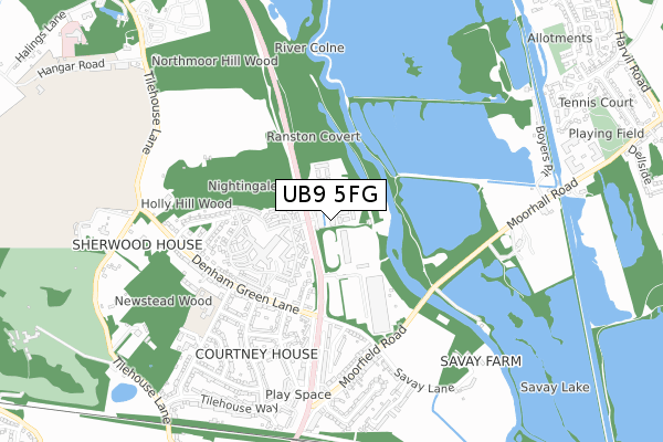
UB9 5FG is located in the Denham electoral ward, within the unitary authority of Buckinghamshire and the English Parliamentary constituency of Beaconsfield. The Sub Integrated Care Board (ICB) Location is NHS Buckinghamshire, Oxfordshire and Berkshire West ICB - 14Y and the police force is Thames Valley. This postcode has been in use since September 2018.


GetTheData
Source: OS Open Zoomstack (Ordnance Survey)
Licence: Open Government Licence (requires attribution)
Attribution: Contains OS data © Crown copyright and database right 2025
Source: Open Postcode Geo
Licence: Open Government Licence (requires attribution)
Attribution: Contains OS data © Crown copyright and database right 2025; Contains Royal Mail data © Royal Mail copyright and database right 2025; Source: Office for National Statistics licensed under the Open Government Licence v.3.0
| Easting | 504125 |
| Northing | 188581 |
| Latitude | 51.586476 |
| Longitude | -0.498449 |
GetTheData
Source: Open Postcode Geo
Licence: Open Government Licence
| Country | England |
| Postcode District | UB9 |
➜ See where UB9 is on a map | |
GetTheData
Source: Land Registry Price Paid Data
Licence: Open Government Licence
| Ward | Denham |
| Constituency | Beaconsfield |
GetTheData
Source: ONS Postcode Database
Licence: Open Government Licence
| Media Park (North Orbital Road) | Denham | 92m |
| Media Park (North Orbital Road) | Denham | 108m |
| Garden Village (Queen Mother's Drive) | Denham Green | 340m |
| Denham Green Lane (North Orbital Road) | Denham | 405m |
| Moorfield Road | Denham | 515m |
| Denham Station | 0.9km |
| Denham Golf Club Station | 1.5km |
| Gerrards Cross Station | 3.9km |
GetTheData
Source: NaPTAN
Licence: Open Government Licence
GetTheData
Source: ONS Postcode Database
Licence: Open Government Licence


➜ Get more ratings from the Food Standards Agency
GetTheData
Source: Food Standards Agency
Licence: FSA terms & conditions
| Last Collection | |||
|---|---|---|---|
| Location | Mon-Fri | Sat | Distance |
| Denham Garden Village | 16:30 | 13:00 | 252m |
| Harvil Road Post Office | 18:45 | 12:45 | 1,298m |
| Broadwater Lane | 16:30 | 12:25 | 1,350m |
GetTheData
Source: Dracos
Licence: Creative Commons Attribution-ShareAlike
The below table lists the International Territorial Level (ITL) codes (formerly Nomenclature of Territorial Units for Statistics (NUTS) codes) and Local Administrative Units (LAU) codes for UB9 5FG:
| ITL 1 Code | Name |
|---|---|
| TLJ | South East (England) |
| ITL 2 Code | Name |
| TLJ1 | Berkshire, Buckinghamshire and Oxfordshire |
| ITL 3 Code | Name |
| TLJ13 | Buckinghamshire |
| LAU 1 Code | Name |
| E06000060 | Buckinghamshire |
GetTheData
Source: ONS Postcode Directory
Licence: Open Government Licence
The below table lists the Census Output Area (OA), Lower Layer Super Output Area (LSOA), and Middle Layer Super Output Area (MSOA) for UB9 5FG:
| Code | Name | |
|---|---|---|
| OA | E00089863 | |
| LSOA | E01017810 | South Bucks 003A |
| MSOA | E02003690 | South Bucks 003 |
GetTheData
Source: ONS Postcode Directory
Licence: Open Government Licence
| UB9 5HR | Broadwater Park | 117m |
| UB9 5PP | Chairmans Walk | 188m |
| UB9 5NT | Redgrave Court | 196m |
| UB9 5NP | Patrons Way East | 205m |
| UB9 5PN | Patrons Way West | 239m |
| UB9 5NS | Olivier Court | 255m |
| UB9 5LJ | Sheepcote Gardens | 267m |
| UB9 5NY | The Eagles | 300m |
| UB9 5GF | John Mills Court | 317m |
| UB9 5PH | Patrons Way West | 319m |
GetTheData
Source: Open Postcode Geo; Land Registry Price Paid Data
Licence: Open Government Licence