UB7 7GE maps, stats, and open data
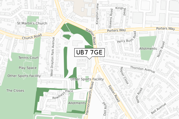
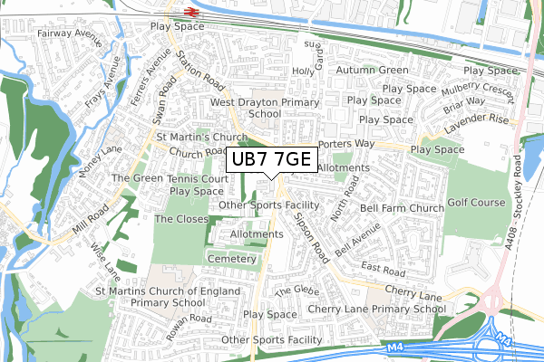
UB7 7GE is located in the West Drayton electoral ward, within the London borough of Hillingdon and the English Parliamentary constituency of Hayes and Harlington. The Sub Integrated Care Board (ICB) Location is NHS North West London ICB - W2U3Z and the police force is Metropolitan Police. This postcode has been in use since May 2018.
UB7 7GE maps


Licence: Open Government Licence (requires attribution)
Attribution: Contains OS data © Crown copyright and database right 2025
Source: Open Postcode Geo
Licence: Open Government Licence (requires attribution)
Attribution: Contains OS data © Crown copyright and database right 2025; Contains Royal Mail data © Royal Mail copyright and database right 2025; Source: Office for National Statistics licensed under the Open Government Licence v.3.0
UB7 7GE geodata
| Easting | 506471 |
| Northing | 179337 |
| Latitude | 51.502951 |
| Longitude | -0.467394 |
Where is UB7 7GE?
| Country | England |
| Postcode District | UB7 |
Politics
| Ward | West Drayton |
|---|---|
| Constituency | Hayes And Harlington |
House Prices
Sales of detached houses in UB7 7GE
47, CONSTABULARY CLOSE, WEST DRAYTON, UB7 7GE 2019 29 MAR £599,995 |
Licence: Contains HM Land Registry data © Crown copyright and database right 2025. This data is licensed under the Open Government Licence v3.0.
Transport
Nearest bus stops to UB7 7GE
| Porters Way | West Drayton | 47m |
| Porters Way | West Drayton | 75m |
| Queens Road (Ub7) (Porters Way) | West Drayton | 173m |
| Church Road (Ub7) | West Drayton | 213m |
| Kings Road (Ub7) (Porters Way) | West Drayton | 231m |
Nearest railway stations to UB7 7GE
| West Drayton Station | 0.9km |
| Iver Station | 2.8km |
| Hayes & Harlington Station | 3.2km |
Broadband
Broadband access in UB7 7GE (2020 data)
| Percentage of properties with Next Generation Access | 100.0% |
| Percentage of properties with Superfast Broadband | 100.0% |
| Percentage of properties with Ultrafast Broadband | 100.0% |
| Percentage of properties with Full Fibre Broadband | 0.0% |
Superfast Broadband is between 30Mbps and 300Mbps
Ultrafast Broadband is > 300Mbps
Broadband speed in UB7 7GE (2019 data)
Download
| Median download speed | 100.0Mbps |
| Average download speed | 124.1Mbps |
| Maximum download speed | 350.00Mbps |
Upload
| Median upload speed | 9.8Mbps |
| Average upload speed | 10.9Mbps |
| Maximum upload speed | 20.00Mbps |
Broadband limitations in UB7 7GE (2020 data)
| Percentage of properties unable to receive 2Mbps | 0.0% |
| Percentage of properties unable to receive 5Mbps | 0.0% |
| Percentage of properties unable to receive 10Mbps | 0.0% |
| Percentage of properties unable to receive 30Mbps | 0.0% |
Deprivation
54.1% of English postcodes are less deprived than UB7 7GE:Food Standards Agency
Three nearest food hygiene ratings to UB7 7GE (metres)


➜ Get more ratings from the Food Standards Agency
Nearest post box to UB7 7GE
| Last Collection | |||
|---|---|---|---|
| Location | Mon-Fri | Sat | Distance |
| Mulberry Parade Post Office | 17:15 | 12:00 | 491m |
| West Drayton Post Office | 17:10 | 12:00 | 697m |
| High Street | 18:30 | 12:30 | 942m |
UB7 7GE ITL and UB7 7GE LAU
The below table lists the International Territorial Level (ITL) codes (formerly Nomenclature of Territorial Units for Statistics (NUTS) codes) and Local Administrative Units (LAU) codes for UB7 7GE:
| ITL 1 Code | Name |
|---|---|
| TLI | London |
| ITL 2 Code | Name |
| TLI7 | Outer London - West and North West |
| ITL 3 Code | Name |
| TLI74 | Harrow and Hillingdon |
| LAU 1 Code | Name |
| E09000017 | Hillingdon |
UB7 7GE census areas
The below table lists the Census Output Area (OA), Lower Layer Super Output Area (LSOA), and Middle Layer Super Output Area (MSOA) for UB7 7GE:
| Code | Name | |
|---|---|---|
| OA | E00012574 | |
| LSOA | E01002525 | Hillingdon 029B |
| MSOA | E02000522 | Hillingdon 029 |
Nearest postcodes to UB7 7GE
| UB7 7PS | Church Road | 119m |
| UB7 9JJ | Harmondsworth Road | 124m |
| UB7 9JT | Thornton Avenue | 136m |
| UB7 9NY | Hanson Close | 148m |
| UB7 9DQ | Sipson Road | 154m |
| UB7 7QA | West Drayton Park Avenue | 187m |
| UB7 9DP | Sipson Road | 210m |
| UB7 9AT | Porters Way | 211m |
| UB7 7NL | Station Road | 218m |
| UB7 9LB | Napier Close | 219m |