TW20 0GL maps, stats, and open data
- Home
- Postcode
- TW
- TW20
- TW20 0
TW20 0GL is located in the Englefield Green West electoral ward, within the local authority district of Runnymede and the English Parliamentary constituency of Runnymede and Weybridge. The Sub Integrated Care Board (ICB) Location is NHS Frimley ICB - D4U1Y and the police force is Surrey. This postcode has been in use since January 2018.
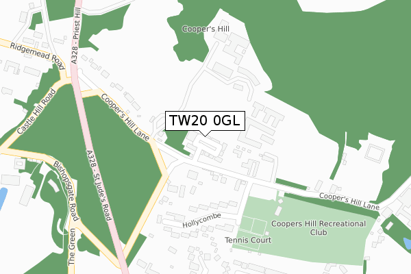
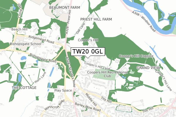
TW20 0GL maps


Source: OS Open Zoomstack (Ordnance Survey)
Licence: Open Government Licence (requires attribution)
Attribution: Contains OS data © Crown copyright and database right 2025
Source: Open Postcode GeoLicence: Open Government Licence (requires attribution)
Attribution: Contains OS data © Crown copyright and database right 2025; Contains Royal Mail data © Royal Mail copyright and database right 2025; Source: Office for National Statistics licensed under the Open Government Licence v.3.0
TW20 0GL geodata
| Easting | 499429 |
| Northing | 171997 |
| Latitude | 51.438254 |
| Longitude | -0.570881 |
Where is TW20 0GL?
| Country | England |
| Postcode District | TW20 |
Politics
| Ward | Englefield Green West |
|---|
| Constituency | Runnymede And Weybridge |
|---|
Transport
Nearest bus stops to TW20 0GL
| Coopers Hill Lane (Priest Hill) | Englefield Green | 309m |
| Middle Hill (St. Judes Road) | Englefield Green | 356m |
| Coopers Hill Lane (Priest Hill) | Englefield Green | 366m |
| Middle Hill (St. Judes Road) | Englefield Green | 448m |
| Kingswood Hall (Coopers Hill Lane) | Englefield Green | 539m |
Nearest railway stations to TW20 0GL
| Egham Station | 1.9km |
| Wraysbury Station | 3km |
| Sunnymeads Station | 3.7km |
Broadband
Broadband access in TW20 0GL (2020 data)
| Percentage of properties with Next Generation Access | 100.0% |
| Percentage of properties with Superfast Broadband | 100.0% |
| Percentage of properties with Ultrafast Broadband | 0.0% |
| Percentage of properties with Full Fibre Broadband | 0.0% |
Superfast Broadband is between 30Mbps and 300Mbps
Ultrafast Broadband is > 300Mbps
Broadband speed in TW20 0GL (2019 data)
Download
| Median download speed | 28.3Mbps |
| Average download speed | 25.5Mbps |
| Maximum download speed | 50.00Mbps |
Upload
| Median upload speed | 6.3Mbps |
| Average upload speed | 5.3Mbps |
| Maximum upload speed | 10.00Mbps |
Broadband limitations in TW20 0GL (2020 data)
| Percentage of properties unable to receive 2Mbps | 0.0% |
| Percentage of properties unable to receive 5Mbps | 0.0% |
| Percentage of properties unable to receive 10Mbps | 0.0% |
| Percentage of properties unable to receive 30Mbps | 0.0% |
Deprivation
26.9% of English postcodes are less deprived than
TW20 0GL:
Food Standards Agency
Three nearest food hygiene ratings to TW20 0GL (metres)
Manorcroft United Football Club
Coopers Hill Recreation Trust
130m
Audley Cooper's Hill
8 Bar 9 - Kingswood Hall Bar
Kingswood Hall Royal Holloway University Of London
559m
➜ Get more ratings from the Food Standards Agency
Nearest post box to TW20 0GL
| | Last Collection | |
|---|
| Location | Mon-Fri | Sat | Distance |
|---|
| Priest Hill | 16:00 | 11:00 | 365m |
| Corby Drive | 16:15 | 11:30 | 1,017m |
| Middle Hill | 17:00 | 11:45 | 1,058m |
TW20 0GL ITL and TW20 0GL LAU
The below table lists the International Territorial Level (ITL) codes (formerly Nomenclature of Territorial Units for Statistics (NUTS) codes) and Local Administrative Units (LAU) codes for TW20 0GL:
| ITL 1 Code | Name |
|---|
| TLJ | South East (England) |
| ITL 2 Code | Name |
|---|
| TLJ2 | Surrey, East and West Sussex |
| ITL 3 Code | Name |
|---|
| TLJ25 | West Surrey |
| LAU 1 Code | Name |
|---|
| E07000212 | Runnymede |
TW20 0GL census areas
The below table lists the Census Output Area (OA), Lower Layer Super Output Area (LSOA), and Middle Layer Super Output Area (MSOA) for TW20 0GL:
| Code | Name |
|---|
| OA | E00156440 | |
|---|
| LSOA | E01030673 | Runnymede 002C |
|---|
| MSOA | E02006394 | Runnymede 002 |
|---|
Nearest postcodes to TW20 0GL


