TW20 0GJ maps, stats, and open data
- Home
- Postcode
- TW
- TW20
- TW20 0
TW20 0GJ is located in the Englefield Green West electoral ward, within the local authority district of Runnymede and the English Parliamentary constituency of Runnymede and Weybridge. The Sub Integrated Care Board (ICB) Location is NHS Frimley ICB - D4U1Y and the police force is Surrey. This postcode has been in use since January 2018.
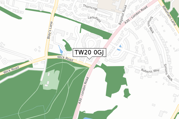
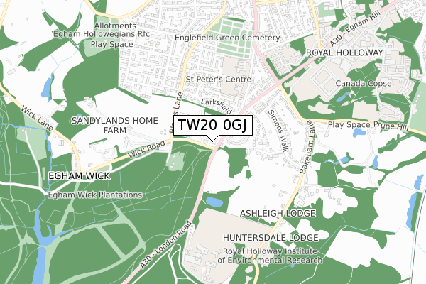
TW20 0GJ maps


Source: OS Open Zoomstack (Ordnance Survey)
Licence: Open Government Licence (requires attribution)
Attribution: Contains OS data © Crown copyright and database right 2025
Source: Open Postcode GeoLicence: Open Government Licence (requires attribution)
Attribution: Contains OS data © Crown copyright and database right 2025; Contains Royal Mail data © Royal Mail copyright and database right 2025; Source: Office for National Statistics licensed under the Open Government Licence v.3.0
TW20 0GJ geodata
| Easting | 499081 |
| Northing | 170147 |
| Latitude | 51.421685 |
| Longitude | -0.576403 |
Where is TW20 0GJ?
| Country | England |
| Postcode District | TW20 |
Politics
| Ward | Englefield Green West |
|---|
| Constituency | Runnymede And Weybridge |
|---|
Transport
Nearest bus stops to TW20 0GJ
| Elmbank Avenue | Englefield Green | 494m |
| Cherrywood Avenue | Englefield Green | 552m |
| St Jude's Cemetery (St. Judes Road) | Englefield Green | 648m |
| Founders Building (Royal Holloway College) | Englefield Green | 648m |
| St Jude's Cemetery (St. Judes Road) | Englefield Green | 666m |
Nearest railway stations to TW20 0GJ
| Egham Station | 2.3km |
| Virginia Water Station | 2.4km |
| Longcross Station | 4.3km |
Broadband
Broadband access in TW20 0GJ (2020 data)
| Percentage of properties with Next Generation Access | 100.0% |
| Percentage of properties with Superfast Broadband | 100.0% |
| Percentage of properties with Ultrafast Broadband | 0.0% |
| Percentage of properties with Full Fibre Broadband | 0.0% |
Superfast Broadband is between 30Mbps and 300Mbps
Ultrafast Broadband is > 300Mbps
Broadband speed in TW20 0GJ (2019 data)
Download
| Median download speed | 40.0Mbps |
| Average download speed | 43.4Mbps |
| Maximum download speed | 79.07Mbps |
Upload
| Median upload speed | 10.0Mbps |
| Average upload speed | 10.3Mbps |
| Maximum upload speed | 20.00Mbps |
Broadband limitations in TW20 0GJ (2020 data)
| Percentage of properties unable to receive 2Mbps | 0.0% |
| Percentage of properties unable to receive 5Mbps | 0.0% |
| Percentage of properties unable to receive 10Mbps | 0.0% |
| Percentage of properties unable to receive 30Mbps | 0.0% |
Deprivation
32.4% of English postcodes are less deprived than
TW20 0GJ:
Food Standards Agency
Three nearest food hygiene ratings to TW20 0GJ (metres)
St Cuthbert's RC Primary
St Cuthberts Roman Catholic Pr
369m
St Judes C of E School
St Judes Church Of England Sch
492m
The Gap Club at St Jude's C of E School
St Judes Church Of England Sch
492m
➜ Get more ratings from the Food Standards Agency
Nearest post box to TW20 0GJ
| | Last Collection | |
|---|
| Location | Mon-Fri | Sat | Distance |
|---|
| St Jude's Close | 16:30 | 11:30 | 683m |
| Royal Holloway College | 16:00 | 11:15 | 856m |
| Corby Drive | 16:15 | 11:30 | 1,017m |
TW20 0GJ ITL and TW20 0GJ LAU
The below table lists the International Territorial Level (ITL) codes (formerly Nomenclature of Territorial Units for Statistics (NUTS) codes) and Local Administrative Units (LAU) codes for TW20 0GJ:
| ITL 1 Code | Name |
|---|
| TLJ | South East (England) |
| ITL 2 Code | Name |
|---|
| TLJ2 | Surrey, East and West Sussex |
| ITL 3 Code | Name |
|---|
| TLJ25 | West Surrey |
| LAU 1 Code | Name |
|---|
| E07000212 | Runnymede |
TW20 0GJ census areas
The below table lists the Census Output Area (OA), Lower Layer Super Output Area (LSOA), and Middle Layer Super Output Area (MSOA) for TW20 0GJ:
| Code | Name |
|---|
| OA | E00156438 | |
|---|
| LSOA | E01030675 | Runnymede 002E |
|---|
| MSOA | E02006394 | Runnymede 002 |
|---|
Nearest postcodes to TW20 0GJ


