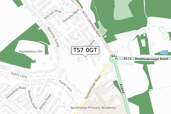
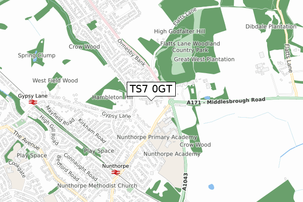
TS7 0GT is located in the Ormesby electoral ward, within the unitary authority of Redcar and Cleveland and the English Parliamentary constituency of Redcar. The Sub Integrated Care Board (ICB) Location is NHS North East and North Cumbria ICB - 16C and the police force is Cleveland. This postcode has been in use since June 2019.


GetTheData
Source: OS Open Zoomstack (Ordnance Survey)
Licence: Open Government Licence (requires attribution)
Attribution: Contains OS data © Crown copyright and database right 2025
Source: Open Postcode Geo
Licence: Open Government Licence (requires attribution)
Attribution: Contains OS data © Crown copyright and database right 2025; Contains Royal Mail data © Royal Mail copyright and database right 2025; Source: Office for National Statistics licensed under the Open Government Licence v.3.0
| Easting | 454156 |
| Northing | 515576 |
| Latitude | 54.532586 |
| Longitude | -1.164638 |
GetTheData
Source: Open Postcode Geo
Licence: Open Government Licence
| Country | England |
| Postcode District | TS7 |
➜ See where TS7 is on a map ➜ Where is Middlesbrough? | |
GetTheData
Source: Land Registry Price Paid Data
Licence: Open Government Licence
| Ward | Ormesby |
| Constituency | Redcar |
GetTheData
Source: ONS Postcode Database
Licence: Open Government Licence
2025 24 JAN £415,000 |
24, DIBDALE GARDENS, NUNTHORPE, MIDDLESBROUGH, TS7 0GT 2025 13 JAN £415,000 |
25, DIBDALE GARDENS, NUNTHORPE, MIDDLESBROUGH, TS7 0GT 2024 28 FEB £308,995 |
19, DIBDALE GARDENS, NUNTHORPE, MIDDLESBROUGH, TS7 0GT 2023 11 AUG £351,496 |
11, DIBDALE GARDENS, NUNTHORPE, MIDDLESBROUGH, TS7 0GT 2023 15 JUN £454,995 |
17, DIBDALE GARDENS, NUNTHORPE, MIDDLESBROUGH, TS7 0GT 2023 26 MAY £347,995 |
15, DIBDALE GARDENS, NUNTHORPE, MIDDLESBROUGH, TS7 0GT 2023 12 MAY £479,995 |
21, DIBDALE GARDENS, NUNTHORPE, MIDDLESBROUGH, TS7 0GT 2023 14 APR £459,995 |
23, DIBDALE GARDENS, NUNTHORPE, MIDDLESBROUGH, TS7 0GT 2023 21 MAR £306,995 |
27, DIBDALE GARDENS, NUNTHORPE, MIDDLESBROUGH, TS7 0GT 2023 10 MAR £317,995 |
GetTheData
Source: HM Land Registry Price Paid Data
Licence: Contains HM Land Registry data © Crown copyright and database right 2025. This data is licensed under the Open Government Licence v3.0.
| Swans Corner (Guisborough Road) | Nunthorpe | 80m |
| Swans Corner (Guisborough Road) | Nunthorpe | 82m |
| Swans Corner (Ormesby Bank) | Nunthorpe | 168m |
| Swans Corner (Ormesby Bank) | Nunthorpe | 192m |
| Gypsy Lane (Guisborough Road) | Nunthorpe | 235m |
| Nunthorpe Station | 0.6km |
| Gypsy Lane Station | 1km |
| Marton Station | 2.6km |
GetTheData
Source: NaPTAN
Licence: Open Government Licence
GetTheData
Source: ONS Postcode Database
Licence: Open Government Licence


➜ Get more ratings from the Food Standards Agency
GetTheData
Source: Food Standards Agency
Licence: FSA terms & conditions
| Last Collection | |||
|---|---|---|---|
| Location | Mon-Fri | Sat | Distance |
| Ormesby Bank | 17:15 | 11:15 | 919m |
| Grey Towers | 16:45 | 09:00 | 1,473m |
| The Avenue, South Bank | 17:45 | 12:45 | 2,924m |
GetTheData
Source: Dracos
Licence: Creative Commons Attribution-ShareAlike
The below table lists the International Territorial Level (ITL) codes (formerly Nomenclature of Territorial Units for Statistics (NUTS) codes) and Local Administrative Units (LAU) codes for TS7 0GT:
| ITL 1 Code | Name |
|---|---|
| TLC | North East (England) |
| ITL 2 Code | Name |
| TLC1 | Tees Valley and Durham |
| ITL 3 Code | Name |
| TLC12 | South Teesside |
| LAU 1 Code | Name |
| E06000003 | Redcar and Cleveland |
GetTheData
Source: ONS Postcode Directory
Licence: Open Government Licence
The below table lists the Census Output Area (OA), Lower Layer Super Output Area (LSOA), and Middle Layer Super Output Area (MSOA) for TS7 0GT:
| Code | Name | |
|---|---|---|
| OA | E00061273 | |
| LSOA | E01012152 | Redcar and Cleveland 021D |
| MSOA | E02006812 | Redcar and Cleveland 021 |
GetTheData
Source: ONS Postcode Directory
Licence: Open Government Licence
| TS7 0LE | Guisborough Road | 91m |
| TS7 0LA | Guisborough Road | 101m |
| TS7 0DR | Gypsy Lane | 185m |
| TS7 0LB | Guisborough Road | 208m |
| TS7 0LL | Rothesay Grove | 255m |
| TS7 0LF | Rothesay Grove | 264m |
| TS7 0DS | Gypsy Lane | 283m |
| TS7 0JY | Guisborough Road | 296m |
| TS7 0DT | Beadlam Avenue | 297m |
| TS7 0HX | Ripon Road | 300m |
GetTheData
Source: Open Postcode Geo; Land Registry Price Paid Data
Licence: Open Government Licence