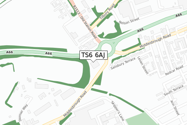
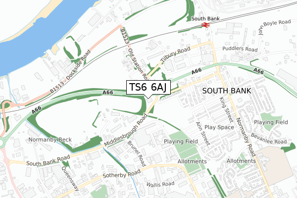
TS6 6AJ is located in the South Bank electoral ward, within the unitary authority of Redcar and Cleveland and the English Parliamentary constituency of Redcar. The Sub Integrated Care Board (ICB) Location is NHS North East and North Cumbria ICB - 16C and the police force is Cleveland. This postcode has been in use since June 2019.


GetTheData
Source: OS Open Zoomstack (Ordnance Survey)
Licence: Open Government Licence (requires attribution)
Attribution: Contains OS data © Crown copyright and database right 2025
Source: Open Postcode Geo
Licence: Open Government Licence (requires attribution)
Attribution: Contains OS data © Crown copyright and database right 2025; Contains Royal Mail data © Royal Mail copyright and database right 2025; Source: Office for National Statistics licensed under the Open Government Licence v.3.0
| Easting | 452829 |
| Northing | 520657 |
| Latitude | 54.578383 |
| Longitude | -1.184232 |
GetTheData
Source: Open Postcode Geo
Licence: Open Government Licence
| Country | England |
| Postcode District | TS6 |
➜ See where TS6 is on a map ➜ Where is South Bank? | |
GetTheData
Source: Land Registry Price Paid Data
Licence: Open Government Licence
| Ward | South Bank |
| Constituency | Redcar |
GetTheData
Source: ONS Postcode Database
Licence: Open Government Licence
| Imperial Food Park (Tilbury Road) | Skippers Lane Ind Est | 228m |
| Station Road (Middlesbrough Road) | South Bank | 253m |
| Station Road (Middlesbrough Road) | South Bank | 260m |
| Imperial Food Park (Tilbury Road) | Skippers Lane Ind Est | 373m |
| St Peters Church (Middlesbrough Road) | South Bank | 440m |
| South Bank Station | 0.8km |
| Middlesbrough Station | 3.3km |
| James Cook University Hospital Station | 3.3km |
GetTheData
Source: NaPTAN
Licence: Open Government Licence
GetTheData
Source: ONS Postcode Database
Licence: Open Government Licence


➜ Get more ratings from the Food Standards Agency
GetTheData
Source: Food Standards Agency
Licence: FSA terms & conditions
| Last Collection | |||
|---|---|---|---|
| Location | Mon-Fri | Sat | Distance |
| Birchington Avenue P.o. | 17:00 | 12:15 | 1,869m |
| North Ormesby Post Office | 18:00 | 12:15 | 2,078m |
| Westerdale Road | 17:45 | 11:45 | 2,320m |
GetTheData
Source: Dracos
Licence: Creative Commons Attribution-ShareAlike
The below table lists the International Territorial Level (ITL) codes (formerly Nomenclature of Territorial Units for Statistics (NUTS) codes) and Local Administrative Units (LAU) codes for TS6 6AJ:
| ITL 1 Code | Name |
|---|---|
| TLC | North East (England) |
| ITL 2 Code | Name |
| TLC1 | Tees Valley and Durham |
| ITL 3 Code | Name |
| TLC12 | South Teesside |
| LAU 1 Code | Name |
| E06000003 | Redcar and Cleveland |
GetTheData
Source: ONS Postcode Directory
Licence: Open Government Licence
The below table lists the Census Output Area (OA), Lower Layer Super Output Area (LSOA), and Middle Layer Super Output Area (MSOA) for TS6 6AJ:
| Code | Name | |
|---|---|---|
| OA | E00174123 | |
| LSOA | E01033470 | Redcar and Cleveland 022G |
| MSOA | E02006910 | Redcar and Cleveland 022 |
GetTheData
Source: ONS Postcode Directory
Licence: Open Government Licence
| TS6 6EX | Salisbury Terrace | 207m |
| TS6 6EB | Tyne Street | 273m |
| TS6 6XH | Dormor Way | 320m |
| TS6 6HE | Owens Road | 332m |
| TS6 6EH | Upper Princess Street | 343m |
| TS6 6LZ | Middlesbrough Road | 344m |
| TS6 6HX | Owens Road | 364m |
| TS6 6EF | Upper Oxford Street | 367m |
| TS6 6HH | South Terrace | 411m |
| TS6 6JD | Ann Street | 411m |
GetTheData
Source: Open Postcode Geo; Land Registry Price Paid Data
Licence: Open Government Licence