TS5 8BF maps, stats, and open data
TS5 8BF is located in the Trimdon electoral ward, within the unitary authority of Middlesbrough and the English Parliamentary constituency of Middlesbrough. The Sub Integrated Care Board (ICB) Location is NHS North East and North Cumbria ICB - 16C and the police force is Cleveland. This postcode has been in use since July 2018.
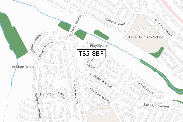
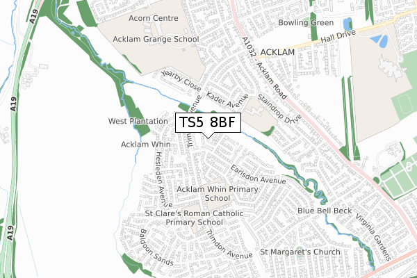
TS5 8BF maps


Licence: Open Government Licence (requires attribution)
Attribution: Contains OS data © Crown copyright and database right 2025
Source: Open Postcode Geo
Licence: Open Government Licence (requires attribution)
Attribution: Contains OS data © Crown copyright and database right 2025; Contains Royal Mail data © Royal Mail copyright and database right 2025; Source: Office for National Statistics licensed under the Open Government Licence v.3.0
TS5 8BF geodata
| Easting | 447903 |
| Northing | 516167 |
| Latitude | 54.538525 |
| Longitude | -1.261162 |
Where is TS5 8BF?
| Country | England |
| Postcode District | TS5 |
Politics
| Ward | Trimdon |
|---|---|
| Constituency | Middlesbrough |
House Prices
Sales of detached houses in TS5 8BF
2025 7 FEB £250,000 |
2024 13 NOV £190,000 |
2023 30 NOV £215,000 |
2020 6 NOV £224,950 |
2020 8 JUL £174,000 |
21, ACORN DRIVE, MIDDLESBROUGH, TS5 8BF 2019 4 JUL £204,950 |
11, ACORN DRIVE, MIDDLESBROUGH, TS5 8BF 2019 28 JUN £164,950 |
18, ACORN DRIVE, MIDDLESBROUGH, TS5 8BF 2019 28 JUN £229,950 |
23, ACORN DRIVE, MIDDLESBROUGH, TS5 8BF 2019 28 JUN £224,950 |
22, ACORN DRIVE, MIDDLESBROUGH, TS5 8BF 2019 28 JUN £209,950 |
Licence: Contains HM Land Registry data © Crown copyright and database right 2025. This data is licensed under the Open Government Licence v3.0.
Transport
Nearest bus stops to TS5 8BF
| Trimdon Avenue Shops (Trimdon Avenue) | Brookfield | 96m |
| Trimdon Avenue Shops (Earlsdon Avenue) | Brookfield | 107m |
| Trimdon Avenue Shops (Trimdon Avenue) | Brookfield | 148m |
| Blue Bell Beck (Trimdon Avenue) | Brookfield | 151m |
| Blue Bell Beck (Trimdon Avenue) | Brookfield | 184m |
Nearest railway stations to TS5 8BF
| Thornaby Station | 3.5km |
| James Cook University Hospital Station | 3.7km |
| Marton Station | 4.1km |
Broadband
Broadband access in TS5 8BF (2020 data)
| Percentage of properties with Next Generation Access | 100.0% |
| Percentage of properties with Superfast Broadband | 100.0% |
| Percentage of properties with Ultrafast Broadband | 100.0% |
| Percentage of properties with Full Fibre Broadband | 100.0% |
Superfast Broadband is between 30Mbps and 300Mbps
Ultrafast Broadband is > 300Mbps
Broadband limitations in TS5 8BF (2020 data)
| Percentage of properties unable to receive 2Mbps | 0.0% |
| Percentage of properties unable to receive 5Mbps | 0.0% |
| Percentage of properties unable to receive 10Mbps | 0.0% |
| Percentage of properties unable to receive 30Mbps | 0.0% |
Deprivation
29.8% of English postcodes are less deprived than TS5 8BF:Food Standards Agency
Three nearest food hygiene ratings to TS5 8BF (metres)


➜ Get more ratings from the Food Standards Agency
Nearest post box to TS5 8BF
| Last Collection | |||
|---|---|---|---|
| Location | Mon-Fri | Sat | Distance |
| Acklam Road Post Office | 18:00 | 12:00 | 848m |
| Brookfield Post Office | 17:00 | 12:00 | 971m |
| Low Lane | 17:15 | 12:30 | 1,244m |
TS5 8BF ITL and TS5 8BF LAU
The below table lists the International Territorial Level (ITL) codes (formerly Nomenclature of Territorial Units for Statistics (NUTS) codes) and Local Administrative Units (LAU) codes for TS5 8BF:
| ITL 1 Code | Name |
|---|---|
| TLC | North East (England) |
| ITL 2 Code | Name |
| TLC1 | Tees Valley and Durham |
| ITL 3 Code | Name |
| TLC12 | South Teesside |
| LAU 1 Code | Name |
| E06000002 | Middlesbrough |
TS5 8BF census areas
The below table lists the Census Output Area (OA), Lower Layer Super Output Area (LSOA), and Middle Layer Super Output Area (MSOA) for TS5 8BF:
| Code | Name | |
|---|---|---|
| OA | E00060644 | |
| LSOA | E01012024 | Middlesbrough 015C |
| MSOA | E02002510 | Middlesbrough 015 |
Nearest postcodes to TS5 8BF
| TS5 8SB | Trimdon Avenue | 73m |
| TS5 8SF | Swainston Close | 86m |
| TS5 8SA | Trimdon Avenue | 121m |
| TS5 8TA | Earlsdon Avenue | 128m |
| TS5 8SD | Earlsdon Avenue | 154m |
| TS5 8RA | Trimdon Avenue | 156m |
| TS5 8SL | Brusselton Close | 156m |
| TS5 8SN | Brafferton Walk | 175m |
| TS5 8SE | Carlbury Avenue | 183m |
| TS5 8RG | Wellspring Close | 191m |