TS28 5GY maps, stats, and open data
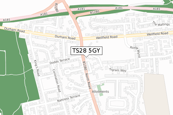
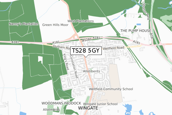
TS28 5GY is located in the Wingate electoral ward, within the unitary authority of County Durham and the English Parliamentary constituency of Sedgefield. The Sub Integrated Care Board (ICB) Location is NHS North East and North Cumbria ICB - 84H and the police force is Durham. This postcode has been in use since September 2017.
TS28 5GY maps


Licence: Open Government Licence (requires attribution)
Attribution: Contains OS data © Crown copyright and database right 2025
Source: Open Postcode Geo
Licence: Open Government Licence (requires attribution)
Attribution: Contains OS data © Crown copyright and database right 2025; Contains Royal Mail data © Royal Mail copyright and database right 2025; Source: Office for National Statistics licensed under the Open Government Licence v.3.0
TS28 5GY geodata
| Easting | 440000 |
| Northing | 538103 |
| Latitude | 54.736327 |
| Longitude | -1.380309 |
Where is TS28 5GY?
| Country | England |
| Postcode District | TS28 |
Politics
| Ward | Wingate |
|---|---|
| Constituency | Sedgefield |
House Prices
Sales of detached houses in TS28 5GY
LAUREL HOUSE, 6, THE VILLAGE GREEN, WINGATE, TS28 5GY 2024 21 AUG £210,000 |
6, THE VILLAGE GREEN, WINGATE, TS28 5GY 2017 22 SEP £169,950 |
Licence: Contains HM Land Registry data © Crown copyright and database right 2025. This data is licensed under the Open Government Licence v3.0.
Transport
Nearest bus stops to TS28 5GY
| Fir Tree Inn (North Road) | Wingate | 33m |
| Fir Tree Inn (North Road) | Wingate | 59m |
| Dairy (Wellfield Road) | Wellfield | 220m |
| Dairy (Wellfield Road) | Wellfield | 283m |
| Cross Row (North Road) | Wingate | 284m |
Broadband
Broadband access in TS28 5GY (2020 data)
| Percentage of properties with Next Generation Access | 100.0% |
| Percentage of properties with Superfast Broadband | 100.0% |
| Percentage of properties with Ultrafast Broadband | 0.0% |
| Percentage of properties with Full Fibre Broadband | 0.0% |
Superfast Broadband is between 30Mbps and 300Mbps
Ultrafast Broadband is > 300Mbps
Broadband limitations in TS28 5GY (2020 data)
| Percentage of properties unable to receive 2Mbps | 0.0% |
| Percentage of properties unable to receive 5Mbps | 0.0% |
| Percentage of properties unable to receive 10Mbps | 0.0% |
| Percentage of properties unable to receive 30Mbps | 0.0% |
Deprivation
87.1% of English postcodes are less deprived than TS28 5GY:Food Standards Agency
Three nearest food hygiene ratings to TS28 5GY (metres)


➜ Get more ratings from the Food Standards Agency
Nearest post box to TS28 5GY
| Last Collection | |||
|---|---|---|---|
| Location | Mon-Fri | Sat | Distance |
| Wellfield | 16:30 | 09:00 | 588m |
| Newlands Road | 16:30 | 09:30 | 3,055m |
| O'neill Drive | 17:15 | 13:15 | 3,435m |
TS28 5GY ITL and TS28 5GY LAU
The below table lists the International Territorial Level (ITL) codes (formerly Nomenclature of Territorial Units for Statistics (NUTS) codes) and Local Administrative Units (LAU) codes for TS28 5GY:
| ITL 1 Code | Name |
|---|---|
| TLC | North East (England) |
| ITL 2 Code | Name |
| TLC1 | Tees Valley and Durham |
| ITL 3 Code | Name |
| TLC14 | Durham |
| LAU 1 Code | Name |
| E06000047 | County Durham |
TS28 5GY census areas
The below table lists the Census Output Area (OA), Lower Layer Super Output Area (LSOA), and Middle Layer Super Output Area (MSOA) for TS28 5GY:
| Code | Name | |
|---|---|---|
| OA | E00105520 | |
| LSOA | E01020793 | County Durham 043B |
| MSOA | E02004332 | County Durham 043 |
Nearest postcodes to TS28 5GY
| TS28 5JB | Salters Lane | 49m |
| TS28 5LF | Burdon Crescent | 51m |
| TS28 5HZ | Granby Terrace | 64m |
| TS28 5HX | Salters Lane | 75m |
| TS28 5HU | Dodds Terrace | 99m |
| TS28 5JA | Dobson Terrace | 113m |
| TS28 5BN | Salters Lane | 140m |
| TS28 5HT | Walton Terrace | 156m |
| TS28 5JZ | Wellfield Road North | 171m |
| TS28 5LL | Whingrove Close | 186m |