Property/Postcode Data Search:
TS26 0FQ maps, stats, and open data
TS26 0FQ is located in the Rural West electoral ward, within the unitary authority of Hartlepool and the English Parliamentary constituency of Hartlepool. The Sub Integrated Care Board (ICB) Location is NHS North East and North Cumbria ICB - 16C and the police force is Cleveland. This postcode has been in use since December 2019.
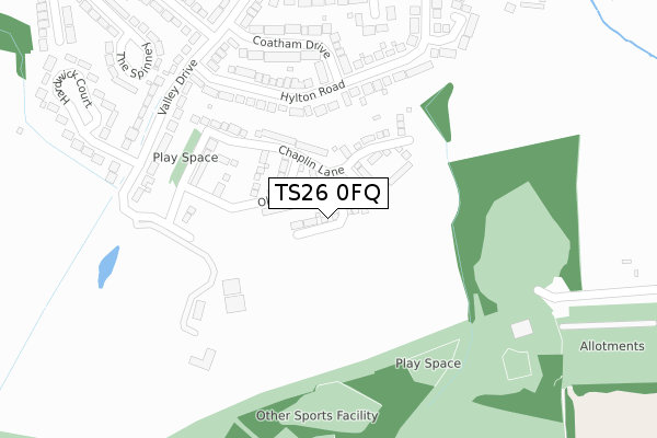
TS26 0FQ maps


Source: OS Open Zoomstack (Ordnance Survey)
Licence: Open Government Licence (requires attribution)
Attribution: Contains OS data © Crown copyright and database right 2025
Source: Open Postcode Geo
Licence: Open Government Licence (requires attribution)
Attribution: Contains OS data © Crown copyright and database right 2025; Contains Royal Mail data © Royal Mail copyright and database right 2025; Source: Office for National Statistics licensed under the Open Government Licence v.3.0
Licence: Open Government Licence (requires attribution)
Attribution: Contains OS data © Crown copyright and database right 2025
Source: Open Postcode Geo
Licence: Open Government Licence (requires attribution)
Attribution: Contains OS data © Crown copyright and database right 2025; Contains Royal Mail data © Royal Mail copyright and database right 2025; Source: Office for National Statistics licensed under the Open Government Licence v.3.0
TS26 0FQ geodata
| Easting | 448586 |
| Northing | 531767 |
| Latitude | 54.678639 |
| Longitude | -1.248029 |
Where is TS26 0FQ?
| Country | England |
| Postcode District | TS26 |
Politics
| Ward | Rural West |
|---|---|
| Constituency | Hartlepool |
House Prices
Sales of detached houses in TS26 0FQ
2023 17 FEB £340,000 |
3, REDGRAVE AVENUE, HARTLEPOOL, TS26 0FQ 2021 22 APR £300,000 |
2, REDGRAVE AVENUE, HARTLEPOOL, TS26 0FQ 2021 21 JAN £372,995 |
1, REDGRAVE AVENUE, HARTLEPOOL, TS26 0FQ 2020 4 DEC £309,995 |
4, REDGRAVE AVENUE, HARTLEPOOL, TS26 0FQ 2020 27 NOV £292,995 |
5, REDGRAVE AVENUE, HARTLEPOOL, TS26 0FQ 2020 26 NOV £315,000 |
10, REDGRAVE AVENUE, HARTLEPOOL, TS26 0FQ 2020 19 NOV £283,000 |
7, REDGRAVE AVENUE, HARTLEPOOL, TS26 0FQ 2020 9 NOV £381,995 |
6, REDGRAVE AVENUE, HARTLEPOOL, TS26 0FQ 2020 23 OCT £271,995 |
2020 24 AUG £302,500 |
Source: HM Land Registry Price Paid Data
Licence: Contains HM Land Registry data © Crown copyright and database right 2025. This data is licensed under the Open Government Licence v3.0.
Licence: Contains HM Land Registry data © Crown copyright and database right 2025. This data is licensed under the Open Government Licence v3.0.
Transport
Nearest bus stops to TS26 0FQ
| Summerhill Park (Summerhill Lane) | Rifthouse | 434m |
| Egerton Road | West Park | 607m |
| Coniscliffe Road (West Park) | West Park | 608m |
| Coniscliffe Road (West Park) | West Park | 627m |
| Egerton Road | West Park | 637m |
Nearest railway stations to TS26 0FQ
| Hartlepool Station | 2.8km |
| Seaton Carew Station | 3.8km |
Deprivation
10.7% of English postcodes are less deprived than TS26 0FQ:Food Standards Agency
Three nearest food hygiene ratings to TS26 0FQ (metres)
Daisy & Bea's @ Summerhill

Summerhill Visitor Centre
371m
Elwick Grange

Elwick Road
592m
Rift House Primary School

Masefield Road
733m
➜ Get more ratings from the Food Standards Agency
Nearest post box to TS26 0FQ
| Last Collection | |||
|---|---|---|---|
| Location | Mon-Fri | Sat | Distance |
| Rosebank, Ellwick Road | 18:00 | 12:30 | 1,103m |
| Eldon Grove Park Road | 18:00 | 12:30 | 1,390m |
| Elm Grove | 17:30 | 12:30 | 1,447m |
TS26 0FQ ITL and TS26 0FQ LAU
The below table lists the International Territorial Level (ITL) codes (formerly Nomenclature of Territorial Units for Statistics (NUTS) codes) and Local Administrative Units (LAU) codes for TS26 0FQ:
| ITL 1 Code | Name |
|---|---|
| TLC | North East (England) |
| ITL 2 Code | Name |
| TLC1 | Tees Valley and Durham |
| ITL 3 Code | Name |
| TLC11 | Hartlepool and Stockton-on-Tees |
| LAU 1 Code | Name |
| E06000001 | Hartlepool |
TS26 0FQ census areas
The below table lists the Census Output Area (OA), Lower Layer Super Output Area (LSOA), and Middle Layer Super Output Area (MSOA) for TS26 0FQ:
| Code | Name | |
|---|---|---|
| OA | E00060427 | |
| LSOA | E01011982 | Hartlepool 014E |
| MSOA | E02006909 | Hartlepool 014 |
Nearest postcodes to TS26 0FQ
| TS26 0AH | Hylton Road | 229m |
| TS26 0AQ | Coatham Drive | 260m |
| TS26 0AJ | Valley Drive | 286m |
| TS26 0AL | Valley Drive | 294m |
| TS26 0AG | Hylton Road | 332m |
| TS26 0AT | Valley Drive | 334m |
| TS26 0AY | Meadow Drive | 355m |
| TS26 0AS | Parklands Way | 383m |
| TS26 0AZ | Hardwick Court | 395m |
| TS26 0AW | The Spinney | 413m |