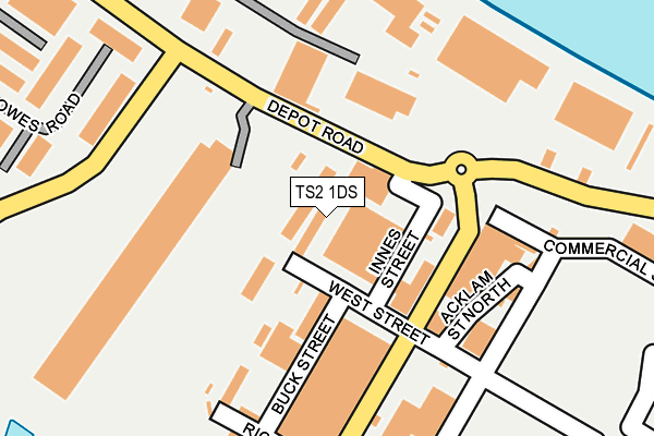
TS2 1DS is located in the Central electoral ward, within the unitary authority of Middlesbrough and the English Parliamentary constituency of Middlesbrough. The Sub Integrated Care Board (ICB) Location is NHS North East and North Cumbria ICB - 16C and the police force is Cleveland. This postcode has been in use since April 2017.


GetTheData
Source: OS OpenMap – Local (Ordnance Survey)
Source: OS VectorMap District (Ordnance Survey)
Licence: Open Government Licence (requires attribution)
| Easting | 449254 |
| Northing | 521284 |
| Latitude | 54.584377 |
| Longitude | -1.239430 |
GetTheData
Source: Open Postcode Geo
Licence: Open Government Licence
| Country | England |
| Postcode District | TS2 |
➜ See where TS2 is on a map ➜ Where is Middlesbrough? | |
GetTheData
Source: Land Registry Price Paid Data
Licence: Open Government Licence
| Ward | Central |
| Constituency | Middlesbrough |
GetTheData
Source: ONS Postcode Database
Licence: Open Government Licence
| Vulcan Street Roundabout (Vulcan Street) | Middlesbrough | 214m |
| Av Dawson (Riverside Park Road) | Middlesbrough | 216m |
| Av Dawson (Riverside Park Road) | Middlesbrough | 220m |
| Dawsons (Snowdon Road) | Middlesbrough | 277m |
| Dawsons (Snowdon Road) | Middlesbrough | 311m |
| Middlesbrough Station | 0.7km |
| Billingham Station | 3.5km |
| South Bank Station | 4.1km |
GetTheData
Source: NaPTAN
Licence: Open Government Licence
GetTheData
Source: ONS Postcode Database
Licence: Open Government Licence


➜ Get more ratings from the Food Standards Agency
GetTheData
Source: Food Standards Agency
Licence: FSA terms & conditions
| Last Collection | |||
|---|---|---|---|
| Location | Mon-Fri | Sat | Distance |
| Queens Square | 18:30 | 12:45 | 632m |
| Railway Station | 18:30 | 12:00 | 682m |
| High Clarence Post Office | 18:30 | 11:45 | 791m |
GetTheData
Source: Dracos
Licence: Creative Commons Attribution-ShareAlike
The below table lists the International Territorial Level (ITL) codes (formerly Nomenclature of Territorial Units for Statistics (NUTS) codes) and Local Administrative Units (LAU) codes for TS2 1DS:
| ITL 1 Code | Name |
|---|---|
| TLC | North East (England) |
| ITL 2 Code | Name |
| TLC1 | Tees Valley and Durham |
| ITL 3 Code | Name |
| TLC12 | South Teesside |
| LAU 1 Code | Name |
| E06000002 | Middlesbrough |
GetTheData
Source: ONS Postcode Directory
Licence: Open Government Licence
The below table lists the Census Output Area (OA), Lower Layer Super Output Area (LSOA), and Middle Layer Super Output Area (MSOA) for TS2 1DS:
| Code | Name | |
|---|---|---|
| OA | E00174105 | |
| LSOA | E01033468 | Middlesbrough 001G |
| MSOA | E02002496 | Middlesbrough 001 |
GetTheData
Source: ONS Postcode Directory
Licence: Open Government Licence
| TS2 1LF | Stockton Street | 166m |
| TS2 1LZ | West Street | 186m |
| TS2 1BU | Stockton Street | 293m |
| TS2 1LU | Bowes Road | 344m |
| TS2 1DW | Washington Street | 366m |
| TS2 1LP | Snowdon Road | 391m |
| TS2 1DR | Florence Street | 422m |
| TS2 1BY | Stockton Street | 450m |
| TS2 1DE | North Road | 573m |
| TS2 1AA | Queens Square | 620m |
GetTheData
Source: Open Postcode Geo; Land Registry Price Paid Data
Licence: Open Government Licence