TS19 8GN maps, stats, and open data
- Home
- Postcode
- TS
- TS19
- TS19 8
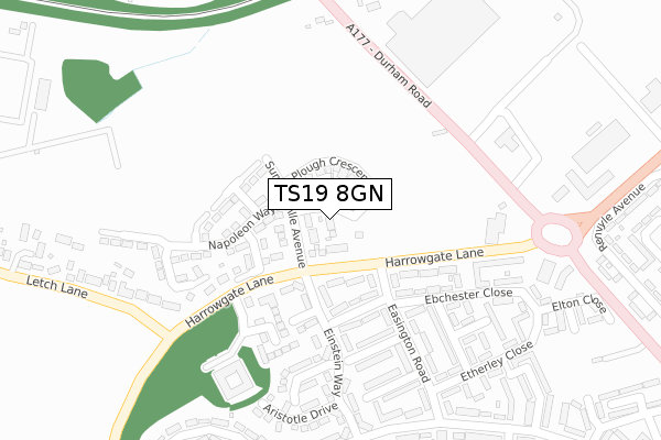
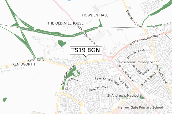
TS19 8GN lies on Piper Knowle View in Stockton-on-tees. TS19 8GN is located in the Hardwick & Salters Lane electoral ward, within the unitary authority of Stockton-on-Tees and the English Parliamentary constituency of Stockton North. The Sub Integrated Care Board (ICB) Location is NHS North East and North Cumbria ICB - 16C and the police force is Cleveland. This postcode has been in use since February 2019.
TS19 8GN maps


Source: OS Open Zoomstack (Ordnance Survey)
Licence: Open Government Licence (requires attribution)
Attribution: Contains OS data © Crown copyright and database right 2025
Source: Open Postcode GeoLicence: Open Government Licence (requires attribution)
Attribution: Contains OS data © Crown copyright and database right 2025; Contains Royal Mail data © Royal Mail copyright and database right 2025; Source: Office for National Statistics licensed under the Open Government Licence v.3.0
TS19 8GN geodata
| Easting | 441737 |
| Northing | 521855 |
| Latitude | 54.590182 |
| Longitude | -1.355648 |
Where is TS19 8GN?
| Street | Piper Knowle View |
| Town/City | Stockton-on-tees |
| Country | England |
| Postcode District | TS19 |
Politics
| Ward | Hardwick & Salters Lane |
|---|
| Constituency | Stockton North |
|---|
Transport
Nearest bus stops to TS19 8GN
| Easington Road End (Harrowgate Lane) | Hardwick | 84m |
| Easington Road End (Harrowgate Lane) | Hardwick | 100m |
| Elwick Close (Easington Road) | Hardwick | 124m |
| Elwick Close (Easington Road) | Hardwick | 196m |
| Summerville Farm (Durham Road) | Hardwick | 239m |
Nearest railway stations to TS19 8GN
| Stockton Station | 3.3km |
| Thornaby Station | 4.9km |
| Billingham Station | 5.2km |
Broadband
Broadband access in TS19 8GN (2020 data)
| Percentage of properties with Next Generation Access | 100.0% |
| Percentage of properties with Superfast Broadband | 100.0% |
| Percentage of properties with Ultrafast Broadband | 100.0% |
| Percentage of properties with Full Fibre Broadband | 100.0% |
Superfast Broadband is between 30Mbps and 300Mbps
Ultrafast Broadband is > 300Mbps
Broadband limitations in TS19 8GN (2020 data)
| Percentage of properties unable to receive 2Mbps | 0.0% |
| Percentage of properties unable to receive 5Mbps | 0.0% |
| Percentage of properties unable to receive 10Mbps | 0.0% |
| Percentage of properties unable to receive 30Mbps | 0.0% |
Deprivation
94% of English postcodes are less deprived than
TS19 8GN:
Food Standards Agency
Three nearest food hygiene ratings to TS19 8GN (metres)
Horse & Jockey
M&S Local
Stockton Lodge Care Home - Elysium Care Limited
➜ Get more ratings from the Food Standards Agency
Nearest post box to TS19 8GN
| | Last Collection | |
|---|
| Location | Mon-Fri | Sat | Distance |
|---|
| Elm Tree Avenue | 16:45 | 11:45 | 1,925m |
| Thorpe Thewles | 16:00 | 11:00 | 2,263m |
| Norton Green | 17:30 | 12:30 | 2,780m |
TS19 8GN ITL and TS19 8GN LAU
The below table lists the International Territorial Level (ITL) codes (formerly Nomenclature of Territorial Units for Statistics (NUTS) codes) and Local Administrative Units (LAU) codes for TS19 8GN:
| ITL 1 Code | Name |
|---|
| TLC | North East (England) |
| ITL 2 Code | Name |
|---|
| TLC1 | Tees Valley and Durham |
| ITL 3 Code | Name |
|---|
| TLC11 | Hartlepool and Stockton-on-Tees |
| LAU 1 Code | Name |
|---|
| E06000004 | Stockton-on-Tees |
TS19 8GN census areas
The below table lists the Census Output Area (OA), Lower Layer Super Output Area (LSOA), and Middle Layer Super Output Area (MSOA) for TS19 8GN:
| Code | Name |
|---|
| OA | E00061772 | |
|---|
| LSOA | E01012250 | Stockton-on-Tees 009E |
|---|
| MSOA | E02002543 | Stockton-on-Tees 009 |
|---|
Nearest postcodes to TS19 8GN


