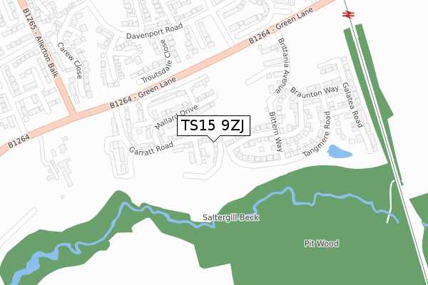
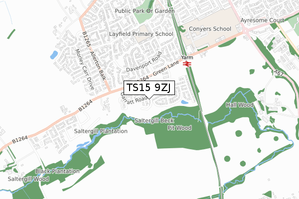
TS15 9ZJ is located in the Yarm electoral ward, within the unitary authority of Stockton-on-Tees and the English Parliamentary constituency of Stockton South. The Sub Integrated Care Board (ICB) Location is NHS North East and North Cumbria ICB - 16C and the police force is Cleveland. This postcode has been in use since April 2020.


GetTheData
Source: OS Open Zoomstack (Ordnance Survey)
Licence: Open Government Licence (requires attribution)
Attribution: Contains OS data © Crown copyright and database right 2025
Source: Open Postcode Geo
Licence: Open Government Licence (requires attribution)
Attribution: Contains OS data © Crown copyright and database right 2025; Contains Royal Mail data © Royal Mail copyright and database right 2025; Source: Office for National Statistics licensed under the Open Government Licence v.3.0
| Easting | 441736 |
| Northing | 510779 |
| Latitude | 54.490650 |
| Longitude | -1.357228 |
GetTheData
Source: Open Postcode Geo
Licence: Open Government Licence
| Country | England |
| Postcode District | TS15 |
➜ See where TS15 is on a map ➜ Where is Yarm? | |
GetTheData
Source: Land Registry Price Paid Data
Licence: Open Government Licence
| Ward | Yarm |
| Constituency | Stockton South |
GetTheData
Source: ONS Postcode Database
Licence: Open Government Licence
7, KINGSTON WAY, YARM, TS15 9ZJ 2024 26 FEB £362,995 |
2023 8 SEP £345,000 |
6, KINGSTON WAY, YARM, TS15 9ZJ 2021 24 SEP £274,995 |
4, KINGSTON WAY, YARM, TS15 9ZJ 2021 24 SEP £274,995 |
8, KINGSTON WAY, YARM, TS15 9ZJ 2021 6 AUG £318,245 |
10, KINGSTON WAY, YARM, TS15 9ZJ 2021 30 JUL £308,745 |
2, KINGSTON WAY, YARM, TS15 9ZJ 2021 30 JUL £269,995 |
3, KINGSTON WAY, YARM, TS15 9ZJ 2021 25 JUN £269,995 |
5, KINGSTON WAY, YARM, TS15 9ZJ 2021 26 MAR £334,995 |
15, KINGSTON WAY, YARM, TS15 9ZJ 2021 26 FEB £362,495 |
GetTheData
Source: HM Land Registry Price Paid Data
Licence: Contains HM Land Registry data © Crown copyright and database right 2025. This data is licensed under the Open Government Licence v3.0.
| Ryedale Close (Davenport Road) | Yarm | 326m |
| Far End Farm (Worsall Road) | Yarm | 332m |
| Far End Farm (Worsall Road) | Yarm | 342m |
| Eskdale Close (Davenport Road) | Yarm | 423m |
| Yarm Rail Station (Car Park) | Yarm | 489m |
| Yarm Station | 0.5km |
| Allens West Station | 3.8km |
| Eaglescliffe Station | 4.3km |
GetTheData
Source: NaPTAN
Licence: Open Government Licence
GetTheData
Source: ONS Postcode Database
Licence: Open Government Licence


➜ Get more ratings from the Food Standards Agency
GetTheData
Source: Food Standards Agency
Licence: FSA terms & conditions
| Last Collection | |||
|---|---|---|---|
| Location | Mon-Fri | Sat | Distance |
| Davenport Road | 16:45 | 10:30 | 505m |
| Fauconberg Way | 17:00 | 10:15 | 701m |
| Low Worsall | 16:45 | 10:15 | 1,778m |
GetTheData
Source: Dracos
Licence: Creative Commons Attribution-ShareAlike
The below table lists the International Territorial Level (ITL) codes (formerly Nomenclature of Territorial Units for Statistics (NUTS) codes) and Local Administrative Units (LAU) codes for TS15 9ZJ:
| ITL 1 Code | Name |
|---|---|
| TLC | North East (England) |
| ITL 2 Code | Name |
| TLC1 | Tees Valley and Durham |
| ITL 3 Code | Name |
| TLC11 | Hartlepool and Stockton-on-Tees |
| LAU 1 Code | Name |
| E06000004 | Stockton-on-Tees |
GetTheData
Source: ONS Postcode Directory
Licence: Open Government Licence
The below table lists the Census Output Area (OA), Lower Layer Super Output Area (LSOA), and Middle Layer Super Output Area (MSOA) for TS15 9ZJ:
| Code | Name | |
|---|---|---|
| OA | E00174138 | |
| LSOA | E01012235 | Stockton-on-Tees 024A |
| MSOA | E02002558 | Stockton-on-Tees 024 |
GetTheData
Source: ONS Postcode Directory
Licence: Open Government Licence
| TS15 9UW | Troutsdale Close | 263m |
| TS15 9PE | Worsall Road | 298m |
| TS15 9UL | Eskdale Close | 309m |
| TS15 9UN | Ryedale Close | 316m |
| TS15 9TN | Davenport Road | 358m |
| TS15 9TJ | Carew Close | 405m |
| TS15 9UE | Nederdale Close | 419m |
| TS15 9UD | Tindale Close | 420m |
| TS15 9UQ | Kingsdale Close | 421m |
| TS15 9EQ | Green Lane | 491m |
GetTheData
Source: Open Postcode Geo; Land Registry Price Paid Data
Licence: Open Government Licence