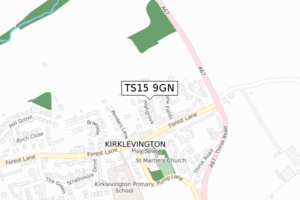
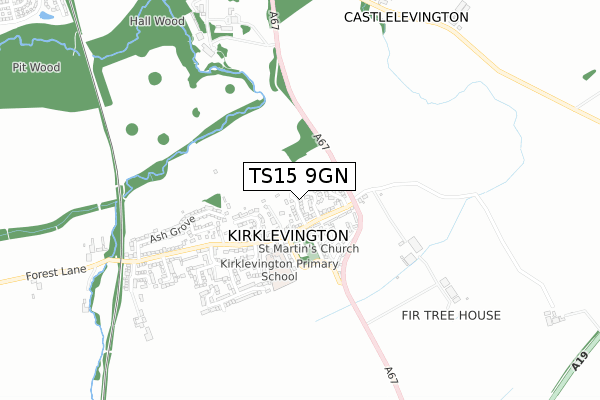
TS15 9GN is located in the Southern Villages electoral ward, within the unitary authority of Stockton-on-Tees and the English Parliamentary constituency of Stockton South. The Sub Integrated Care Board (ICB) Location is NHS North East and North Cumbria ICB - 16C and the police force is Cleveland. This postcode has been in use since September 2019.


GetTheData
Source: OS Open Zoomstack (Ordnance Survey)
Licence: Open Government Licence (requires attribution)
Attribution: Contains OS data © Crown copyright and database right 2025
Source: Open Postcode Geo
Licence: Open Government Licence (requires attribution)
Attribution: Contains OS data © Crown copyright and database right 2025; Contains Royal Mail data © Royal Mail copyright and database right 2025; Source: Office for National Statistics licensed under the Open Government Licence v.3.0
| Easting | 443103 |
| Northing | 510046 |
| Latitude | 54.483949 |
| Longitude | -1.336234 |
GetTheData
Source: Open Postcode Geo
Licence: Open Government Licence
| Country | England |
| Postcode District | TS15 |
➜ See where TS15 is on a map ➜ Where is Kirklevington? | |
GetTheData
Source: Land Registry Price Paid Data
Licence: Open Government Licence
| Ward | Southern Villages |
| Constituency | Stockton South |
GetTheData
Source: ONS Postcode Database
Licence: Open Government Licence
2024 22 AUG £685,000 |
2023 15 MAY £596,000 |
2021 29 JUN £535,000 |
2021 27 APR £534,000 |
13, HIGHGROVE, KIRKLEVINGTON, YARM, TS15 9GN 2021 12 FEB £410,000 |
2020 30 OCT £550,000 |
11, HIGHGROVE, KIRKLEVINGTON, YARM, TS15 9GN 2020 22 SEP £475,000 |
2020 11 SEP £595,000 |
12, HIGHGROVE, KIRKLEVINGTON, YARM, TS15 9GN 2020 14 AUG £614,000 |
7, HIGHGROVE, KIRKLEVINGTON, YARM, TS15 9GN 2020 3 APR £508,000 |
GetTheData
Source: HM Land Registry Price Paid Data
Licence: Contains HM Land Registry data © Crown copyright and database right 2025. This data is licensed under the Open Government Licence v3.0.
| Forest Lane | Kirklevington | 113m |
| Forest Lane | Kirklevington | 126m |
| Village (Thirsk Road) | Kirklevington | 242m |
| Village (Thirsk Road) | Kirklevington | 251m |
| Forest Lane | Kirklevington | 304m |
| Yarm Station | 1.5km |
| Allens West Station | 4.8km |
GetTheData
Source: NaPTAN
Licence: Open Government Licence
| Percentage of properties with Next Generation Access | 100.0% |
| Percentage of properties with Superfast Broadband | 100.0% |
| Percentage of properties with Ultrafast Broadband | 0.0% |
| Percentage of properties with Full Fibre Broadband | 0.0% |
Superfast Broadband is between 30Mbps and 300Mbps
Ultrafast Broadband is > 300Mbps
| Percentage of properties unable to receive 2Mbps | 0.0% |
| Percentage of properties unable to receive 5Mbps | 0.0% |
| Percentage of properties unable to receive 10Mbps | 0.0% |
| Percentage of properties unable to receive 30Mbps | 0.0% |
GetTheData
Source: Ofcom
Licence: Ofcom Terms of Use (requires attribution)
GetTheData
Source: ONS Postcode Database
Licence: Open Government Licence


➜ Get more ratings from the Food Standards Agency
GetTheData
Source: Food Standards Agency
Licence: FSA terms & conditions
| Last Collection | |||
|---|---|---|---|
| Location | Mon-Fri | Sat | Distance |
| Davenport Road | 16:45 | 10:30 | 1,742m |
| Fauconberg Way | 17:00 | 10:15 | 2,143m |
| Low Worsall | 16:45 | 10:15 | 2,693m |
GetTheData
Source: Dracos
Licence: Creative Commons Attribution-ShareAlike
The below table lists the International Territorial Level (ITL) codes (formerly Nomenclature of Territorial Units for Statistics (NUTS) codes) and Local Administrative Units (LAU) codes for TS15 9GN:
| ITL 1 Code | Name |
|---|---|
| TLC | North East (England) |
| ITL 2 Code | Name |
| TLC1 | Tees Valley and Durham |
| ITL 3 Code | Name |
| TLC11 | Hartlepool and Stockton-on-Tees |
| LAU 1 Code | Name |
| E06000004 | Stockton-on-Tees |
GetTheData
Source: ONS Postcode Directory
Licence: Open Government Licence
The below table lists the Census Output Area (OA), Lower Layer Super Output Area (LSOA), and Middle Layer Super Output Area (MSOA) for TS15 9GN:
| Code | Name | |
|---|---|---|
| OA | E00174174 | |
| LSOA | E01012235 | Stockton-on-Tees 024A |
| MSOA | E02002558 | Stockton-on-Tees 024 |
GetTheData
Source: ONS Postcode Directory
Licence: Open Government Licence
| TS15 9JD | Jasmine Fields | 84m |
| TS15 9LY | Forest Lane | 100m |
| TS15 9LZ | Penders Lane | 112m |
| TS15 9LX | Forest Lane | 167m |
| TS15 9LU | Springfield Grove | 180m |
| TS15 9NB | Braeside | 192m |
| TS15 9NA | Forest Lane | 203m |
| TS15 9NZ | Town End Close | 209m |
| TS15 9LR | Thirsk Road | 214m |
| TS15 9LQ | Pump Lane | 230m |
GetTheData
Source: Open Postcode Geo; Land Registry Price Paid Data
Licence: Open Government Licence