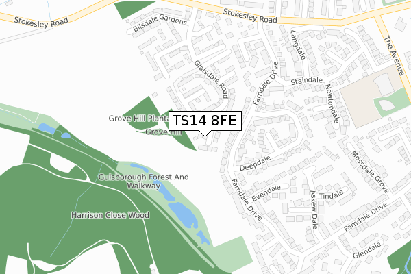
TS14 8FE maps, stats, and open data
TS14 8FE is located in the Hutton electoral ward, within the unitary authority of Redcar and Cleveland and the English Parliamentary constituency of Middlesbrough South and East Cleveland. The Sub Integrated Care Board (ICB) Location is NHS North East and North Cumbria ICB - 16C and the police force is Cleveland. This postcode has been in use since August 2018.
TS14 8FE maps


Licence: Open Government Licence (requires attribution)
Attribution: Contains OS data © Crown copyright and database right 2025
Source: Open Postcode Geo
Licence: Open Government Licence (requires attribution)
Attribution: Contains OS data © Crown copyright and database right 2025; Contains Royal Mail data © Royal Mail copyright and database right 2025; Source: Office for National Statistics licensed under the Open Government Licence v.3.0
TS14 8FE geodata
| Easting | 459117 |
| Northing | 515162 |
| Latitude | 54.528312 |
| Longitude | -1.088069 |
Where is TS14 8FE?
| Country | England |
| Postcode District | TS14 |
Politics
| Ward | Hutton |
|---|---|
| Constituency | Middlesbrough South And East Cleveland |
House Prices
Sales of detached houses in TS14 8FE
2024 8 AUG £335,000 |
2023 22 SEP £365,000 |
2021 5 OCT £300,000 |
2021 19 MAR £283,000 |
11, LOCKTON CLOSE, GUISBOROUGH, TS14 8FE 2019 10 APR £261,995 |
2, LOCKTON CLOSE, GUISBOROUGH, TS14 8FE 2019 7 MAR £309,995 |
5, LOCKTON CLOSE, GUISBOROUGH, TS14 8FE 2019 28 FEB £261,995 |
16, LOCKTON CLOSE, GUISBOROUGH, TS14 8FE 2019 31 JAN £212,995 |
12, LOCKTON CLOSE, GUISBOROUGH, TS14 8FE 2018 20 DEC £221,995 |
9, LOCKTON CLOSE, GUISBOROUGH, TS14 8FE 2018 20 DEC £338,995 |
Licence: Contains HM Land Registry data © Crown copyright and database right 2025. This data is licensed under the Open Government Licence v3.0.
Transport
Nearest bus stops to TS14 8FE
| Deepdale (Farndale Drive) | Guisborough | 87m |
| Deepdale (Farndale Drive) | Guisborough | 106m |
| Galley Hill (A173 - Stokesley Road) | Guisborough | 313m |
| Galley Hill (A173 - Stokesley Road) | Guisborough | 363m |
| Aiskewdale (Farndale Drive) | Guisborough | 391m |
Nearest railway stations to TS14 8FE
| Great Ayton Station | 4.7km |
Broadband
Broadband access in TS14 8FE (2020 data)
| Percentage of properties with Next Generation Access | 100.0% |
| Percentage of properties with Superfast Broadband | 100.0% |
| Percentage of properties with Ultrafast Broadband | 100.0% |
| Percentage of properties with Full Fibre Broadband | 100.0% |
Superfast Broadband is between 30Mbps and 300Mbps
Ultrafast Broadband is > 300Mbps
Broadband limitations in TS14 8FE (2020 data)
| Percentage of properties unable to receive 2Mbps | 0.0% |
| Percentage of properties unable to receive 5Mbps | 0.0% |
| Percentage of properties unable to receive 10Mbps | 0.0% |
| Percentage of properties unable to receive 30Mbps | 0.0% |
Deprivation
15.7% of English postcodes are less deprived than TS14 8FE:Food Standards Agency
Three nearest food hygiene ratings to TS14 8FE (metres)


➜ Get more ratings from the Food Standards Agency
Nearest post box to TS14 8FE
| Last Collection | |||
|---|---|---|---|
| Location | Mon-Fri | Sat | Distance |
| Falcon Way | 16:15 | 10:45 | 385m |
| Farndale Drive | 16:15 | 10:45 | 566m |
| Pinchinthorpe | 17:15 | 11:30 | 717m |
TS14 8FE ITL and TS14 8FE LAU
The below table lists the International Territorial Level (ITL) codes (formerly Nomenclature of Territorial Units for Statistics (NUTS) codes) and Local Administrative Units (LAU) codes for TS14 8FE:
| ITL 1 Code | Name |
|---|---|
| TLC | North East (England) |
| ITL 2 Code | Name |
| TLC1 | Tees Valley and Durham |
| ITL 3 Code | Name |
| TLC12 | South Teesside |
| LAU 1 Code | Name |
| E06000003 | Redcar and Cleveland |
TS14 8FE census areas
The below table lists the Census Output Area (OA), Lower Layer Super Output Area (LSOA), and Middle Layer Super Output Area (MSOA) for TS14 8FE:
| Code | Name | |
|---|---|---|
| OA | E00061143 | |
| LSOA | E01012124 | Redcar and Cleveland 020B |
| MSOA | E02002534 | Redcar and Cleveland 020 |
Nearest postcodes to TS14 8FE
| TS14 8DF | Glaisdale Road | 123m |
| TS14 8JX | Farndale Drive | 127m |
| TS14 8JY | Deepdale | 173m |
| TS14 8JW | Evendale | 190m |
| TS14 8FA | Cringle Gardens | 238m |
| TS14 8JR | Bransdale | 248m |
| TS14 8DQ | Danby Close | 277m |
| TS14 8JG | Askew Dale | 280m |
| TS14 8EX | Kirkdale | 294m |
| TS14 8JQ | Overdale | 301m |