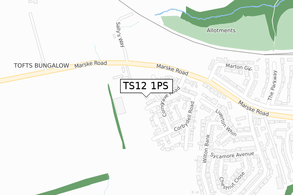
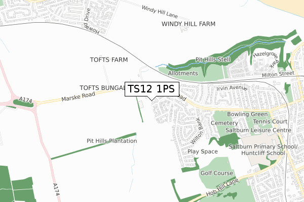
TS12 1PS is located in the Saltburn electoral ward, within the unitary authority of Redcar and Cleveland and the English Parliamentary constituency of Redcar. The Sub Integrated Care Board (ICB) Location is NHS North East and North Cumbria ICB - 16C and the police force is Cleveland. This postcode has been in use since March 2018.


GetTheData
Source: OS Open Zoomstack (Ordnance Survey)
Licence: Open Government Licence (requires attribution)
Attribution: Contains OS data © Crown copyright and database right 2025
Source: Open Postcode Geo
Licence: Open Government Licence (requires attribution)
Attribution: Contains OS data © Crown copyright and database right 2025; Contains Royal Mail data © Royal Mail copyright and database right 2025; Source: Office for National Statistics licensed under the Open Government Licence v.3.0
| Easting | 464951 |
| Northing | 521170 |
| Latitude | 54.581584 |
| Longitude | -0.996615 |
GetTheData
Source: Open Postcode Geo
Licence: Open Government Licence
| Country | England |
| Postcode District | TS12 |
➜ See where TS12 is on a map ➜ Where is Saltburn-by-the-Sea? | |
GetTheData
Source: Land Registry Price Paid Data
Licence: Open Government Licence
| Ward | Saltburn |
| Constituency | Redcar |
GetTheData
Source: ONS Postcode Database
Licence: Open Government Licence
8, CORBY DALES CLOSE, SALTBURN-BY-THE-SEA, TS12 1PS 2019 20 DEC £269,950 |
2, CORBY DALES CLOSE, SALTBURN-BY-THE-SEA, TS12 1PS 2019 20 DEC £304,950 |
4, CORBY DALES CLOSE, SALTBURN-BY-THE-SEA, TS12 1PS 2019 20 DEC £224,950 |
3, CORBY DALES CLOSE, SALTBURN-BY-THE-SEA, TS12 1PS 2019 18 DEC £334,950 |
12, CORBY DALES CLOSE, SALTBURN-BY-THE-SEA, TS12 1PS 2019 11 DEC £249,950 |
9, CORBY DALES CLOSE, SALTBURN-BY-THE-SEA, TS12 1PS 2019 29 NOV £269,950 |
1, CORBY DALES CLOSE, SALTBURN-BY-THE-SEA, TS12 1PS 2019 13 NOV £334,950 |
➜ Saltburn-by-the-Sea house prices
GetTheData
Source: HM Land Registry Price Paid Data
Licence: Contains HM Land Registry data © Crown copyright and database right 2025. This data is licensed under the Open Government Licence v3.0.
| Riding School (Marske Road) | Saltburn | 126m |
| Riding School (Marske Road) | Saltburn | 156m |
| Ox Close (Marske Road) | Saltburn | 412m |
| Ox Close (Marske Road) | Saltburn | 478m |
| Cricket Field (Marske Road) | Saltburn | 678m |
| Saltburn Station | 1.5km |
| Marske Station | 1.6km |
| Longbeck Station | 2.3km |
GetTheData
Source: NaPTAN
Licence: Open Government Licence
GetTheData
Source: ONS Postcode Database
Licence: Open Government Licence


➜ Get more ratings from the Food Standards Agency
GetTheData
Source: Food Standards Agency
Licence: FSA terms & conditions
| Last Collection | |||
|---|---|---|---|
| Location | Mon-Fri | Sat | Distance |
| Upleatham Street | 17:15 | 11:30 | 1,373m |
| Station Street | 17:30 | 12:30 | 1,474m |
| Milton Street | 17:15 | 11:30 | 1,526m |
GetTheData
Source: Dracos
Licence: Creative Commons Attribution-ShareAlike
The below table lists the International Territorial Level (ITL) codes (formerly Nomenclature of Territorial Units for Statistics (NUTS) codes) and Local Administrative Units (LAU) codes for TS12 1PS:
| ITL 1 Code | Name |
|---|---|
| TLC | North East (England) |
| ITL 2 Code | Name |
| TLC1 | Tees Valley and Durham |
| ITL 3 Code | Name |
| TLC12 | South Teesside |
| LAU 1 Code | Name |
| E06000003 | Redcar and Cleveland |
GetTheData
Source: ONS Postcode Directory
Licence: Open Government Licence
The below table lists the Census Output Area (OA), Lower Layer Super Output Area (LSOA), and Middle Layer Super Output Area (MSOA) for TS12 1PS:
| Code | Name | |
|---|---|---|
| OA | E00061313 | |
| LSOA | E01012155 | Redcar and Cleveland 006F |
| MSOA | E02002520 | Redcar and Cleveland 006 |
GetTheData
Source: ONS Postcode Directory
Licence: Open Government Licence
| TS12 1PN | Marske Road | 229m |
| TS12 1PQ | Liverton Whin | 238m |
| TS12 1PG | Wilton Bank | 240m |
| TS12 1PJ | Elm Close | 268m |
| TS12 1QX | Marske Road | 289m |
| TS12 1QU | Marton Gill | 316m |
| TS12 1PL | Oxclose Cottages | 316m |
| TS12 1PH | Liverton Whin | 321m |
| TS12 1PF | Sycamore Avenue | 332m |
| TS12 1PD | Wilton Bank | 351m |
GetTheData
Source: Open Postcode Geo; Land Registry Price Paid Data
Licence: Open Government Licence