TR8 5FR maps, stats, and open data
TR8 5FR is located in the St Newlyn East, Cubert & Goonhavern electoral ward, within the unitary authority of Cornwall and the English Parliamentary constituency of St Austell and Newquay. The Sub Integrated Care Board (ICB) Location is NHS Cornwall and the Isles of Scilly ICB - 11N and the police force is Devon & Cornwall. This postcode has been in use since January 2020.
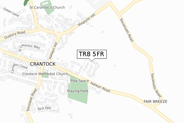
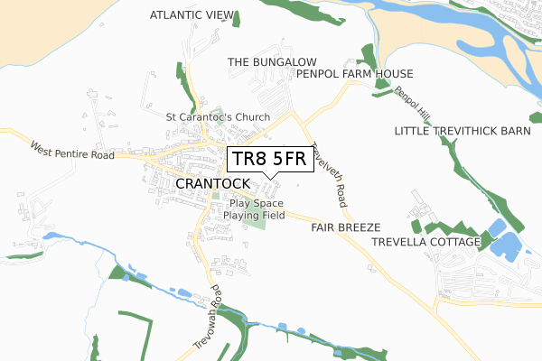
TR8 5FR maps


Licence: Open Government Licence (requires attribution)
Attribution: Contains OS data © Crown copyright and database right 2025
Source: Open Postcode Geo
Licence: Open Government Licence (requires attribution)
Attribution: Contains OS data © Crown copyright and database right 2025; Contains Royal Mail data © Royal Mail copyright and database right 2025; Source: Office for National Statistics licensed under the Open Government Licence v.3.0
TR8 5FR geodata
| Easting | 179296 |
| Northing | 60202 |
| Latitude | 50.400146 |
| Longitude | -5.107017 |
Where is TR8 5FR?
| Country | England |
| Postcode District | TR8 |
Politics
| Ward | St Newlyn East, Cubert & Goonhavern |
|---|---|
| Constituency | St Austell And Newquay |
House Prices
Sales of detached houses in TR8 5FR
4, KELSEY DRIVE, CRANTOCK, NEWQUAY, TR8 5FR 2020 17 AUG £688,000 |
11, KELSEY DRIVE, CRANTOCK, NEWQUAY, TR8 5FR 2020 12 AUG £665,000 |
12, KELSEY DRIVE, CRANTOCK, NEWQUAY, TR8 5FR 2020 30 JUL £560,000 |
3, KELSEY DRIVE, CRANTOCK, NEWQUAY, TR8 5FR 2020 17 JUL £580,000 |
10, KELSEY DRIVE, CRANTOCK, NEWQUAY, TR8 5FR 2020 30 JUN £665,000 |
9, KELSEY DRIVE, CRANTOCK, NEWQUAY, TR8 5FR 2020 15 JUN £399,500 |
14, KELSEY DRIVE, CRANTOCK, NEWQUAY, TR8 5FR 2020 12 JUN £410,000 |
13, KELSEY DRIVE, CRANTOCK, NEWQUAY, TR8 5FR 2020 8 JUN £560,000 |
Licence: Contains HM Land Registry data © Crown copyright and database right 2025. This data is licensed under the Open Government Licence v3.0.
Transport
Nearest bus stops to TR8 5FR
| Winstowe Terrace (Halwyn Road) | Crantock | 195m |
| Winstowe Terrace (Halwyn Road) | Crantock | 195m |
| The Square (Vosporth Hill) | Crantock | 248m |
| Bus Shelter | Crantock | 273m |
| Chapel Close (Trevowah Road) | Crantock | 281m |
Nearest railway stations to TR8 5FR
| Newquay Station | 2.8km |
Deprivation
59.9% of English postcodes are less deprived than TR8 5FR:Food Standards Agency
Three nearest food hygiene ratings to TR8 5FR (metres)


➜ Get more ratings from the Food Standards Agency
Nearest post box to TR8 5FR
| Last Collection | |||
|---|---|---|---|
| Location | Mon-Fri | Sat | Distance |
| Crantock Post Office | 16:10 | 11:05 | 260m |
| Treago Gate | 12:00 | 11:00 | 1,159m |
| Carines Gate | 10:00 | 10:00 | 1,577m |
TR8 5FR ITL and TR8 5FR LAU
The below table lists the International Territorial Level (ITL) codes (formerly Nomenclature of Territorial Units for Statistics (NUTS) codes) and Local Administrative Units (LAU) codes for TR8 5FR:
| ITL 1 Code | Name |
|---|---|
| TLK | South West (England) |
| ITL 2 Code | Name |
| TLK3 | Cornwall and Isles of Scilly |
| ITL 3 Code | Name |
| TLK30 | Cornwall and Isles of Scilly |
| LAU 1 Code | Name |
| E06000052 | Cornwall |
TR8 5FR census areas
The below table lists the Census Output Area (OA), Lower Layer Super Output Area (LSOA), and Middle Layer Super Output Area (MSOA) for TR8 5FR:
| Code | Name | |
|---|---|---|
| OA | E00096149 | |
| LSOA | E01019031 | Cornwall 020D |
| MSOA | E02003954 | Cornwall 020 |
Nearest postcodes to TR8 5FR
| TR8 5TR | Halwyn Road | 134m |
| TR8 5RX | Chapel Close | 187m |
| TR8 5RS | Winstowe Terrace | 193m |
| TR8 5RT | Halwyn Road | 198m |
| TR8 5RW | Vosporth Road | 216m |
| TR8 5RR | Halwyn Hill | 229m |
| TR8 5ER | Halwyn Hill | 230m |
| TR8 5SF | St Ambrusca Road | 260m |
| TR8 5SQ | An Lowarth | 264m |
| TR8 5RQ | Vosporth Road | 267m |