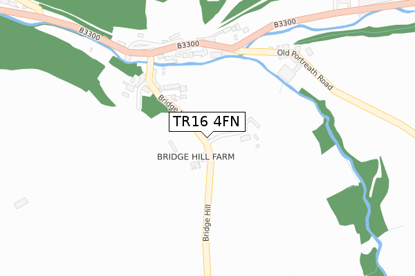
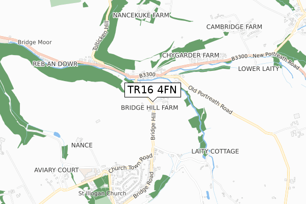
TR16 4FN is located in the Illogan & Portreath electoral ward, within the unitary authority of Cornwall and the English Parliamentary constituency of Camborne and Redruth. The Sub Integrated Care Board (ICB) Location is NHS Cornwall and the Isles of Scilly ICB - 11N and the police force is Devon & Cornwall. This postcode has been in use since September 2018.


GetTheData
Source: OS Open Zoomstack (Ordnance Survey)
Licence: Open Government Licence (requires attribution)
Attribution: Contains OS data © Crown copyright and database right 2025
Source: Open Postcode Geo
Licence: Open Government Licence (requires attribution)
Attribution: Contains OS data © Crown copyright and database right 2025; Contains Royal Mail data © Royal Mail copyright and database right 2025; Source: Office for National Statistics licensed under the Open Government Licence v.3.0
| Easting | 167516 |
| Northing | 44670 |
| Latitude | 50.256147 |
| Longitude | -5.262928 |
GetTheData
Source: Open Postcode Geo
Licence: Open Government Licence
| Country | England |
| Postcode District | TR16 |
➜ See where TR16 is on a map | |
GetTheData
Source: Land Registry Price Paid Data
Licence: Open Government Licence
| Ward | Illogan & Portreath |
| Constituency | Camborne And Redruth |
GetTheData
Source: ONS Postcode Database
Licence: Open Government Licence
| Bridge Hill | Bridge | 211m |
| Bridge Hill | Bridge | 212m |
| Bridge Inn (Penberthy Road) | Bridge | 244m |
| Rose Villa | Bridge | 259m |
| Hall | Bridge | 323m |
| Redruth Station | 3.7km |
| Camborne Station | 5.7km |
GetTheData
Source: NaPTAN
Licence: Open Government Licence
| Percentage of properties with Next Generation Access | 100.0% |
| Percentage of properties with Superfast Broadband | 100.0% |
| Percentage of properties with Ultrafast Broadband | 0.0% |
| Percentage of properties with Full Fibre Broadband | 0.0% |
Superfast Broadband is between 30Mbps and 300Mbps
Ultrafast Broadband is > 300Mbps
| Percentage of properties unable to receive 2Mbps | 0.0% |
| Percentage of properties unable to receive 5Mbps | 0.0% |
| Percentage of properties unable to receive 10Mbps | 0.0% |
| Percentage of properties unable to receive 30Mbps | 0.0% |
GetTheData
Source: Ofcom
Licence: Ofcom Terms of Use (requires attribution)
GetTheData
Source: ONS Postcode Database
Licence: Open Government Licence


➜ Get more ratings from the Food Standards Agency
GetTheData
Source: Food Standards Agency
Licence: FSA terms & conditions
| Last Collection | |||
|---|---|---|---|
| Location | Mon-Fri | Sat | Distance |
| Illogan | 17:00 | 10:15 | 639m |
| Portreath Beach | 16:35 | 10:15 | 2,170m |
| Pool | 17:00 | 11:30 | 2,780m |
GetTheData
Source: Dracos
Licence: Creative Commons Attribution-ShareAlike
The below table lists the International Territorial Level (ITL) codes (formerly Nomenclature of Territorial Units for Statistics (NUTS) codes) and Local Administrative Units (LAU) codes for TR16 4FN:
| ITL 1 Code | Name |
|---|---|
| TLK | South West (England) |
| ITL 2 Code | Name |
| TLK3 | Cornwall and Isles of Scilly |
| ITL 3 Code | Name |
| TLK30 | Cornwall and Isles of Scilly |
| LAU 1 Code | Name |
| E06000052 | Cornwall |
GetTheData
Source: ONS Postcode Directory
Licence: Open Government Licence
The below table lists the Census Output Area (OA), Lower Layer Super Output Area (LSOA), and Middle Layer Super Output Area (MSOA) for TR16 4FN:
| Code | Name | |
|---|---|---|
| OA | E00095382 | |
| LSOA | E01018893 | Cornwall 045E |
| MSOA | E02003918 | Cornwall 045 |
GetTheData
Source: ONS Postcode Directory
Licence: Open Government Licence
| TR16 4QP | 115m | |
| TR16 4QW | Bridge Row | 193m |
| TR16 4QG | 211m | |
| TR16 4QE | 274m | |
| TR16 4SD | Bridge Hill | 406m |
| TR16 4QR | Bridge Hill | 421m |
| TR16 4QQ | New Portreath Road | 475m |
| TR16 4SF | Churchtown Road | 509m |
| TR16 4QS | Watergate | 592m |
| TR16 4SJ | Churchtown Road | 597m |
GetTheData
Source: Open Postcode Geo; Land Registry Price Paid Data
Licence: Open Government Licence