TR11 4FT maps, stats, and open data
TR11 4FT is located in the Falmouth Trescobeas & Budock electoral ward, within the unitary authority of Cornwall and the English Parliamentary constituency of Truro and Falmouth. The Sub Integrated Care Board (ICB) Location is NHS Cornwall and the Isles of Scilly ICB - 11N and the police force is Devon & Cornwall. This postcode has been in use since October 2019.
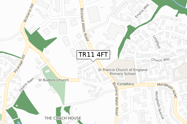
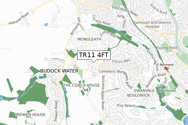
TR11 4FT maps


Licence: Open Government Licence (requires attribution)
Attribution: Contains OS data © Crown copyright and database right 2025
Source: Open Postcode Geo
Licence: Open Government Licence (requires attribution)
Attribution: Contains OS data © Crown copyright and database right 2025; Contains Royal Mail data © Royal Mail copyright and database right 2025; Source: Office for National Statistics licensed under the Open Government Licence v.3.0
TR11 4FT geodata
| Easting | 178867 |
| Northing | 32445 |
| Latitude | 50.150719 |
| Longitude | -5.096818 |
Where is TR11 4FT?
| Country | England |
| Postcode District | TR11 |
Politics
| Ward | Falmouth Trescobeas & Budock |
|---|---|
| Constituency | Truro And Falmouth |
Transport
Nearest bus stops to TR11 4FT
| Church Way | Mongleath | 213m |
| Burial Ground (Mongleath Road) | Mongleath | 221m |
| Church Way (Longfield) | Mongleath | 228m |
| Burial Ground (Mongleath Road) | Mongleath | 229m |
| Sub Station | Mongleath | 290m |
Nearest railway stations to TR11 4FT
| Penmere Station | 1km |
| Falmouth Town Station | 2.3km |
| Penryn Station | 2.5km |
Deprivation
36.7% of English postcodes are less deprived than TR11 4FT:Food Standards Agency
Three nearest food hygiene ratings to TR11 4FT (metres)


➜ Get more ratings from the Food Standards Agency
Nearest post box to TR11 4FT
| Last Collection | |||
|---|---|---|---|
| Location | Mon-Fri | Sat | Distance |
| Conway Road | 16:15 | 10:45 | 592m |
| Venton Road | 16:15 | 11:30 | 704m |
| Boslowick Post Office | 17:00 | 11:15 | 742m |
TR11 4FT ITL and TR11 4FT LAU
The below table lists the International Territorial Level (ITL) codes (formerly Nomenclature of Territorial Units for Statistics (NUTS) codes) and Local Administrative Units (LAU) codes for TR11 4FT:
| ITL 1 Code | Name |
|---|---|
| TLK | South West (England) |
| ITL 2 Code | Name |
| TLK3 | Cornwall and Isles of Scilly |
| ITL 3 Code | Name |
| TLK30 | Cornwall and Isles of Scilly |
| LAU 1 Code | Name |
| E06000052 | Cornwall |
TR11 4FT census areas
The below table lists the Census Output Area (OA), Lower Layer Super Output Area (LSOA), and Middle Layer Super Output Area (MSOA) for TR11 4FT:
| Code | Name | |
|---|---|---|
| OA | E00094966 | |
| LSOA | E01018814 | Cornwall 064D |
| MSOA | E02003917 | Cornwall 064 |
Nearest postcodes to TR11 4FT
| TR11 4SD | Bickland Water Road | 137m |
| TR11 4SJ | Longfield | 247m |
| TR11 5BZ | 269m | |
| TR11 4TA | Bickland Industrial Park | 289m |
| TR11 4RT | Chough Close | 296m |
| TR11 4SF | Pit Meadow | 306m |
| TR11 4SN | Tregoniggie Industrial Estate | 342m |
| TR11 4PW | Mongleath Road | 362m |
| TR11 4SQ | Garden Meadow | 367m |
| TR11 4SZ | Falmouth Business Park | 376m |