TQ5 0HF maps, stats, and open data
TQ5 0HF is located in the Dartmouth & East Dart electoral ward, within the local authority district of South Hams and the English Parliamentary constituency of Totnes. The Sub Integrated Care Board (ICB) Location is NHS Devon ICB - 15N and the police force is Devon & Cornwall. This postcode has been in use since May 2018.
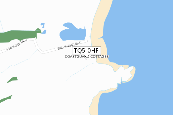
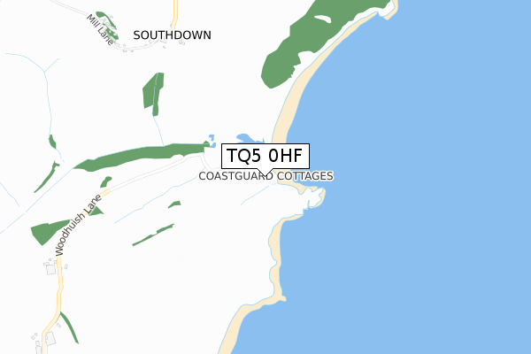
TQ5 0HF maps


Licence: Open Government Licence (requires attribution)
Attribution: Contains OS data © Crown copyright and database right 2025
Source: Open Postcode Geo
Licence: Open Government Licence (requires attribution)
Attribution: Contains OS data © Crown copyright and database right 2025; Contains Royal Mail data © Royal Mail copyright and database right 2025; Source: Office for National Statistics licensed under the Open Government Licence v.3.0
TQ5 0HF geodata
| Easting | 292241 |
| Northing | 53295 |
| Latitude | 50.369641 |
| Longitude | -3.516611 |
Where is TQ5 0HF?
| Country | England |
| Postcode District | TQ5 |
Politics
| Ward | Dartmouth & East Dart |
|---|---|
| Constituency | Totnes |
Transport
Nearest bus stops to TQ5 0HF
| Ocean View Drive | Brixham | 1,547m |
| Elizabeth Avenue (Milton Street) | Brixham | 1,565m |
| Maple Road (Milton Street) | Brixham | 1,568m |
| Maple Road (Milton Street) | Brixham | 1,569m |
| Milton Park (Milton Street) | Brixham | 1,570m |
Broadband
Broadband access in TQ5 0HF (2020 data)
| Percentage of properties with Next Generation Access | 100.0% |
| Percentage of properties with Superfast Broadband | 0.0% |
| Percentage of properties with Ultrafast Broadband | 0.0% |
| Percentage of properties with Full Fibre Broadband | 0.0% |
Superfast Broadband is between 30Mbps and 300Mbps
Ultrafast Broadband is > 300Mbps
Broadband limitations in TQ5 0HF (2020 data)
| Percentage of properties unable to receive 2Mbps | 0.0% |
| Percentage of properties unable to receive 5Mbps | 0.0% |
| Percentage of properties unable to receive 10Mbps | 0.0% |
| Percentage of properties unable to receive 30Mbps | 100.0% |
Deprivation
47.2% of English postcodes are less deprived than TQ5 0HF:Food Standards Agency
Three nearest food hygiene ratings to TQ5 0HF (metres)


➜ Get more ratings from the Food Standards Agency
Nearest post box to TQ5 0HF
| Last Collection | |||
|---|---|---|---|
| Location | Mon-Fri | Sat | Distance |
| Chestnut Drive | 17:15 | 11:45 | 1,325m |
| Milton Street | 17:00 | 11:45 | 1,647m |
| Metherell Avenue | 17:15 | 12:00 | 1,652m |
TQ5 0HF ITL and TQ5 0HF LAU
The below table lists the International Territorial Level (ITL) codes (formerly Nomenclature of Territorial Units for Statistics (NUTS) codes) and Local Administrative Units (LAU) codes for TQ5 0HF:
| ITL 1 Code | Name |
|---|---|
| TLK | South West (England) |
| ITL 2 Code | Name |
| TLK4 | Devon |
| ITL 3 Code | Name |
| TLK43 | Devon CC |
| LAU 1 Code | Name |
| E07000044 | South Hams |
TQ5 0HF census areas
The below table lists the Census Output Area (OA), Lower Layer Super Output Area (LSOA), and Middle Layer Super Output Area (MSOA) for TQ5 0HF:
| Code | Name | |
|---|---|---|
| OA | E00102061 | |
| LSOA | E01020153 | South Hams 004A |
| MSOA | E02004192 | South Hams 004 |
Nearest postcodes to TQ5 0HF
| TQ5 0AH | Southdown Hill | 1306m |
| TQ5 0AQ | Southdown Close | 1329m |
| TQ5 0AN | Southdown Avenue | 1412m |
| TQ5 0BD | Milton Crescent | 1451m |
| TQ5 9RL | Springdale Close | 1470m |
| TQ5 0BE | Ocean View Crescent | 1473m |
| TQ5 0AT | Milton Park | 1474m |
| TQ5 9QR | Upton Hill Road | 1480m |
| TQ5 0AE | Southdown Hill | 1485m |
| TQ5 0AW | Nut Tree Orchard | 1495m |