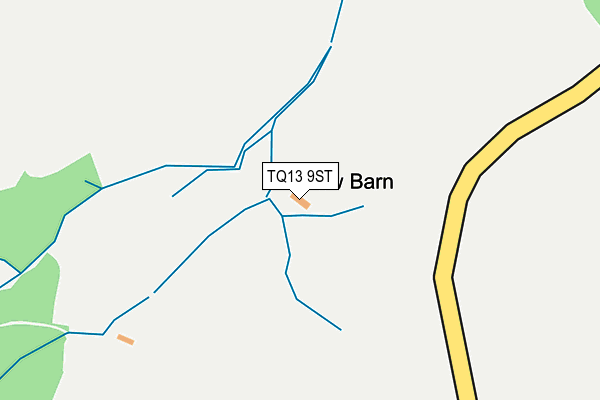
TQ13 9ST is located in the Teign Valley electoral ward, within the local authority district of Teignbridge and the English Parliamentary constituency of Central Devon. The Sub Integrated Care Board (ICB) Location is NHS Devon ICB - 15N and the police force is Devon & Cornwall. This postcode has been in use since April 2017.


GetTheData
Source: OS OpenMap – Local (Ordnance Survey)
Source: OS VectorMap District (Ordnance Survey)
Licence: Open Government Licence (requires attribution)
| Easting | 284071 |
| Northing | 80254 |
| Latitude | 50.610436 |
| Longitude | -3.639815 |
GetTheData
Source: Open Postcode Geo
Licence: Open Government Licence
| Country | England |
| Postcode District | TQ13 |
➜ See where TQ13 is on a map | |
GetTheData
Source: Land Registry Price Paid Data
Licence: Open Government Licence
| Ward | Teign Valley |
| Constituency | Central Devon |
GetTheData
Source: ONS Postcode Database
Licence: Open Government Licence
| Phone Box | Teign Village | 773m |
| Phone Box | Teign Village | 796m |
| Trusham Cross | Trusham | 1,057m |
| Trusham Cross | Trusham | 1,063m |
| Palk Arms (Church Road) | Hennock | 1,172m |
GetTheData
Source: NaPTAN
Licence: Open Government Licence
| Percentage of properties with Next Generation Access | 100.0% |
| Percentage of properties with Superfast Broadband | 0.0% |
| Percentage of properties with Ultrafast Broadband | 0.0% |
| Percentage of properties with Full Fibre Broadband | 0.0% |
Superfast Broadband is between 30Mbps and 300Mbps
Ultrafast Broadband is > 300Mbps
| Percentage of properties unable to receive 2Mbps | 0.0% |
| Percentage of properties unable to receive 5Mbps | 0.0% |
| Percentage of properties unable to receive 10Mbps | 0.0% |
| Percentage of properties unable to receive 30Mbps | 100.0% |
GetTheData
Source: Ofcom
Licence: Ofcom Terms of Use (requires attribution)
GetTheData
Source: ONS Postcode Database
Licence: Open Government Licence


➜ Get more ratings from the Food Standards Agency
GetTheData
Source: Food Standards Agency
Licence: FSA terms & conditions
| Last Collection | |||
|---|---|---|---|
| Location | Mon-Fri | Sat | Distance |
| Coombe Cross | 16:00 | 08:30 | 2,613m |
| East Street | 16:00 | 08:15 | 2,647m |
| Wolleigh | 15:15 | 09:30 | 3,529m |
GetTheData
Source: Dracos
Licence: Creative Commons Attribution-ShareAlike
The below table lists the International Territorial Level (ITL) codes (formerly Nomenclature of Territorial Units for Statistics (NUTS) codes) and Local Administrative Units (LAU) codes for TQ13 9ST:
| ITL 1 Code | Name |
|---|---|
| TLK | South West (England) |
| ITL 2 Code | Name |
| TLK4 | Devon |
| ITL 3 Code | Name |
| TLK43 | Devon CC |
| LAU 1 Code | Name |
| E07000045 | Teignbridge |
GetTheData
Source: ONS Postcode Directory
Licence: Open Government Licence
The below table lists the Census Output Area (OA), Lower Layer Super Output Area (LSOA), and Middle Layer Super Output Area (MSOA) for TQ13 9ST:
| Code | Name | |
|---|---|---|
| OA | E00102430 | |
| LSOA | E01020223 | Teignbridge 004F |
| MSOA | E02004204 | Teignbridge 004 |
GetTheData
Source: ONS Postcode Directory
Licence: Open Government Licence
| TQ13 9QH | 644m | |
| TQ13 9QJ | Teign Village | 774m |
| TQ13 9QQ | 863m | |
| TQ13 9PY | 865m | |
| TQ13 9PZ | 884m | |
| TQ13 9PX | 893m | |
| TQ13 9PP | 894m | |
| TQ13 9QA | 1056m | |
| TQ13 9PU | 1089m | |
| TQ13 9QB | 1113m |
GetTheData
Source: Open Postcode Geo; Land Registry Price Paid Data
Licence: Open Government Licence