Property/Postcode Data Search:
TN31 6FP maps, stats, and open data
TN31 6FP is located in the Brede & Udimore electoral ward, within the local authority district of Rother and the English Parliamentary constituency of Hastings and Rye. The Sub Integrated Care Board (ICB) Location is NHS Sussex ICB - 97R and the police force is Sussex. This postcode has been in use since April 2020.
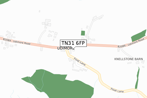
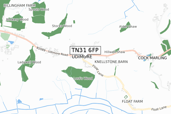
TN31 6FP maps


Source: OS Open Zoomstack (Ordnance Survey)
Licence: Open Government Licence (requires attribution)
Attribution: Contains OS data © Crown copyright and database right 2025
Source: Open Postcode Geo
Licence: Open Government Licence (requires attribution)
Attribution: Contains OS data © Crown copyright and database right 2025; Contains Royal Mail data © Royal Mail copyright and database right 2025; Source: Office for National Statistics licensed under the Open Government Licence v.3.0
Licence: Open Government Licence (requires attribution)
Attribution: Contains OS data © Crown copyright and database right 2025
Source: Open Postcode Geo
Licence: Open Government Licence (requires attribution)
Attribution: Contains OS data © Crown copyright and database right 2025; Contains Royal Mail data © Royal Mail copyright and database right 2025; Source: Office for National Statistics licensed under the Open Government Licence v.3.0
TN31 6FP geodata
| Easting | 587481 |
| Northing | 118806 |
| Latitude | 50.938214 |
| Longitude | 0.667062 |
Where is TN31 6FP?
| Country | England |
| Postcode District | TN31 |
Politics
| Ward | Brede & Udimore |
|---|---|
| Constituency | Hastings And Rye |
Transport
Nearest bus stops to TN31 6FP
| Road End Gate (Udimore Road) | Cock Marling | 892m |
| Road End Gate (Udimore Road) | Cock Marling | 1,001m |
| Kings Head (Udimore Road) | Udimore | 1,428m |
| Kings Head (Udimore Road) | Udimore | 1,449m |
Nearest railway stations to TN31 6FP
| Winchelsea Station | 2.5km |
| Doleham Station | 4.6km |
| Rye Station | 4.7km |
Deprivation
52.3% of English postcodes are less deprived than TN31 6FP:Food Standards Agency
Three nearest food hygiene ratings to TN31 6FP (metres)
The Kings Head

The Kings Head Udimore Road
1,530m
➜ Get more ratings from the Food Standards Agency
Nearest post box to TN31 6FP
| Last Collection | |||
|---|---|---|---|
| Location | Mon-Fri | Sat | Distance |
| Sea Road | 17:00 | 10:30 | 4,238m |
| Tilling Green Post Office | 17:15 | 10:30 | 4,258m |
| Doleham Hill | 16:45 | 09:00 | 4,430m |
TN31 6FP ITL and TN31 6FP LAU
The below table lists the International Territorial Level (ITL) codes (formerly Nomenclature of Territorial Units for Statistics (NUTS) codes) and Local Administrative Units (LAU) codes for TN31 6FP:
| ITL 1 Code | Name |
|---|---|
| TLJ | South East (England) |
| ITL 2 Code | Name |
| TLJ2 | Surrey, East and West Sussex |
| ITL 3 Code | Name |
| TLJ22 | East Sussex CC |
| LAU 1 Code | Name |
| E07000064 | Rother |
TN31 6FP census areas
The below table lists the Census Output Area (OA), Lower Layer Super Output Area (LSOA), and Middle Layer Super Output Area (MSOA) for TN31 6FP:
| Code | Name | |
|---|---|---|
| OA | E00107107 | |
| LSOA | E01021087 | Rother 005A |
| MSOA | E02004396 | Rother 005 |
Nearest postcodes to TN31 6FP
| TN31 6AS | 76m | |
| TN31 6AT | 153m | |
| TN31 6AR | 192m | |
| TN31 6AY | 681m | |
| TN31 6AN | 758m | |
| TN31 6BY | 881m | |
| TN31 6AL | 981m | |
| TN31 6BB | 1145m | |
| TN31 6BA | 1151m | |
| TN31 6AJ | 1171m |