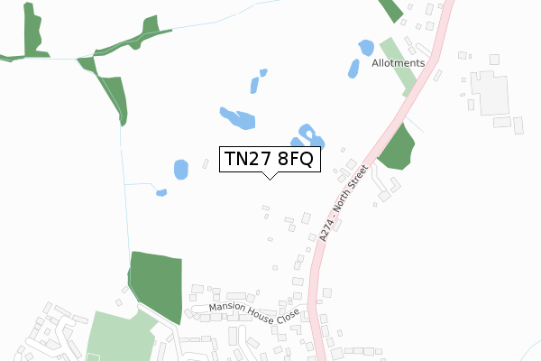
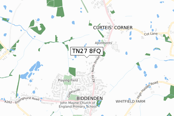
TN27 8FQ is located in the Biddenden electoral ward, within the local authority district of Ashford and the English Parliamentary constituency of Ashford. The Sub Integrated Care Board (ICB) Location is NHS Kent and Medway ICB - 91Q and the police force is Kent. This postcode has been in use since April 2020.


GetTheData
Source: OS Open Zoomstack (Ordnance Survey)
Licence: Open Government Licence (requires attribution)
Attribution: Contains OS data © Crown copyright and database right 2025
Source: Open Postcode Geo
Licence: Open Government Licence (requires attribution)
Attribution: Contains OS data © Crown copyright and database right 2025; Contains Royal Mail data © Royal Mail copyright and database right 2025; Source: Office for National Statistics licensed under the Open Government Licence v.3.0
| Easting | 584980 |
| Northing | 138871 |
| Latitude | 51.119259 |
| Longitude | 0.641739 |
GetTheData
Source: Open Postcode Geo
Licence: Open Government Licence
| Country | England |
| Postcode District | TN27 |
➜ See where TN27 is on a map ➜ Where is Biddenden? | |
GetTheData
Source: Land Registry Price Paid Data
Licence: Open Government Licence
| Ward | Biddenden |
| Constituency | Ashford |
GetTheData
Source: ONS Postcode Database
Licence: Open Government Licence
31, FULLERS WAY, BIDDENDEN, ASHFORD, TN27 8FQ 2021 17 DEC £749,950 |
29, FULLERS WAY, BIDDENDEN, ASHFORD, TN27 8FQ 2021 31 AUG £840,000 |
30, FULLERS WAY, BIDDENDEN, ASHFORD, TN27 8FQ 2021 27 AUG £932,000 |
39, FULLERS WAY, BIDDENDEN, ASHFORD, TN27 8FQ 2021 13 AUG £1,260,000 |
38, FULLERS WAY, BIDDENDEN, ASHFORD, TN27 8FQ 2021 30 JUL £855,000 |
37, FULLERS WAY, BIDDENDEN, ASHFORD, TN27 8FQ 2021 25 JUN £755,000 |
44, FULLERS WAY, BIDDENDEN, ASHFORD, TN27 8FQ 2021 26 MAY £920,000 |
10, FULLERS WAY, BIDDENDEN, ASHFORD, TN27 8FQ 2021 18 MAY £732,000 |
9, FULLERS WAY, BIDDENDEN, ASHFORD, TN27 8FQ 2020 18 DEC £817,000 |
8, FULLERS WAY, BIDDENDEN, ASHFORD, TN27 8FQ 2020 18 NOV £755,000 |
GetTheData
Source: HM Land Registry Price Paid Data
Licence: Contains HM Land Registry data © Crown copyright and database right 2025. This data is licensed under the Open Government Licence v3.0.
| The Weavers (North Street) | Biddenden | 456m |
| The Weavers (North Street) | Biddenden | 472m |
| Worsenden (Sissinghurst Road) | Biddenden | 1,022m |
| Worsenden (Sissinghurst Road) | Biddenden | 1,028m |
GetTheData
Source: NaPTAN
Licence: Open Government Licence
GetTheData
Source: ONS Postcode Database
Licence: Open Government Licence


➜ Get more ratings from the Food Standards Agency
GetTheData
Source: Food Standards Agency
Licence: FSA terms & conditions
| Last Collection | |||
|---|---|---|---|
| Location | Mon-Fri | Sat | Distance |
| Benenden C H Post Office | 16:00 | 09:45 | 3,948m |
| Walford | 16:45 | 09:45 | 4,137m |
| Frittenden Post Office | 16:45 | 09:45 | 4,185m |
GetTheData
Source: Dracos
Licence: Creative Commons Attribution-ShareAlike
The below table lists the International Territorial Level (ITL) codes (formerly Nomenclature of Territorial Units for Statistics (NUTS) codes) and Local Administrative Units (LAU) codes for TN27 8FQ:
| ITL 1 Code | Name |
|---|---|
| TLJ | South East (England) |
| ITL 2 Code | Name |
| TLJ4 | Kent |
| ITL 3 Code | Name |
| TLJ45 | Mid Kent |
| LAU 1 Code | Name |
| E07000105 | Ashford |
GetTheData
Source: ONS Postcode Directory
Licence: Open Government Licence
The below table lists the Census Output Area (OA), Lower Layer Super Output Area (LSOA), and Middle Layer Super Output Area (MSOA) for TN27 8FQ:
| Code | Name | |
|---|---|---|
| OA | E00121753 | |
| LSOA | E01023979 | Ashford 011B |
| MSOA | E02005006 | Ashford 011 |
GetTheData
Source: ONS Postcode Directory
Licence: Open Government Licence
| TN27 8BA | North Street | 133m |
| TN27 8DE | Mansion House Close | 146m |
| TN27 8AW | The Meadows | 199m |
| TN27 8AE | North Street | 201m |
| TN27 8AY | Spinners Close | 224m |
| TN27 8AZ | Spinners Close | 233m |
| TN27 8AX | Shuttle Close | 265m |
| TN27 8AN | The Meadows | 274m |
| TN27 8AS | North Street | 304m |
| TN27 8AG | North Street | 306m |
GetTheData
Source: Open Postcode Geo; Land Registry Price Paid Data
Licence: Open Government Licence