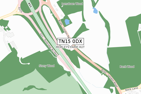
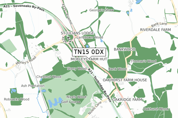
TN15 0DX is located in the Hildenborough electoral ward, within the local authority district of Tonbridge and Malling and the English Parliamentary constituency of Tonbridge and Malling. The Sub Integrated Care Board (ICB) Location is NHS Kent and Medway ICB - 91Q and the police force is Kent. This postcode has been in use since June 2018.


GetTheData
Source: OS Open Zoomstack (Ordnance Survey)
Licence: Open Government Licence (requires attribution)
Attribution: Contains OS data © Crown copyright and database right 2025
Source: Open Postcode Geo
Licence: Open Government Licence (requires attribution)
Attribution: Contains OS data © Crown copyright and database right 2025; Contains Royal Mail data © Royal Mail copyright and database right 2025; Source: Office for National Statistics licensed under the Open Government Licence v.3.0
| Easting | 554531 |
| Northing | 151011 |
| Latitude | 51.237356 |
| Longitude | 0.212261 |
GetTheData
Source: Open Postcode Geo
Licence: Open Government Licence
| Country | England |
| Postcode District | TN15 |
➜ See where TN15 is on a map | |
GetTheData
Source: Land Registry Price Paid Data
Licence: Open Government Licence
| Ward | Hildenborough |
| Constituency | Tonbridge And Malling |
GetTheData
Source: ONS Postcode Database
Licence: Open Government Licence
| Morleys Roundabout (London Road) | Sevenoaks Weald | 204m |
| Morleys Roundabout (London Road) | Sevenoaks Weald | 257m |
| Bank Lane (London Road) | Hildenborough | 438m |
| Bank Lane (London Road) | Hildenborough | 503m |
| Morley's Road | Sevenoaks Weald | 690m |
| Hildenborough Station | 2.8km |
| Leigh (Kent) Station | 4.8km |
| Sevenoaks Station | 4.9km |
GetTheData
Source: NaPTAN
Licence: Open Government Licence
GetTheData
Source: ONS Postcode Database
Licence: Open Government Licence


➜ Get more ratings from the Food Standards Agency
GetTheData
Source: Food Standards Agency
Licence: FSA terms & conditions
| Last Collection | |||
|---|---|---|---|
| Location | Mon-Fri | Sat | Distance |
| Morleys Hill | 16:00 | 09:00 | 698m |
| Four Wents | 16:00 | 09:30 | 1,440m |
| Fletchers Green | 16:00 | 10:00 | 1,506m |
GetTheData
Source: Dracos
Licence: Creative Commons Attribution-ShareAlike
The below table lists the International Territorial Level (ITL) codes (formerly Nomenclature of Territorial Units for Statistics (NUTS) codes) and Local Administrative Units (LAU) codes for TN15 0DX:
| ITL 1 Code | Name |
|---|---|
| TLJ | South East (England) |
| ITL 2 Code | Name |
| TLJ4 | Kent |
| ITL 3 Code | Name |
| TLJ46 | West Kent |
| LAU 1 Code | Name |
| E07000115 | Tonbridge and Malling |
GetTheData
Source: ONS Postcode Directory
Licence: Open Government Licence
The below table lists the Census Output Area (OA), Lower Layer Super Output Area (LSOA), and Middle Layer Super Output Area (MSOA) for TN15 0DX:
| Code | Name | |
|---|---|---|
| OA | E00125650 | |
| LSOA | E01024754 | Tonbridge and Malling 010D |
| MSOA | E02005158 | Tonbridge and Malling 010 |
GetTheData
Source: ONS Postcode Directory
Licence: Open Government Licence
| TN15 0RS | Riverhill | 307m |
| TN11 8NR | Bank Lane | 562m |
| TN11 8BF | Oakhurst Park Gardens | 568m |
| TN14 6QY | Morleys Road | 673m |
| TN11 8LZ | Ashbourne Place | 800m |
| TN11 8NP | London Road | 834m |
| TN11 8NU | Nizels Lane | 839m |
| TN11 8NL | Grove Cottages | 857m |
| TN14 6QR | Elses Cottages | 938m |
| TN14 6QX | Morleys Road | 1035m |
GetTheData
Source: Open Postcode Geo; Land Registry Price Paid Data
Licence: Open Government Licence