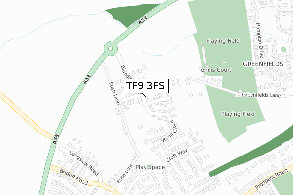
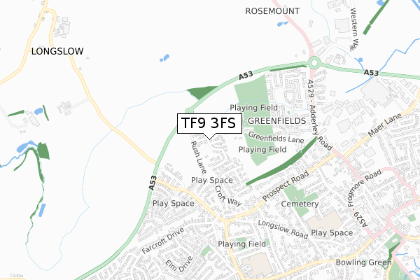
TF9 3FS maps, stats, and open data
TF9 3FS is located in the Market Drayton West electoral ward, within the unitary authority of Shropshire and the English Parliamentary constituency of North Shropshire. The Sub Integrated Care Board (ICB) Location is NHS Shropshire, Telford and Wrekin ICB - M2L0M and the police force is West Mercia. This postcode has been in use since March 2018.
TF9 3FS maps


Licence: Open Government Licence (requires attribution)
Attribution: Contains OS data © Crown copyright and database right 2025
Source: Open Postcode Geo
Licence: Open Government Licence (requires attribution)
Attribution: Contains OS data © Crown copyright and database right 2025; Contains Royal Mail data © Royal Mail copyright and database right 2025; Source: Office for National Statistics licensed under the Open Government Licence v.3.0
TF9 3FS geodata
| Easting | 366490 |
| Northing | 334671 |
| Latitude | 52.908432 |
| Longitude | -2.499705 |
Where is TF9 3FS?
| Country | England |
| Postcode District | TF9 |
Politics
| Ward | Market Drayton West |
|---|---|
| Constituency | North Shropshire |
House Prices
Sales of detached houses in TF9 3FS
2025 23 MAY £340,000 |
5, BLANDFORD WAY, MARKET DRAYTON, TF9 3FS 2022 23 SEP £470,000 |
20, BLANDFORD WAY, MARKET DRAYTON, TF9 3FS 2022 16 SEP £385,000 |
18, BLANDFORD WAY, MARKET DRAYTON, TF9 3FS 2022 16 SEP £450,000 |
7, BLANDFORD WAY, MARKET DRAYTON, TF9 3FS 2022 24 JUN £415,000 |
2021 8 DEC £355,000 |
22, BLANDFORD WAY, MARKET DRAYTON, TF9 3FS 2020 11 DEC £375,000 |
24, BLANDFORD WAY, MARKET DRAYTON, TF9 3FS 2020 25 AUG £295,000 |
51, BLANDFORD WAY, MARKET DRAYTON, TF9 3FS 2019 17 JUL £310,000 |
28, BLANDFORD WAY, MARKET DRAYTON, TF9 3FS 2019 28 JUN £290,000 |
Licence: Contains HM Land Registry data © Crown copyright and database right 2025. This data is licensed under the Open Government Licence v3.0.
Transport
Nearest bus stops to TF9 3FS
| Bishops Lane Jct (Prospect Road) | Market Drayton | 488m |
| Cemetery Road Jct (Prospect Road) | Market Drayton | 498m |
| Elm Drive Jct (Farcroft Drive) | Market Drayton | 606m |
| Cheshire Street Jct (Prospect Road) | Market Drayton | 715m |
| Cattle Market (Adderley Road) | Market Drayton | 834m |
Broadband
Broadband access in TF9 3FS (2020 data)
| Percentage of properties with Next Generation Access | 100.0% |
| Percentage of properties with Superfast Broadband | 100.0% |
| Percentage of properties with Ultrafast Broadband | 100.0% |
| Percentage of properties with Full Fibre Broadband | 100.0% |
Superfast Broadband is between 30Mbps and 300Mbps
Ultrafast Broadband is > 300Mbps
Broadband limitations in TF9 3FS (2020 data)
| Percentage of properties unable to receive 2Mbps | 0.0% |
| Percentage of properties unable to receive 5Mbps | 0.0% |
| Percentage of properties unable to receive 10Mbps | 0.0% |
| Percentage of properties unable to receive 30Mbps | 0.0% |
Deprivation
27.4% of English postcodes are less deprived than TF9 3FS:Food Standards Agency
Three nearest food hygiene ratings to TF9 3FS (metres)


➜ Get more ratings from the Food Standards Agency
Nearest post box to TF9 3FS
| Last Collection | |||
|---|---|---|---|
| Location | Mon-Fri | Sat | Distance |
| Fairfields | 17:15 | 11:30 | 1,261m |
| Peatswood | 11:00 | 11:00 | 2,923m |
| Betton | 16:00 | 11:15 | 3,283m |
TF9 3FS ITL and TF9 3FS LAU
The below table lists the International Territorial Level (ITL) codes (formerly Nomenclature of Territorial Units for Statistics (NUTS) codes) and Local Administrative Units (LAU) codes for TF9 3FS:
| ITL 1 Code | Name |
|---|---|
| TLG | West Midlands (England) |
| ITL 2 Code | Name |
| TLG2 | Shropshire and Staffordshire |
| ITL 3 Code | Name |
| TLG22 | Shropshire |
| LAU 1 Code | Name |
| E06000051 | Shropshire |
TF9 3FS census areas
The below table lists the Census Output Area (OA), Lower Layer Super Output Area (LSOA), and Middle Layer Super Output Area (MSOA) for TF9 3FS:
| Code | Name | |
|---|---|---|
| OA | E00174566 | |
| LSOA | E01028875 | Shropshire 005C |
| MSOA | E02006018 | Shropshire 005 |
Nearest postcodes to TF9 3FS
| TF9 3QX | Rush Lane | 203m |
| TF9 3UH | Farm Close | 242m |
| TF9 3UB | Croft Way | 247m |
| TF9 3SL | Greenfields Lane | 253m |
| TF9 3UJ | Pezenas Drive | 276m |
| TF9 3UG | Meadow Close | 291m |
| TF9 3UL | Ridings Close | 293m |
| TF9 3QZ | Longslow Road | 321m |
| TF9 3UP | Priory Court | 336m |
| TF9 3UF | Stable Lane | 340m |