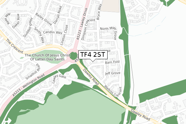
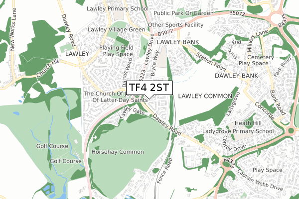
TF4 2ST is located in the Lawley electoral ward, within the unitary authority of Telford and Wrekin and the English Parliamentary constituency of Telford. The Sub Integrated Care Board (ICB) Location is NHS Shropshire, Telford and Wrekin ICB - M2L0M and the police force is West Mercia. This postcode has been in use since December 2018.


GetTheData
Source: OS Open Zoomstack (Ordnance Survey)
Licence: Open Government Licence (requires attribution)
Attribution: Contains OS data © Crown copyright and database right 2025
Source: Open Postcode Geo
Licence: Open Government Licence (requires attribution)
Attribution: Contains OS data © Crown copyright and database right 2025; Contains Royal Mail data © Royal Mail copyright and database right 2025; Source: Office for National Statistics licensed under the Open Government Licence v.3.0
| Easting | 367438 |
| Northing | 308298 |
| Latitude | 52.671419 |
| Longitude | -2.482974 |
GetTheData
Source: Open Postcode Geo
Licence: Open Government Licence
| Country | England |
| Postcode District | TF4 |
➜ See where TF4 is on a map ➜ Where is Telford? | |
GetTheData
Source: Land Registry Price Paid Data
Licence: Open Government Licence
| Ward | Lawley |
| Constituency | Telford |
GetTheData
Source: ONS Postcode Database
Licence: Open Government Licence
1, WALKISS CRESCENT, LAWLEY, TELFORD, TF4 2ST 2019 3 JAN £276,190 |
3, WALKISS CRESCENT, LAWLEY, TELFORD, TF4 2ST 2018 20 DEC £264,950 |
5, WALKISS CRESCENT, LAWLEY, TELFORD, TF4 2ST 2018 20 DEC £219,950 |
GetTheData
Source: HM Land Registry Price Paid Data
Licence: Contains HM Land Registry data © Crown copyright and database right 2025. This data is licensed under the Open Government Licence v3.0.
| Wall Close (The Crescent) | Lawley | 296m |
| Lawley Academy (Bryce Way) | Lawley | 350m |
| Smallhill Road (The Crescent) | Lawley | 470m |
| Lawley Academy (Bryce Way) | Lawley | 507m |
| Heath Hill Industrial Estate (Heath Hill) | Dawley | 512m |
| Telford Central Station | 3km |
| Oakengates Station | 3.3km |
| Wellington (Shropshire) Station | 4.1km |
GetTheData
Source: NaPTAN
Licence: Open Government Licence
| Percentage of properties with Next Generation Access | 100.0% |
| Percentage of properties with Superfast Broadband | 100.0% |
| Percentage of properties with Ultrafast Broadband | 100.0% |
| Percentage of properties with Full Fibre Broadband | 100.0% |
Superfast Broadband is between 30Mbps and 300Mbps
Ultrafast Broadband is > 300Mbps
| Percentage of properties unable to receive 2Mbps | 0.0% |
| Percentage of properties unable to receive 5Mbps | 0.0% |
| Percentage of properties unable to receive 10Mbps | 0.0% |
| Percentage of properties unable to receive 30Mbps | 0.0% |
GetTheData
Source: Ofcom
Licence: Ofcom Terms of Use (requires attribution)
GetTheData
Source: ONS Postcode Database
Licence: Open Government Licence


➜ Get more ratings from the Food Standards Agency
GetTheData
Source: Food Standards Agency
Licence: FSA terms & conditions
| Last Collection | |||
|---|---|---|---|
| Location | Mon-Fri | Sat | Distance |
| Lawley | 17:30 | 11:00 | 823m |
| The Rock | 14:45 | 11:30 | 1,380m |
| Bellpitt Road | 17:30 | 11:00 | 1,742m |
GetTheData
Source: Dracos
Licence: Creative Commons Attribution-ShareAlike
The below table lists the International Territorial Level (ITL) codes (formerly Nomenclature of Territorial Units for Statistics (NUTS) codes) and Local Administrative Units (LAU) codes for TF4 2ST:
| ITL 1 Code | Name |
|---|---|
| TLG | West Midlands (England) |
| ITL 2 Code | Name |
| TLG2 | Shropshire and Staffordshire |
| ITL 3 Code | Name |
| TLG21 | Telford and Wrekin |
| LAU 1 Code | Name |
| E06000020 | Telford and Wrekin |
GetTheData
Source: ONS Postcode Directory
Licence: Open Government Licence
The below table lists the Census Output Area (OA), Lower Layer Super Output Area (LSOA), and Middle Layer Super Output Area (MSOA) for TF4 2ST:
| Code | Name | |
|---|---|---|
| OA | E00071446 | |
| LSOA | E01014147 | Telford and Wrekin 016B |
| MSOA | E02002943 | Telford and Wrekin 016 |
GetTheData
Source: ONS Postcode Directory
Licence: Open Government Licence
| TF4 2GJ | Candlin Way | 189m |
| TF4 2SH | Lineton Close | 205m |
| TF4 2SJ | Peregrine Drive | 268m |
| TF4 2NZ | Lawley Gate | 284m |
| TF4 2SL | Leonard Grove | 304m |
| TF4 2GF | Darrall Road | 317m |
| TF4 2GE | Smithy Way | 326m |
| TF4 2GR | Wall Close | 338m |
| TF4 2GG | Bailey Grove | 352m |
| TF4 2GS | Bush Lane | 357m |
GetTheData
Source: Open Postcode Geo; Land Registry Price Paid Data
Licence: Open Government Licence