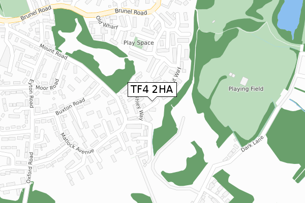
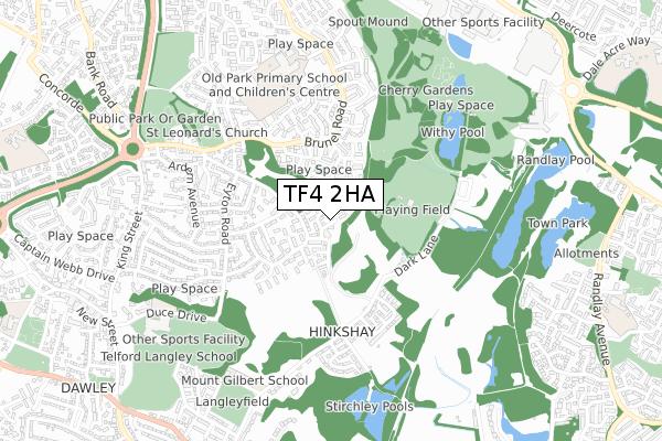
TF4 2HA is located in the Malinslee & Dawley Bank electoral ward, within the unitary authority of Telford and Wrekin and the English Parliamentary constituency of Telford. The Sub Integrated Care Board (ICB) Location is NHS Shropshire, Telford and Wrekin ICB - M2L0M and the police force is West Mercia. This postcode has been in use since October 2017.


GetTheData
Source: OS Open Zoomstack (Ordnance Survey)
Licence: Open Government Licence (requires attribution)
Attribution: Contains OS data © Crown copyright and database right 2025
Source: Open Postcode Geo
Licence: Open Government Licence (requires attribution)
Attribution: Contains OS data © Crown copyright and database right 2025; Contains Royal Mail data © Royal Mail copyright and database right 2025; Source: Office for National Statistics licensed under the Open Government Licence v.3.0
| Easting | 369372 |
| Northing | 307766 |
| Latitude | 52.666750 |
| Longitude | -2.454325 |
GetTheData
Source: Open Postcode Geo
Licence: Open Government Licence
| Country | England |
| Postcode District | TF4 |
➜ See where TF4 is on a map ➜ Where is Telford? | |
GetTheData
Source: Land Registry Price Paid Data
Licence: Open Government Licence
| Ward | Malinslee & Dawley Bank |
| Constituency | Telford |
GetTheData
Source: ONS Postcode Database
Licence: Open Government Licence
| Matlock Avenue (Buxton Road) | Dawley | 182m |
| Matlock Avenue (Buxton Road) | Dawley | 195m |
| Waggoner's Fold (Brunel Road) | Malins Lee | 311m |
| Waggoneer's Fold (Brunel Road) | Malins Lee | 318m |
| Eyton Road (Buxton Road) | Dawley | 356m |
| Telford Central Station | 1.8km |
| Oakengates Station | 3km |
| Wellington (Shropshire) Station | 5.7km |
GetTheData
Source: NaPTAN
Licence: Open Government Licence
| Percentage of properties with Next Generation Access | 100.0% |
| Percentage of properties with Superfast Broadband | 100.0% |
| Percentage of properties with Ultrafast Broadband | 100.0% |
| Percentage of properties with Full Fibre Broadband | 100.0% |
Superfast Broadband is between 30Mbps and 300Mbps
Ultrafast Broadband is > 300Mbps
| Median download speed | 100.0Mbps |
| Average download speed | 120.8Mbps |
| Maximum download speed | 350.00Mbps |
| Median upload speed | 1.2Mbps |
| Average upload speed | 1.2Mbps |
| Maximum upload speed | 1.17Mbps |
| Percentage of properties unable to receive 2Mbps | 0.0% |
| Percentage of properties unable to receive 5Mbps | 0.0% |
| Percentage of properties unable to receive 10Mbps | 0.0% |
| Percentage of properties unable to receive 30Mbps | 0.0% |
GetTheData
Source: Ofcom
Licence: Ofcom Terms of Use (requires attribution)
GetTheData
Source: ONS Postcode Database
Licence: Open Government Licence


➜ Get more ratings from the Food Standards Agency
GetTheData
Source: Food Standards Agency
Licence: FSA terms & conditions
| Last Collection | |||
|---|---|---|---|
| Location | Mon-Fri | Sat | Distance |
| Malinslee Centre | 17:30 | 11:00 | 597m |
| Telford Centre Post Office | 17:30 | 12:15 | 1,039m |
| Randlay | 17:15 | 12:00 | 1,087m |
GetTheData
Source: Dracos
Licence: Creative Commons Attribution-ShareAlike
The below table lists the International Territorial Level (ITL) codes (formerly Nomenclature of Territorial Units for Statistics (NUTS) codes) and Local Administrative Units (LAU) codes for TF4 2HA:
| ITL 1 Code | Name |
|---|---|
| TLG | West Midlands (England) |
| ITL 2 Code | Name |
| TLG2 | Shropshire and Staffordshire |
| ITL 3 Code | Name |
| TLG21 | Telford and Wrekin |
| LAU 1 Code | Name |
| E06000020 | Telford and Wrekin |
GetTheData
Source: ONS Postcode Directory
Licence: Open Government Licence
The below table lists the Census Output Area (OA), Lower Layer Super Output Area (LSOA), and Middle Layer Super Output Area (MSOA) for TF4 2HA:
| Code | Name | |
|---|---|---|
| OA | E00071525 | |
| LSOA | E01014163 | Telford and Wrekin 017B |
| MSOA | E02002944 | Telford and Wrekin 017 |
GetTheData
Source: ONS Postcode Directory
Licence: Open Government Licence
| TF3 2HE | Spout Way | 91m |
| TF4 2EL | Matlock Avenue | 149m |
| TF3 2HF | Spout Way | 178m |
| TF4 2QT | Melbourne Close | 190m |
| TF4 2EJ | Matlock Avenue | 192m |
| TF3 2HD | Spout Way | 198m |
| TF4 2EW | Buxton Road | 225m |
| TF4 2QS | George Chetwood Court | 227m |
| TF4 2EN | Matlock Avenue | 262m |
| TF3 2HB | Old Wharf | 264m |
GetTheData
Source: Open Postcode Geo; Land Registry Price Paid Data
Licence: Open Government Licence