TF13 6FF maps, stats, and open data
TF13 6FF is located in the Much Wenlock electoral ward, within the unitary authority of Shropshire and the English Parliamentary constituency of Ludlow. The Sub Integrated Care Board (ICB) Location is NHS Shropshire, Telford and Wrekin ICB - M2L0M and the police force is West Mercia. This postcode has been in use since February 2019.
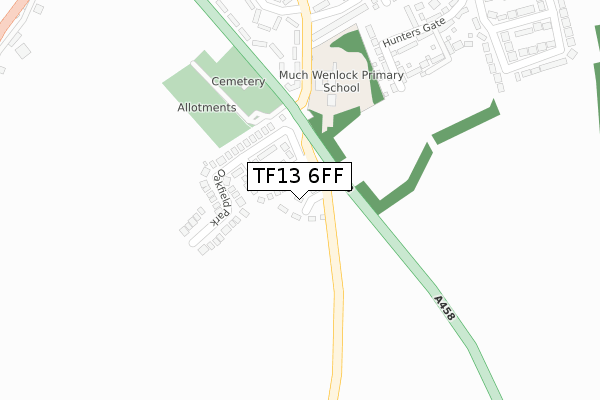
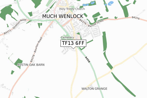
TF13 6FF maps


Licence: Open Government Licence (requires attribution)
Attribution: Contains OS data © Crown copyright and database right 2025
Source: Open Postcode Geo
Licence: Open Government Licence (requires attribution)
Attribution: Contains OS data © Crown copyright and database right 2025; Contains Royal Mail data © Royal Mail copyright and database right 2025; Source: Office for National Statistics licensed under the Open Government Licence v.3.0
TF13 6FF geodata
| Easting | 358577 |
| Northing | 297512 |
| Latitude | 52.573855 |
| Longitude | -2.612651 |
Where is TF13 6FF?
| Country | England |
| Postcode District | TF13 |
Politics
| Ward | Much Wenlock |
|---|---|
| Constituency | Ludlow |
Transport
Nearest bus stops to TF13 6FF
| Car Park (B4371) | Presthope | 221m |
| Car Park (B4371) | Presthope | 261m |
| War Memorial (Main Road) | Bourton | 1,493m |
| War Memorial (Main Road) | Bourton | 1,495m |
Broadband
Broadband access in TF13 6FF (2020 data)
| Percentage of properties with Next Generation Access | 100.0% |
| Percentage of properties with Superfast Broadband | 100.0% |
| Percentage of properties with Ultrafast Broadband | 100.0% |
| Percentage of properties with Full Fibre Broadband | 100.0% |
Superfast Broadband is between 30Mbps and 300Mbps
Ultrafast Broadband is > 300Mbps
Broadband limitations in TF13 6FF (2020 data)
| Percentage of properties unable to receive 2Mbps | 0.0% |
| Percentage of properties unable to receive 5Mbps | 0.0% |
| Percentage of properties unable to receive 10Mbps | 0.0% |
| Percentage of properties unable to receive 30Mbps | 0.0% |
Deprivation
41.7% of English postcodes are less deprived than TF13 6FF:TF13 6FF ITL and TF13 6FF LAU
The below table lists the International Territorial Level (ITL) codes (formerly Nomenclature of Territorial Units for Statistics (NUTS) codes) and Local Administrative Units (LAU) codes for TF13 6FF:
| ITL 1 Code | Name |
|---|---|
| TLG | West Midlands (England) |
| ITL 2 Code | Name |
| TLG2 | Shropshire and Staffordshire |
| ITL 3 Code | Name |
| TLG22 | Shropshire |
| LAU 1 Code | Name |
| E06000051 | Shropshire |
TF13 6FF census areas
The below table lists the Census Output Area (OA), Lower Layer Super Output Area (LSOA), and Middle Layer Super Output Area (MSOA) for TF13 6FF:
| Code | Name | |
|---|---|---|
| OA | E00146948 | |
| LSOA | E01028851 | Shropshire 029F |
| MSOA | E02006010 | Shropshire 029 |
Nearest postcodes to TF13 6FF
| TF13 6DQ | 364m | |
| TF13 6DF | 1238m | |
| TF13 6QF | 1378m | |
| TF13 6QG | 1472m | |
| TF13 6QD | 1539m | |
| TF13 6QH | 1611m | |
| TF13 6QE | 1638m | |
| SY5 6NX | 1909m | |
| SY5 6LT | 2090m | |
| TF13 6DE | 2092m |