Property/Postcode Data Search:
TF10 7GU maps, stats, and open data
TF10 7GU is located in the Newport South electoral ward, within the unitary authority of Telford and Wrekin and the English Parliamentary constituency of The Wrekin. The Sub Integrated Care Board (ICB) Location is NHS Shropshire, Telford and Wrekin ICB - M2L0M and the police force is West Mercia. This postcode has been in use since September 2019.
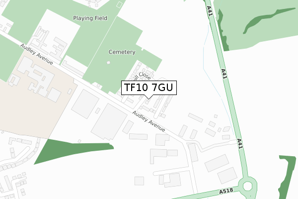
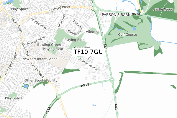
TF10 7GU maps


Source: OS Open Zoomstack (Ordnance Survey)
Licence: Open Government Licence (requires attribution)
Attribution: Contains OS data © Crown copyright and database right 2025
Source: Open Postcode Geo
Licence: Open Government Licence (requires attribution)
Attribution: Contains OS data © Crown copyright and database right 2025; Contains Royal Mail data © Royal Mail copyright and database right 2025; Source: Office for National Statistics licensed under the Open Government Licence v.3.0
Licence: Open Government Licence (requires attribution)
Attribution: Contains OS data © Crown copyright and database right 2025
Source: Open Postcode Geo
Licence: Open Government Licence (requires attribution)
Attribution: Contains OS data © Crown copyright and database right 2025; Contains Royal Mail data © Royal Mail copyright and database right 2025; Source: Office for National Statistics licensed under the Open Government Licence v.3.0
TF10 7GU geodata
| Easting | 375569 |
| Northing | 318842 |
| Latitude | 52.766633 |
| Longitude | -2.363521 |
Where is TF10 7GU?
| Country | England |
| Postcode District | TF10 |
Politics
| Ward | Newport South |
|---|---|
| Constituency | The Wrekin |
House Prices
Sales of detached houses in TF10 7GU
2024 10 DEC £300,000 |
20, CENTENARY WAY, NEWPORT, TF10 7GU 2023 24 NOV £181,250 |
16, CENTENARY WAY, NEWPORT, TF10 7GU 2023 23 AUG £299,950 |
18, CENTENARY WAY, NEWPORT, TF10 7GU 2023 6 APR £299,950 |
22, CENTENARY WAY, NEWPORT, TF10 7GU 2022 21 DEC £307,500 |
66, CENTENARY WAY, NEWPORT, TF10 7GU 2022 20 DEC £324,950 |
52, CENTENARY WAY, NEWPORT, TF10 7GU 2022 16 DEC £324,950 |
46, CENTENARY WAY, NEWPORT, TF10 7GU 2022 9 DEC £324,950 |
58, CENTENARY WAY, NEWPORT, TF10 7GU 2022 30 SEP £319,950 |
54, CENTENARY WAY, NEWPORT, TF10 7GU 2022 30 SEP £384,950 |
Source: HM Land Registry Price Paid Data
Licence: Contains HM Land Registry data © Crown copyright and database right 2025. This data is licensed under the Open Government Licence v3.0.
Licence: Contains HM Land Registry data © Crown copyright and database right 2025. This data is licensed under the Open Government Licence v3.0.
Transport
Nearest bus stops to TF10 7GU
| Barnmeadow Close (Barnmeadow Road) | Newport | 316m |
| Burton Borough School (Audley Avenue) | Newport | 407m |
| Barnmeadow Road | Newport | 422m |
| Mere Park Garden Centre (A518) | Newport | 494m |
| Daniels Cross (Stafford Road) | Newport | 503m |
Deprivation
48.9% of English postcodes are less deprived than TF10 7GU:Food Standards Agency
Three nearest food hygiene ratings to TF10 7GU (metres)
Subway

Unit 3 Audley Avenue Business Park Audley Avenue
329m
BP Newport SF Connect (Food Only)

Units 6-10 Audley Avenue Industrial Estate Audley Avenue
334m
Bargain Buys

Unit 1 Audley Avenue Business Park Audley Avenue
367m
➜ Get more ratings from the Food Standards Agency
Nearest post box to TF10 7GU
| Last Collection | |||
|---|---|---|---|
| Location | Mon-Fri | Sat | Distance |
| Barnmeadow Road | 17:30 | 11:30 | 385m |
| Audley Avenue | 17:30 | 11:30 | 691m |
| Stafford Road | 17:15 | 11:30 | 694m |
TF10 7GU ITL and TF10 7GU LAU
The below table lists the International Territorial Level (ITL) codes (formerly Nomenclature of Territorial Units for Statistics (NUTS) codes) and Local Administrative Units (LAU) codes for TF10 7GU:
| ITL 1 Code | Name |
|---|---|
| TLG | West Midlands (England) |
| ITL 2 Code | Name |
| TLG2 | Shropshire and Staffordshire |
| ITL 3 Code | Name |
| TLG21 | Telford and Wrekin |
| LAU 1 Code | Name |
| E06000020 | Telford and Wrekin |
TF10 7GU census areas
The below table lists the Census Output Area (OA), Lower Layer Super Output Area (LSOA), and Middle Layer Super Output Area (MSOA) for TF10 7GU:
| Code | Name | |
|---|---|---|
| OA | E00071580 | |
| LSOA | E01014175 | Telford and Wrekin 003A |
| MSOA | E02002930 | Telford and Wrekin 003 |
Nearest postcodes to TF10 7GU
| TF10 7NS | Barnmeadow Road | 227m |
| TF10 7NR | Barnmeadow Road | 269m |
| TF10 7NW | Meadow View Road | 287m |
| TF10 7NT | Barnmeadow Close | 293m |
| TF10 7DS | Audley Avenue | 296m |
| TF10 7NL | Meadow View Road | 298m |
| TF10 7NP | Barnmeadow Road | 323m |
| TF10 7NU | Barnmeadow Road | 354m |
| TF10 7BP | Audley House Mews | 372m |
| TF10 7FP | Saxon Drive | 386m |