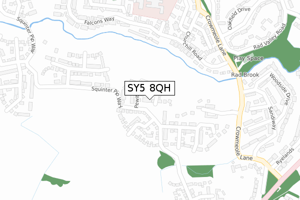
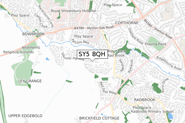
SY5 8QH is located in the Radbrook electoral ward, within the unitary authority of Shropshire and the English Parliamentary constituency of Shrewsbury and Atcham. The Sub Integrated Care Board (ICB) Location is NHS Shropshire, Telford and Wrekin ICB - M2L0M and the police force is West Mercia. This postcode has been in use since May 2019.


GetTheData
Source: OS Open Zoomstack (Ordnance Survey)
Licence: Open Government Licence (requires attribution)
Attribution: Contains OS data © Crown copyright and database right 2025
Source: Open Postcode Geo
Licence: Open Government Licence (requires attribution)
Attribution: Contains OS data © Crown copyright and database right 2025; Contains Royal Mail data © Royal Mail copyright and database right 2025; Source: Office for National Statistics licensed under the Open Government Licence v.3.0
| Easting | 346748 |
| Northing | 311980 |
| Latitude | 52.702874 |
| Longitude | -2.789518 |
GetTheData
Source: Open Postcode Geo
Licence: Open Government Licence
| Country | England |
| Postcode District | SY5 |
➜ See where SY5 is on a map ➜ Where is Shrewsbury? | |
GetTheData
Source: Land Registry Price Paid Data
Licence: Open Government Licence
| Ward | Radbrook |
| Constituency | Shrewsbury And Atcham |
GetTheData
Source: ONS Postcode Database
Licence: Open Government Licence
2024 27 FEB £395,000 |
10, PEWIT CLOSE, BOWBROOK, SHREWSBURY, SY5 8QH 2020 30 JUN £349,995 |
2, PEWIT CLOSE, BOWBROOK, SHREWSBURY, SY5 8QH 2020 26 JUN £379,995 |
26, PEWIT CLOSE, BOWBROOK, SHREWSBURY, SY5 8QH 2020 19 JUN £349,995 |
8, PEWIT CLOSE, BOWBROOK, SHREWSBURY, SY5 8QH 2020 19 JUN £349,995 |
14, PEWIT CLOSE, BOWBROOK, SHREWSBURY, SY5 8QH 2020 12 JUN £429,995 |
40, PEWIT CLOSE, BOWBROOK, SHREWSBURY, SY5 8QH 2020 29 MAY £399,995 |
30, PEWIT CLOSE, BOWBROOK, SHREWSBURY, SY5 8QH 2020 22 MAY £394,995 |
12, PEWIT CLOSE, BOWBROOK, SHREWSBURY, SY5 8QH 2020 15 APR £379,995 |
9, PEWIT CLOSE, BOWBROOK, SHREWSBURY, SY5 8QH 2020 9 APR £374,995 |
GetTheData
Source: HM Land Registry Price Paid Data
Licence: Contains HM Land Registry data © Crown copyright and database right 2025. This data is licensed under the Open Government Licence v3.0.
| Radbrook Valley Rd Jct (Crowmeole Lane) | Copthorne | 278m |
| Radbrook Valley Rd Jct (Crowmeole Lane) | Copthorne | 283m |
| No. 1 (Sandiway) | Radbrook | 318m |
| Crowmeole Road Jct (Crowmere Lane) | Copthorne | 381m |
| Crowmeole Road Jct (Crowmere Lane) | Copthorne | 387m |
| Shrewsbury Station | 2.9km |
GetTheData
Source: NaPTAN
Licence: Open Government Licence
| Percentage of properties with Next Generation Access | 100.0% |
| Percentage of properties with Superfast Broadband | 100.0% |
| Percentage of properties with Ultrafast Broadband | 83.3% |
| Percentage of properties with Full Fibre Broadband | 83.3% |
Superfast Broadband is between 30Mbps and 300Mbps
Ultrafast Broadband is > 300Mbps
| Percentage of properties unable to receive 2Mbps | 0.0% |
| Percentage of properties unable to receive 5Mbps | 0.0% |
| Percentage of properties unable to receive 10Mbps | 0.0% |
| Percentage of properties unable to receive 30Mbps | 0.0% |
GetTheData
Source: Ofcom
Licence: Ofcom Terms of Use (requires attribution)
GetTheData
Source: ONS Postcode Database
Licence: Open Government Licence


➜ Get more ratings from the Food Standards Agency
GetTheData
Source: Food Standards Agency
Licence: FSA terms & conditions
| Last Collection | |||
|---|---|---|---|
| Location | Mon-Fri | Sat | Distance |
| Crowmeole Lane | 19:15 | 11:45 | 313m |
| Churchill Drive | 19:00 | 11:45 | 361m |
| Worthington Drive | 19:00 | 11:45 | 601m |
GetTheData
Source: Dracos
Licence: Creative Commons Attribution-ShareAlike
The below table lists the International Territorial Level (ITL) codes (formerly Nomenclature of Territorial Units for Statistics (NUTS) codes) and Local Administrative Units (LAU) codes for SY5 8QH:
| ITL 1 Code | Name |
|---|---|
| TLG | West Midlands (England) |
| ITL 2 Code | Name |
| TLG2 | Shropshire and Staffordshire |
| ITL 3 Code | Name |
| TLG22 | Shropshire |
| LAU 1 Code | Name |
| E06000051 | Shropshire |
GetTheData
Source: ONS Postcode Directory
Licence: Open Government Licence
The below table lists the Census Output Area (OA), Lower Layer Super Output Area (LSOA), and Middle Layer Super Output Area (MSOA) for SY5 8QH:
| Code | Name | |
|---|---|---|
| OA | E00147382 | |
| LSOA | E01028941 | Shropshire 020A |
| MSOA | E02006034 | Shropshire 020 |
GetTheData
Source: ONS Postcode Directory
Licence: Open Government Licence
| SY3 8ZF | Ravenscourt Walk | 197m |
| SY3 8ZQ | Churchill Road | 232m |
| SY3 8ZE | Falcons Way | 241m |
| SY3 8ZA | Churchill Road | 242m |
| SY3 8ZB | Dickens Place | 254m |
| SY5 8PX | Squinter Pip Way | 262m |
| SY3 8ZD | Copperfield Drive | 274m |
| SY3 8GD | Cavell Drive | 309m |
| SY3 8BA | Crowmeole Lane | 315m |
| SY3 8ZG | Falcons Way | 323m |
GetTheData
Source: Open Postcode Geo; Land Registry Price Paid Data
Licence: Open Government Licence