Property/Postcode Data Search:
SY21 7NX maps, stats, and open data
SY21 7NX is located in the Welshpool Llanerchyddol electoral ward, within the unitary authority of Powys and the Welsh Parliamentary constituency of Montgomeryshire. The Local Health Board is Powys Teaching and the police force is Dyfed-Powys. This postcode has been in use since February 2020.
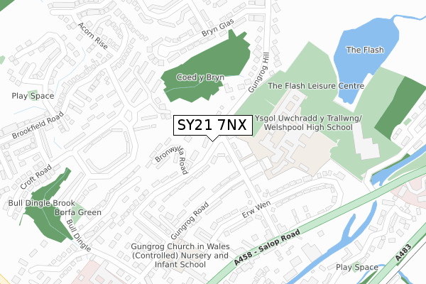
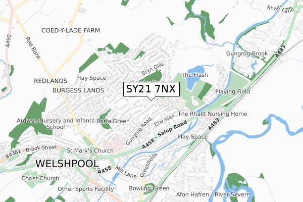
SY21 7NX maps


Source: OS Open Zoomstack (Ordnance Survey)
Licence: Open Government Licence (requires attribution)
Attribution: Contains OS data © Crown copyright and database right 2025
Source: Open Postcode Geo
Licence: Open Government Licence (requires attribution)
Attribution: Contains OS data © Crown copyright and database right 2025; Contains Royal Mail data © Royal Mail copyright and database right 2025; Source: Office for National Statistics licensed under the Open Government Licence v.3.0
Licence: Open Government Licence (requires attribution)
Attribution: Contains OS data © Crown copyright and database right 2025
Source: Open Postcode Geo
Licence: Open Government Licence (requires attribution)
Attribution: Contains OS data © Crown copyright and database right 2025; Contains Royal Mail data © Royal Mail copyright and database right 2025; Source: Office for National Statistics licensed under the Open Government Licence v.3.0
SY21 7NX geodata
| Easting | 322404 |
| Northing | 307743 |
| Latitude | 52.661845 |
| Longitude | -3.148720 |
Where is SY21 7NX?
| Country | Wales |
| Postcode District | SY21 |
Politics
| Ward | Welshpool Llanerchyddol |
|---|---|
| Constituency | Montgomeryshire |
Transport
Nearest bus stops to SY21 7NX
| Glan Lledan Cottages (Jehu Road) | Welshpool | 119m |
| Glan Lledan Cottages (Jehu Road) | Welshpool | 127m |
| Church Bank | Welshpool | 184m |
| High Street | Welshpool | 194m |
| High Street | Welshpool | 198m |
Nearest underground/metro/tram to SY21 7NX
| Welshpool Raven Square Station (W&llr) | Welshpool | 779m |
Nearest railway stations to SY21 7NX
| Welshpool Station | 0.8km |
Deprivation
38.7% of Welsh postcodes are less deprived than SY21 7NX:Food Standards Agency
Three nearest food hygiene ratings to SY21 7NX (metres)
Inglenook Cafe

Union Street
115m
Pheasant Inn

43 High Street
127m
The Town Hall

High Street
127m
➜ Get more ratings from the Food Standards Agency
Nearest post box to SY21 7NX
| Last Collection | |||
|---|---|---|---|
| Location | Mon-Fri | Sat | Distance |
| Welshpool Delivery Office | 18:00 | 12:00 | 386m |
| Erw-wen | 17:30 | 12:00 | 810m |
| Buttington Church | 17:15 | 11:45 | 2,829m |
SY21 7NX ITL and SY21 7NX LAU
The below table lists the International Territorial Level (ITL) codes (formerly Nomenclature of Territorial Units for Statistics (NUTS) codes) and Local Administrative Units (LAU) codes for SY21 7NX:
| ITL 1 Code | Name |
|---|---|
| TLL | Wales |
| ITL 2 Code | Name |
| TLL2 | East Wales |
| ITL 3 Code | Name |
| TLL24 | Powys |
| LAU 1 Code | Name |
| W06000023 | Powys |
SY21 7NX census areas
The below table lists the Census Output Area (OA), Lower Layer Super Output Area (LSOA), and Middle Layer Super Output Area (MSOA) for SY21 7NX:
| Code | Name | |
|---|---|---|
| OA | W00002676 | |
| LSOA | W01000501 | Powys 003D |
| MSOA | W02000099 | Powys 003 |
Nearest postcodes to SY21 7NX
| SY21 7PH | Brook Street | 24m |
| SY21 7PJ | Red Bank | 66m |
| SY21 7PQ | Nelson Place | 84m |
| SY21 7NL | Bronybuckley | 101m |
| SY21 7NH | Bronybuckley | 102m |
| SY21 7PG | Union Street | 111m |
| SY21 7NW | Bronybuckley | 118m |
| SY21 7PL | Red Bank | 123m |
| SY21 7JQ | High Street | 128m |
| SY21 7RY | Hall Street | 130m |