SY13 3LP maps, stats, and open data
SY13 3LP is located in the Whitchurch South electoral ward, within the unitary authority of Shropshire and the English Parliamentary constituency of North Shropshire. The Sub Integrated Care Board (ICB) Location is NHS Shropshire, Telford and Wrekin ICB - M2L0M and the police force is West Mercia. This postcode has been in use since August 2017.
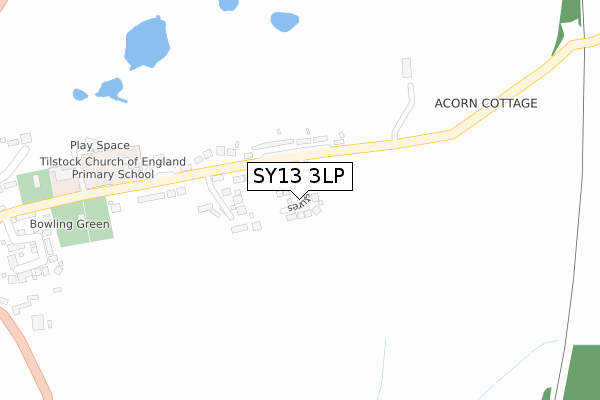
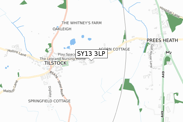
SY13 3LP maps


Licence: Open Government Licence (requires attribution)
Attribution: Contains OS data © Crown copyright and database right 2025
Source: Open Postcode Geo
Licence: Open Government Licence (requires attribution)
Attribution: Contains OS data © Crown copyright and database right 2025; Contains Royal Mail data © Royal Mail copyright and database right 2025; Source: Office for National Statistics licensed under the Open Government Licence v.3.0
SY13 3LP geodata
| Easting | 354706 |
| Northing | 337845 |
| Latitude | 52.936095 |
| Longitude | -2.675352 |
Where is SY13 3LP?
| Country | England |
| Postcode District | SY13 |
Politics
| Ward | Whitchurch South |
|---|---|
| Constituency | North Shropshire |
House Prices
Sales of detached houses in SY13 3LP
2023 28 JUN £460,000 |
2022 26 AUG £350,000 |
2021 22 SEP £362,000 |
2021 22 SEP £393,000 |
2021 16 MAR £360,000 |
2021 10 MAR £379,995 |
2020 17 NOV £270,000 |
2019 30 OCT £315,000 |
2019 21 MAY £350,000 |
2018 31 JUL £250,000 |
Licence: Contains HM Land Registry data © Crown copyright and database right 2025. This data is licensed under the Open Government Licence v3.0.
Transport
Nearest bus stops to SY13 3LP
| Hawkstone View (Tilstock Lane) | Tilstock | 84m |
| Hawkstone View (Tilstock Lane) | Tilstock | 87m |
| Parish Rooms (Tilstock Lane) | Tilstock | 469m |
| Parish Rooms (Tilstock Lane) | Tilstock | 514m |
| Horseshoes Inn (B5476) | Tilstock | 577m |
Nearest railway stations to SY13 3LP
| Whitchurch (Shrops) Station | 3.6km |
| Prees Station | 4.2km |
Broadband
Broadband access in SY13 3LP (2020 data)
| Percentage of properties with Next Generation Access | 100.0% |
| Percentage of properties with Superfast Broadband | 100.0% |
| Percentage of properties with Ultrafast Broadband | 0.0% |
| Percentage of properties with Full Fibre Broadband | 0.0% |
Superfast Broadband is between 30Mbps and 300Mbps
Ultrafast Broadband is > 300Mbps
Broadband speed in SY13 3LP (2019 data)
Download
| Median download speed | 64.9Mbps |
| Average download speed | 59.1Mbps |
| Maximum download speed | 80.00Mbps |
Upload
| Median upload speed | 11.0Mbps |
| Average upload speed | 11.3Mbps |
| Maximum upload speed | 14.79Mbps |
Broadband limitations in SY13 3LP (2020 data)
| Percentage of properties unable to receive 2Mbps | 0.0% |
| Percentage of properties unable to receive 5Mbps | 0.0% |
| Percentage of properties unable to receive 10Mbps | 0.0% |
| Percentage of properties unable to receive 30Mbps | 0.0% |
Deprivation
64.7% of English postcodes are less deprived than SY13 3LP:Food Standards Agency
Three nearest food hygiene ratings to SY13 3LP (metres)


➜ Get more ratings from the Food Standards Agency
Nearest post box to SY13 3LP
| Last Collection | |||
|---|---|---|---|
| Location | Mon-Fri | Sat | Distance |
| Alkington Gardens | 17:45 | 11:30 | 3,174m |
| Newport Road | 17:45 | 11:30 | 3,230m |
| Dodington | 17:45 | 11:45 | 3,312m |
SY13 3LP ITL and SY13 3LP LAU
The below table lists the International Territorial Level (ITL) codes (formerly Nomenclature of Territorial Units for Statistics (NUTS) codes) and Local Administrative Units (LAU) codes for SY13 3LP:
| ITL 1 Code | Name |
|---|---|
| TLG | West Midlands (England) |
| ITL 2 Code | Name |
| TLG2 | Shropshire and Staffordshire |
| ITL 3 Code | Name |
| TLG22 | Shropshire |
| LAU 1 Code | Name |
| E06000051 | Shropshire |
SY13 3LP census areas
The below table lists the Census Output Area (OA), Lower Layer Super Output Area (LSOA), and Middle Layer Super Output Area (MSOA) for SY13 3LP:
| Code | Name | |
|---|---|---|
| OA | E00147143 | |
| LSOA | E01028893 | Shropshire 002D |
| MSOA | E02006016 | Shropshire 002 |
Nearest postcodes to SY13 3LP
| SY13 3JW | Tilstock Lane | 123m |
| SY13 3JN | Hawkstone View | 135m |
| SY13 3JH | Church Close | 452m |
| SY13 3JL | 468m | |
| SY13 3PG | Tilstock Close | 543m |
| SY13 3NR | 569m | |
| SY13 3NS | 598m | |
| SY13 3JP | Tilstock Lane | 648m |
| SY13 3NT | Hollins Lane | 741m |
| SY13 3NP | 774m |