Property/Postcode Data Search:
SY11 4FP maps, stats, and open data
SY11 4FP is located in the Whittington electoral ward, within the unitary authority of Shropshire and the English Parliamentary constituency of North Shropshire. The Sub Integrated Care Board (ICB) Location is NHS Shropshire, Telford and Wrekin ICB - M2L0M and the police force is West Mercia. This postcode has been in use since April 2020.
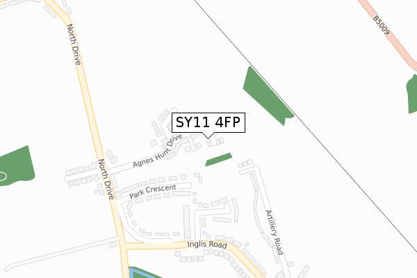
SY11 4FP maps


Source: OS Open Zoomstack (Ordnance Survey)
Licence: Open Government Licence (requires attribution)
Attribution: Contains OS data © Crown copyright and database right 2025
Source: Open Postcode Geo
Licence: Open Government Licence (requires attribution)
Attribution: Contains OS data © Crown copyright and database right 2025; Contains Royal Mail data © Royal Mail copyright and database right 2025; Source: Office for National Statistics licensed under the Open Government Licence v.3.0
Licence: Open Government Licence (requires attribution)
Attribution: Contains OS data © Crown copyright and database right 2025
Source: Open Postcode Geo
Licence: Open Government Licence (requires attribution)
Attribution: Contains OS data © Crown copyright and database right 2025; Contains Royal Mail data © Royal Mail copyright and database right 2025; Source: Office for National Statistics licensed under the Open Government Licence v.3.0
SY11 4FP geodata
| Easting | 332776 |
| Northing | 330784 |
| Latitude | 52.870328 |
| Longitude | -3.000130 |
Where is SY11 4FP?
| Country | England |
| Postcode District | SY11 |
Politics
| Ward | Whittington |
|---|---|
| Constituency | North Shropshire |
House Prices
Sales of detached houses in SY11 4FP
28, ROWSON DRIVE, WHITTINGTON, OSWESTRY, SY11 4FP 2021 26 FEB £350,000 |
26, ROWSON DRIVE, WHITTINGTON, OSWESTRY, SY11 4FP 2021 26 FEB £345,995 |
16, ROWSON DRIVE, WHITTINGTON, OSWESTRY, SY11 4FP 2021 25 FEB £335,995 |
24, ROWSON DRIVE, WHITTINGTON, OSWESTRY, SY11 4FP 2021 19 FEB £348,995 |
18, ROWSON DRIVE, WHITTINGTON, OSWESTRY, SY11 4FP 2020 18 DEC £256,000 |
14, ROWSON DRIVE, WHITTINGTON, OSWESTRY, SY11 4FP 2020 4 DEC £365,000 |
10, ROWSON DRIVE, WHITTINGTON, OSWESTRY, SY11 4FP 2020 26 NOV £299,995 |
12, ROWSON DRIVE, WHITTINGTON, OSWESTRY, SY11 4FP 2020 28 AUG £299,995 |
Source: HM Land Registry Price Paid Data
Licence: Contains HM Land Registry data © Crown copyright and database right 2025. This data is licensed under the Open Government Licence v3.0.
Licence: Contains HM Land Registry data © Crown copyright and database right 2025. This data is licensed under the Open Government Licence v3.0.
Transport
Nearest bus stops to SY11 4FP
| School (Station Road) | Whittington | 168m |
| School (Station Road) | Whittington | 180m |
| Three Trees (A495) | Whittington | 204m |
| Three Trees (A495) | Whittington | 225m |
| White Lion (Castle Street) | Whittington | 314m |
Nearest railway stations to SY11 4FP
| Gobowen Station | 3.6km |
Deprivation
50.3% of English postcodes are less deprived than SY11 4FP:Food Standards Agency
Three nearest food hygiene ratings to SY11 4FP (metres)
Three Trees Premier Stores

Station Road
170m
Whittington's

Station Road
221m
Dining @ Whittington C Of E School

Whittington C Of E School
221m
➜ Get more ratings from the Food Standards Agency
Nearest post box to SY11 4FP
| Last Collection | |||
|---|---|---|---|
| Location | Mon-Fri | Sat | Distance |
| Middleton Road | 17:45 | 11:30 | 3,394m |
| Somerfield | 18:00 | 12:00 | 3,459m |
| Beatrice Street | 18:00 | 12:00 | 3,698m |
SY11 4FP ITL and SY11 4FP LAU
The below table lists the International Territorial Level (ITL) codes (formerly Nomenclature of Territorial Units for Statistics (NUTS) codes) and Local Administrative Units (LAU) codes for SY11 4FP:
| ITL 1 Code | Name |
|---|---|
| TLG | West Midlands (England) |
| ITL 2 Code | Name |
| TLG2 | Shropshire and Staffordshire |
| ITL 3 Code | Name |
| TLG22 | Shropshire |
| LAU 1 Code | Name |
| E06000051 | Shropshire |
SY11 4FP census areas
The below table lists the Census Output Area (OA), Lower Layer Super Output Area (LSOA), and Middle Layer Super Output Area (MSOA) for SY11 4FP:
| Code | Name | |
|---|---|---|
| OA | E00147296 | |
| LSOA | E01028927 | Shropshire 011D |
| MSOA | E02006026 | Shropshire 011 |
Nearest postcodes to SY11 4FP
| SY11 4DB | Station Road | 180m |
| SY11 4DE | Station Road | 198m |
| SY11 4PS | Birchwood Drive | 215m |
| SY11 4PY | Donnett Mews | 217m |
| SY11 4PJ | Plas Cerrig Close | 218m |
| SY11 4DA | Station Road | 221m |
| SY11 4PL | Oaklands Drive | 233m |
| SY11 4BZ | Laburnum Cottages | 235m |
| SY11 4BY | Station Road | 256m |
| SY11 4FA | Penrhos Court | 260m |