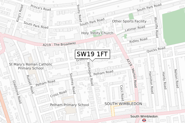
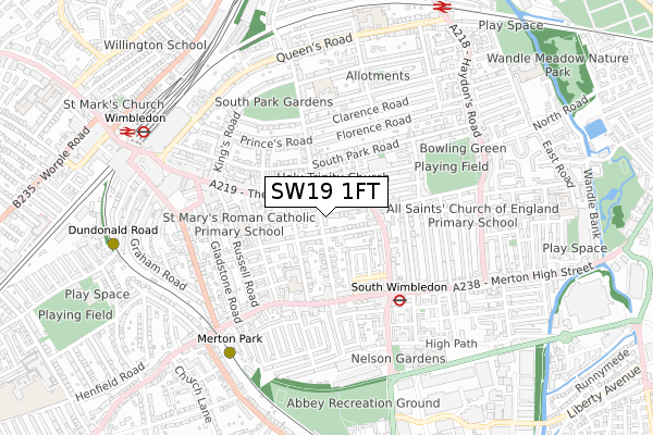
SW19 1FT is located in the Abbey electoral ward, within the London borough of Merton and the English Parliamentary constituency of Wimbledon. The Sub Integrated Care Board (ICB) Location is NHS South West London ICB - 36L and the police force is Metropolitan Police. This postcode has been in use since February 2018.


GetTheData
Source: OS Open Zoomstack (Ordnance Survey)
Licence: Open Government Licence (requires attribution)
Attribution: Contains OS data © Crown copyright and database right 2025
Source: Open Postcode Geo
Licence: Open Government Licence (requires attribution)
Attribution: Contains OS data © Crown copyright and database right 2025; Contains Royal Mail data © Royal Mail copyright and database right 2025; Source: Office for National Statistics licensed under the Open Government Licence v.3.0
| Easting | 525549 |
| Northing | 170352 |
| Latitude | 51.418288 |
| Longitude | -0.195847 |
GetTheData
Source: Open Postcode Geo
Licence: Open Government Licence
| Country | England |
| Postcode District | SW19 |
➜ See where SW19 is on a map ➜ Where is Wimbledon? | |
GetTheData
Source: Land Registry Price Paid Data
Licence: Open Government Licence
| Ward | Abbey |
| Constituency | Wimbledon |
GetTheData
Source: ONS Postcode Database
Licence: Open Government Licence
| The Polka Theatre | South Wimbledon | 126m |
| The Polka Theatre | South Wimbledon | 128m |
| Merton Road | Merton | 251m |
| Merton Road | Merton | 267m |
| Wimbledon Theatre | South Wimbledon | 290m |
| South Wimbledon Underground Station | South Wimbledon | 427m |
| Merton Park Tram Stop (Off Rutlish Road) | Merton | 642m |
| Wimbledon Tram Stop (The Broadway) | Wimbledon | 757m |
| Wimbledon Underground Station | Wimbledon | 812m |
| Dundonald Road Tram Stop (Dundonald Road) | Wimbledon | 825m |
| Wimbledon Station | 0.8km |
| Haydons Road Station | 0.9km |
| Wimbledon Chase Station | 1.6km |
GetTheData
Source: NaPTAN
Licence: Open Government Licence
| Percentage of properties with Next Generation Access | 100.0% |
| Percentage of properties with Superfast Broadband | 100.0% |
| Percentage of properties with Ultrafast Broadband | 100.0% |
| Percentage of properties with Full Fibre Broadband | 0.0% |
Superfast Broadband is between 30Mbps and 300Mbps
Ultrafast Broadband is > 300Mbps
| Median download speed | 100.0Mbps |
| Average download speed | 107.6Mbps |
| Maximum download speed | 200.00Mbps |
| Median upload speed | 9.8Mbps |
| Average upload speed | 13.0Mbps |
| Maximum upload speed | 19.53Mbps |
| Percentage of properties unable to receive 2Mbps | 0.0% |
| Percentage of properties unable to receive 5Mbps | 0.0% |
| Percentage of properties unable to receive 10Mbps | 0.0% |
| Percentage of properties unable to receive 30Mbps | 0.0% |
GetTheData
Source: Ofcom
Licence: Ofcom Terms of Use (requires attribution)
GetTheData
Source: ONS Postcode Database
Licence: Open Government Licence


➜ Get more ratings from the Food Standards Agency
GetTheData
Source: Food Standards Agency
Licence: FSA terms & conditions
| Last Collection | |||
|---|---|---|---|
| Location | Mon-Fri | Sat | Distance |
| Griffiths Road | 17:30 | 12:00 | 170m |
| 132 The Broadway | 18:30 | 12:00 | 274m |
| Balfour Road | 17:30 | 12:00 | 319m |
GetTheData
Source: Dracos
Licence: Creative Commons Attribution-ShareAlike
The below table lists the International Territorial Level (ITL) codes (formerly Nomenclature of Territorial Units for Statistics (NUTS) codes) and Local Administrative Units (LAU) codes for SW19 1FT:
| ITL 1 Code | Name |
|---|---|
| TLI | London |
| ITL 2 Code | Name |
| TLI6 | Outer London - South |
| ITL 3 Code | Name |
| TLI63 | Merton, Kingston upon Thames and Sutton |
| LAU 1 Code | Name |
| E09000024 | Merton |
GetTheData
Source: ONS Postcode Directory
Licence: Open Government Licence
The below table lists the Census Output Area (OA), Lower Layer Super Output Area (LSOA), and Middle Layer Super Output Area (MSOA) for SW19 1FT:
| Code | Name | |
|---|---|---|
| OA | E00017003 | |
| LSOA | E01003358 | Merton 009C |
| MSOA | E02000697 | Merton 009 |
GetTheData
Source: ONS Postcode Directory
Licence: Open Government Licence
| SW19 1SP | Griffiths Road | 81m |
| SW19 1NW | Pelham Road | 83m |
| SW19 1SS | Griffiths Road | 88m |
| SW19 1SA | Montague Road | 94m |
| SW19 1TZ | Montague Road | 97m |
| SW19 1SU | Pelham Road | 100m |
| SW19 1SX | Pelham Road | 117m |
| SW19 1NP | Pelham Road | 126m |
| SW19 1SD | The Broadway | 126m |
| SW19 1NL | The Broadway | 131m |
GetTheData
Source: Open Postcode Geo; Land Registry Price Paid Data
Licence: Open Government Licence