SW18 2BF maps, stats, and open data
- Home
- Postcode
- SW
- SW18
- SW18 2
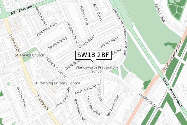
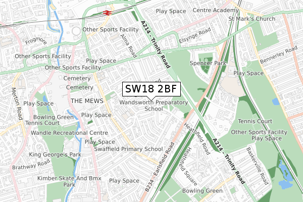
SW18 2BF is located in the Wandsworth Town electoral ward, within the London borough of Wandsworth and the English Parliamentary constituency of Tooting. The Sub Integrated Care Board (ICB) Location is NHS South West London ICB - 36L and the police force is Metropolitan Police. This postcode has been in use since May 2019.
SW18 2BF maps


Source: OS Open Zoomstack (Ordnance Survey)
Licence: Open Government Licence (requires attribution)
Attribution: Contains OS data © Crown copyright and database right 2025
Source: Open Postcode GeoLicence: Open Government Licence (requires attribution)
Attribution: Contains OS data © Crown copyright and database right 2025; Contains Royal Mail data © Royal Mail copyright and database right 2025; Source: Office for National Statistics licensed under the Open Government Licence v.3.0
SW18 2BF geodata
| Easting | 526351 |
| Northing | 174395 |
| Latitude | 51.454446 |
| Longitude | -0.182878 |
Where is SW18 2BF?
| Country | England |
| Postcode District | SW18 |
Politics
| Ward | Wandsworth Town |
|---|
| Constituency | Tooting |
|---|
Transport
Nearest bus stops to SW18 2BF
| West Side (Trinity Road) | Wandsworth | 264m |
| West Side | Wandsworth | 299m |
| Heathfield Road (Earlsfield Road) | Earlsfield | 325m |
| Heathfield Road (Earlsfield Road) | Earlsfield | 327m |
| Alexander Court | Wandsworth | 352m |
Nearest railway stations to SW18 2BF
| Wandsworth Town Station | 0.8km |
| Earlsfield Station | 1.4km |
| Clapham Junction Station | 1.4km |
Broadband
Broadband access in SW18 2BF (2020 data)
| Percentage of properties with Next Generation Access | 100.0% |
| Percentage of properties with Superfast Broadband | 100.0% |
| Percentage of properties with Ultrafast Broadband | 100.0% |
| Percentage of properties with Full Fibre Broadband | 0.0% |
Superfast Broadband is between 30Mbps and 300Mbps
Ultrafast Broadband is > 300Mbps
Broadband limitations in SW18 2BF (2020 data)
| Percentage of properties unable to receive 2Mbps | 0.0% |
| Percentage of properties unable to receive 5Mbps | 0.0% |
| Percentage of properties unable to receive 10Mbps | 0.0% |
| Percentage of properties unable to receive 30Mbps | 0.0% |
Deprivation
24.5% of English postcodes are less deprived than
SW18 2BF:
Food Standards Agency
Three nearest food hygiene ratings to SW18 2BF (metres)
Wandsworth Preparatory School
Wandsworth Preparatory School The Old Library
31m
Noah's Ark Nursery School (Westside
Mehmet's Cafe
➜ Get more ratings from the Food Standards Agency
Nearest post box to SW18 2BF
| | Last Collection | |
|---|
| Location | Mon-Fri | Sat | Distance |
|---|
| Geraldine Road | 17:30 | 12:00 | 110m |
| 1a Heathfield Road | 17:30 | 12:00 | 206m |
| 19 Barmouth Road | 17:30 | 12:00 | 231m |
SW18 2BF ITL and SW18 2BF LAU
The below table lists the International Territorial Level (ITL) codes (formerly Nomenclature of Territorial Units for Statistics (NUTS) codes) and Local Administrative Units (LAU) codes for SW18 2BF:
| ITL 1 Code | Name |
|---|
| TLI | London |
| ITL 2 Code | Name |
|---|
| TLI3 | Inner London - West |
| ITL 3 Code | Name |
|---|
| TLI34 | Wandsworth |
| LAU 1 Code | Name |
|---|
| E09000032 | Wandsworth |
SW18 2BF census areas
The below table lists the Census Output Area (OA), Lower Layer Super Output Area (LSOA), and Middle Layer Super Output Area (MSOA) for SW18 2BF:
| Code | Name |
|---|
| OA | E00023310 | |
|---|
| LSOA | E01004627 | Wandsworth 019F |
|---|
| MSOA | E02000941 | Wandsworth 019 |
|---|
Nearest postcodes to SW18 2BF


