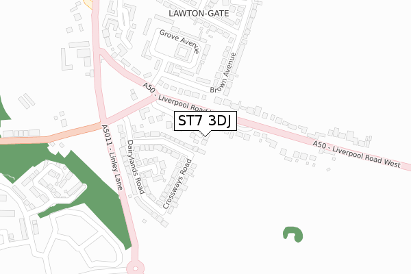
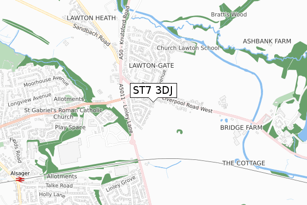
ST7 3DJ is located in the Odd Rode electoral ward, within the unitary authority of Cheshire East and the English Parliamentary constituency of Congleton. The Sub Integrated Care Board (ICB) Location is NHS Cheshire and Merseyside ICB - 27D and the police force is Cheshire. This postcode has been in use since April 2020.


GetTheData
Source: OS Open Zoomstack (Ordnance Survey)
Licence: Open Government Licence (requires attribution)
Attribution: Contains OS data © Crown copyright and database right 2025
Source: Open Postcode Geo
Licence: Open Government Licence (requires attribution)
Attribution: Contains OS data © Crown copyright and database right 2025; Contains Royal Mail data © Royal Mail copyright and database right 2025; Source: Office for National Statistics licensed under the Open Government Licence v.3.0
| Easting | 381163 |
| Northing | 355759 |
| Latitude | 53.098712 |
| Longitude | -2.282774 |
GetTheData
Source: Open Postcode Geo
Licence: Open Government Licence
| Country | England |
| Postcode District | ST7 |
➜ See where ST7 is on a map ➜ Where is Alsager? | |
GetTheData
Source: Land Registry Price Paid Data
Licence: Open Government Licence
| Ward | Odd Rode |
| Constituency | Congleton |
GetTheData
Source: ONS Postcode Database
Licence: Open Government Licence
2, ROWLEY MEADOWS, CHURCH LAWTON, STOKE-ON-TRENT, ST7 3DJ 2021 14 MAY £380,000 |
3, ROWLEY MEADOWS, CHURCH LAWTON, STOKE-ON-TRENT, ST7 3DJ 2020 12 JUN £390,000 |
1, ROWLEY MEADOWS, CHURCH LAWTON, STOKE-ON-TRENT, ST7 3DJ 2020 12 MAY £415,000 |
GetTheData
Source: HM Land Registry Price Paid Data
Licence: Contains HM Land Registry data © Crown copyright and database right 2025. This data is licensed under the Open Government Licence v3.0.
| Lawton Arms Ph (Liverpool Road West) | Church Lawton | 151m |
| Lawton Arms Ph (Crewe Road) | Church Lawton | 183m |
| Crewe Road (Liverpool Road West) | Church Lawton | 215m |
| Crewe Road (Liverpool Road West) | Church Lawton | 250m |
| Lawton Arms Ph (Linley Lane) | Church Lawton | 292m |
| Alsager Station | 1.3km |
| Kidsgrove Station | 2.9km |
GetTheData
Source: NaPTAN
Licence: Open Government Licence
GetTheData
Source: ONS Postcode Database
Licence: Open Government Licence


➜ Get more ratings from the Food Standards Agency
GetTheData
Source: Food Standards Agency
Licence: FSA terms & conditions
| Last Collection | |||
|---|---|---|---|
| Location | Mon-Fri | Sat | Distance |
| Barratt Road | 17:00 | 10:30 | 865m |
| Alsager Post Office | 17:30 | 11:30 | 1,019m |
| Crewe Road | 16:30 | 10:30 | 1,890m |
GetTheData
Source: Dracos
Licence: Creative Commons Attribution-ShareAlike
The below table lists the International Territorial Level (ITL) codes (formerly Nomenclature of Territorial Units for Statistics (NUTS) codes) and Local Administrative Units (LAU) codes for ST7 3DJ:
| ITL 1 Code | Name |
|---|---|
| TLD | North West (England) |
| ITL 2 Code | Name |
| TLD6 | Cheshire |
| ITL 3 Code | Name |
| TLD62 | Cheshire East |
| LAU 1 Code | Name |
| E06000049 | Cheshire East |
GetTheData
Source: ONS Postcode Directory
Licence: Open Government Licence
The below table lists the Census Output Area (OA), Lower Layer Super Output Area (LSOA), and Middle Layer Super Output Area (MSOA) for ST7 3DJ:
| Code | Name | |
|---|---|---|
| OA | E00092941 | |
| LSOA | E01018417 | Cheshire East 033B |
| MSOA | E02003822 | Cheshire East 033 |
GetTheData
Source: ONS Postcode Directory
Licence: Open Government Licence
| ST7 3DQ | Crewe Road | 95m |
| ST7 3EZ | Grove Park Avenue | 105m |
| ST7 3EX | Elmwood Close | 124m |
| ST7 3EY | Crossway Road | 134m |
| ST7 3DB | Crewe Road | 163m |
| ST7 3DG | Liverpool Road West | 167m |
| ST7 3EE | Brown Avenue | 169m |
| ST7 3EA | Liverpool Road West | 171m |
| ST7 3EU | Dairylands Road | 180m |
| ST7 3EB | Grove Avenue | 212m |
GetTheData
Source: Open Postcode Geo; Land Registry Price Paid Data
Licence: Open Government Licence