ST14 5ND maps, stats, and open data
ST14 5ND is located in the Stramshall & Weaver electoral ward, within the local authority district of East Staffordshire and the English Parliamentary constituency of Burton. The Sub Integrated Care Board (ICB) Location is NHS Staffordshire and Stoke-on-Trent ICB - 05D and the police force is Staffordshire. This postcode has been in use since June 2019.
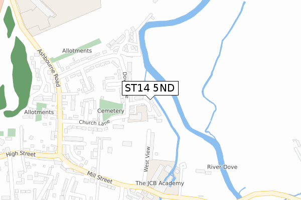
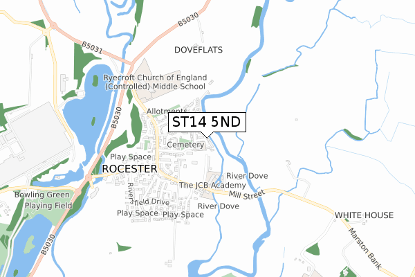
ST14 5ND maps


Licence: Open Government Licence (requires attribution)
Attribution: Contains OS data © Crown copyright and database right 2025
Source: Open Postcode Geo
Licence: Open Government Licence (requires attribution)
Attribution: Contains OS data © Crown copyright and database right 2025; Contains Royal Mail data © Royal Mail copyright and database right 2025; Source: Office for National Statistics licensed under the Open Government Licence v.3.0
ST14 5ND geodata
| Easting | 411251 |
| Northing | 339507 |
| Latitude | 52.952843 |
| Longitude | -1.833982 |
Where is ST14 5ND?
| Country | England |
| Postcode District | ST14 |
Politics
| Ward | Stramshall & Weaver |
|---|---|
| Constituency | Burton |
House Prices
Sales of detached houses in ST14 5ND
2024 20 DEC £352,000 |
2024 31 JUL £325,000 |
2021 28 MAY £438,500 |
2021 28 MAY £387,000 |
15, WENTWORTH PLACE, ROCESTER, UTTOXETER, ST14 5ND 2021 14 MAY £389,950 |
19, WENTWORTH PLACE, ROCESTER, UTTOXETER, ST14 5ND 2021 26 FEB £327,500 |
2, WENTWORTH PLACE, ROCESTER, UTTOXETER, ST14 5ND 2020 23 NOV £270,000 |
2020 16 OCT £279,995 |
17, WENTWORTH PLACE, ROCESTER, UTTOXETER, ST14 5ND 2020 24 JUL £328,000 |
23, WENTWORTH PLACE, ROCESTER, UTTOXETER, ST14 5ND 2020 20 JUL £540,000 |
Licence: Contains HM Land Registry data © Crown copyright and database right 2025. This data is licensed under the Open Government Licence v3.0.
Transport
Nearest bus stops to ST14 5ND
| Northfield Avenue (Ashbourne Road) | Rocester | 306m |
| Northfield Avenue (Ashbourne Road) | Rocester | 318m |
| Ashbourne Road Garage (Ashbourne Road) | Rocester | 318m |
| Ashbourne Road Garage (Ashbourne Road) | Rocester | 329m |
| Riversfield Drive (High Street) | Rocester | 475m |
Broadband
Broadband access in ST14 5ND (2020 data)
| Percentage of properties with Next Generation Access | 100.0% |
| Percentage of properties with Superfast Broadband | 100.0% |
| Percentage of properties with Ultrafast Broadband | 0.0% |
| Percentage of properties with Full Fibre Broadband | 0.0% |
Superfast Broadband is between 30Mbps and 300Mbps
Ultrafast Broadband is > 300Mbps
Broadband limitations in ST14 5ND (2020 data)
| Percentage of properties unable to receive 2Mbps | 0.0% |
| Percentage of properties unable to receive 5Mbps | 0.0% |
| Percentage of properties unable to receive 10Mbps | 0.0% |
| Percentage of properties unable to receive 30Mbps | 0.0% |
Deprivation
50% of English postcodes are less deprived than ST14 5ND:Food Standards Agency
Three nearest food hygiene ratings to ST14 5ND (metres)


➜ Get more ratings from the Food Standards Agency
Nearest post box to ST14 5ND
| Last Collection | |||
|---|---|---|---|
| Location | Mon-Fri | Sat | Distance |
| Roston | 16:45 | 09:45 | 2,541m |
| Waldley Lane | 16:30 | 11:15 | 2,707m |
| Marston Montgomery P O | 16:00 | 10:15 | 2,709m |
ST14 5ND ITL and ST14 5ND LAU
The below table lists the International Territorial Level (ITL) codes (formerly Nomenclature of Territorial Units for Statistics (NUTS) codes) and Local Administrative Units (LAU) codes for ST14 5ND:
| ITL 1 Code | Name |
|---|---|
| TLG | West Midlands (England) |
| ITL 2 Code | Name |
| TLG2 | Shropshire and Staffordshire |
| ITL 3 Code | Name |
| TLG24 | Staffordshire CC |
| LAU 1 Code | Name |
| E07000193 | East Staffordshire |
ST14 5ND census areas
The below table lists the Census Output Area (OA), Lower Layer Super Output Area (LSOA), and Middle Layer Super Output Area (MSOA) for ST14 5ND:
| Code | Name | |
|---|---|---|
| OA | E00149915 | |
| LSOA | E01029423 | East Staffordshire 001D |
| MSOA | E02006131 | East Staffordshire 001 |
Nearest postcodes to ST14 5ND
| ST14 5LA | Dove Lane | 113m |
| ST14 5LB | Dove Lane | 118m |
| ST14 5JY | West View | 139m |
| ST14 5LD | Coronation Crescent | 171m |
| ST14 5NA | Woodseat Grove | 209m |
| ST14 5JZ | Church Lane | 227m |
| ST14 5PL | Castrum Court | 229m |
| ST14 5LG | Swinson Close | 231m |
| ST14 5LE | Northfield Avenue | 239m |
| ST14 5DA | Rowan Court | 264m |