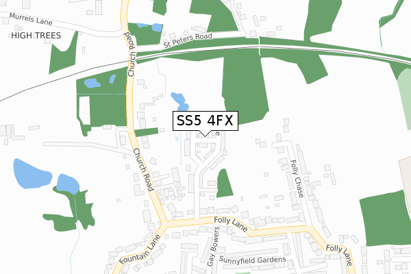
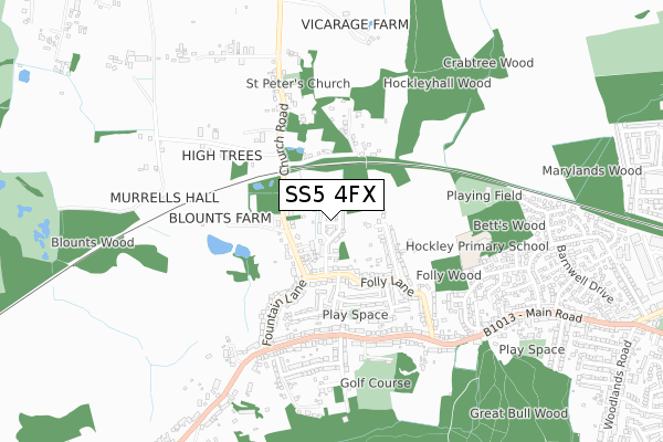
SS5 4FX maps, stats, and open data
SS5 4FX is located in the Hockley electoral ward, within the local authority district of Rochford and the English Parliamentary constituency of Rayleigh and Wickford. The Sub Integrated Care Board (ICB) Location is NHS Mid and South Essex ICB - 99F and the police force is Essex. This postcode has been in use since January 2018.
SS5 4FX maps


Licence: Open Government Licence (requires attribution)
Attribution: Contains OS data © Crown copyright and database right 2025
Source: Open Postcode Geo
Licence: Open Government Licence (requires attribution)
Attribution: Contains OS data © Crown copyright and database right 2025; Contains Royal Mail data © Royal Mail copyright and database right 2025; Source: Office for National Statistics licensed under the Open Government Licence v.3.0
SS5 4FX geodata
| Easting | 582752 |
| Northing | 192864 |
| Latitude | 51.604959 |
| Longitude | 0.637662 |
Where is SS5 4FX?
| Country | England |
| Postcode District | SS5 |
Politics
| Ward | Hockley |
|---|---|
| Constituency | Rayleigh And Wickford |
House Prices
Sales of detached houses in SS5 4FX
2022 27 SEP £530,000 |
2021 19 NOV £425,000 |
2021 25 JUN £455,000 |
5, BARTLETT VIEW, HOCKLEY, SS5 4FX 2018 29 JUN £450,000 |
2018 31 MAY £390,000 |
2018 30 APR £455,000 |
3, BARTLETT VIEW, HOCKLEY, SS5 4FX 2018 29 MAR £460,000 |
2017 21 DEC £390,000 |
Licence: Contains HM Land Registry data © Crown copyright and database right 2025. This data is licensed under the Open Government Licence v3.0.
Transport
Nearest bus stops to SS5 4FX
| Folly Lane (Aldermans Hill) | Hockley | 486m |
| Folly Lane (Aldermans Hill) | Hockley | 487m |
| Fountain Lane (High Road) | Hockley | 522m |
| Fountain Lane (High Road) | Hockley | 532m |
| The Bull (Main Road) | Hockley | 682m |
Nearest railway stations to SS5 4FX
| Hockley Station | 1.5km |
| Rayleigh Station | 3.1km |
| Rochford Station | 5.2km |
Broadband
Broadband access in SS5 4FX (2020 data)
| Percentage of properties with Next Generation Access | 100.0% |
| Percentage of properties with Superfast Broadband | 100.0% |
| Percentage of properties with Ultrafast Broadband | 100.0% |
| Percentage of properties with Full Fibre Broadband | 100.0% |
Superfast Broadband is between 30Mbps and 300Mbps
Ultrafast Broadband is > 300Mbps
Broadband limitations in SS5 4FX (2020 data)
| Percentage of properties unable to receive 2Mbps | 0.0% |
| Percentage of properties unable to receive 5Mbps | 0.0% |
| Percentage of properties unable to receive 10Mbps | 0.0% |
| Percentage of properties unable to receive 30Mbps | 0.0% |
Deprivation
3% of English postcodes are less deprived than SS5 4FX:Food Standards Agency
Three nearest food hygiene ratings to SS5 4FX (metres)


➜ Get more ratings from the Food Standards Agency
Nearest post box to SS5 4FX
| Last Collection | |||
|---|---|---|---|
| Location | Mon-Fri | Sat | Distance |
| High Road | 17:00 | 09:00 | 963m |
| 69 Southend Road | 17:00 | 09:00 | 1,267m |
| Hockley Delivery Office | 17:30 | 12:30 | 1,352m |
SS5 4FX ITL and SS5 4FX LAU
The below table lists the International Territorial Level (ITL) codes (formerly Nomenclature of Territorial Units for Statistics (NUTS) codes) and Local Administrative Units (LAU) codes for SS5 4FX:
| ITL 1 Code | Name |
|---|---|
| TLH | East |
| ITL 2 Code | Name |
| TLH3 | Essex |
| ITL 3 Code | Name |
| TLH37 | Essex Thames Gateway |
| LAU 1 Code | Name |
| E07000075 | Rochford |
SS5 4FX census areas
The below table lists the Census Output Area (OA), Lower Layer Super Output Area (LSOA), and Middle Layer Super Output Area (MSOA) for SS5 4FX:
| Code | Name | |
|---|---|---|
| OA | E00111447 | |
| LSOA | E01021941 | Rochford 003I |
| MSOA | E02004565 | Rochford 003 |
Nearest postcodes to SS5 4FX
| SS5 4SS | Church Road | 138m |
| SS5 4SB | The Astors | 145m |
| SS5 4SR | Folly Lane | 189m |
| SS5 4SJ | Folly Lane | 249m |
| SS5 4SF | Folly Chase | 266m |
| SS5 4SN | Gay Bowers | 282m |
| SS5 4SP | Silvertree Close | 295m |
| SS5 4SL | Sunnyfield Gardens | 328m |
| SS5 6AA | St Peters Road | 334m |
| SS5 4SW | Hawthorne Gardens | 365m |