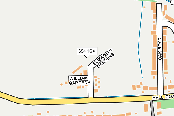
SS4 1GX is located in the Roche South electoral ward, within the local authority district of Rochford and the English Parliamentary constituency of Rochford and Southend East. The Sub Integrated Care Board (ICB) Location is NHS Mid and South Essex ICB - 99F and the police force is Essex. This postcode has been in use since June 2017.


GetTheData
Source: OS OpenMap – Local (Ordnance Survey)
Source: OS VectorMap District (Ordnance Survey)
Licence: Open Government Licence (requires attribution)
| Easting | 586449 |
| Northing | 190543 |
| Latitude | 51.582903 |
| Longitude | 0.689756 |
GetTheData
Source: Open Postcode Geo
Licence: Open Government Licence
| Country | England |
| Postcode District | SS4 |
➜ See where SS4 is on a map ➜ Where is Rochford? | |
GetTheData
Source: Land Registry Price Paid Data
Licence: Open Government Licence
| Ward | Roche South |
| Constituency | Rochford And Southend East |
GetTheData
Source: ONS Postcode Database
Licence: Open Government Licence
2021 27 AUG £450,000 |
1, JAMES DRIVE, ROCHFORD, SS4 1GX 2021 18 AUG £643,995 |
15, JAMES DRIVE, ROCHFORD, SS4 1GX 2018 28 JUN £464,995 |
13, JAMES DRIVE, ROCHFORD, SS4 1GX 2018 18 JUN £474,995 |
17, JAMES DRIVE, ROCHFORD, SS4 1GX 2018 18 JUN £472,995 |
28, JAMES DRIVE, ROCHFORD, SS4 1GX 2018 5 JUN £600,000 |
19, JAMES DRIVE, ROCHFORD, SS4 1GX 2018 29 MAY £384,995 |
36, JAMES DRIVE, ROCHFORD, SS4 1GX 2018 4 MAY £489,995 |
34, JAMES DRIVE, ROCHFORD, SS4 1GX 2018 30 APR £486,995 |
7, JAMES DRIVE, ROCHFORD, SS4 1GX 2018 31 JAN £530,000 |
GetTheData
Source: HM Land Registry Price Paid Data
Licence: Contains HM Land Registry data © Crown copyright and database right 2025. This data is licensed under the Open Government Licence v3.0.
| Roche Avenue (Ashingdon Road) | Rochford | 829m |
| Roche Avenue (Ashingdon Road) | Rochford | 852m |
| Railway Station (Church Street) | Rochford | 858m |
| Rochford Station Carpark (Church Street) | Rochford | 913m |
| Holt Farm School (Ashingdon Road) | Rochford | 1,031m |
| Rochford Station | 0.9km |
| Southend Airport Station | 1.9km |
| Hockley Station | 3.1km |
GetTheData
Source: NaPTAN
Licence: Open Government Licence
| Percentage of properties with Next Generation Access | 100.0% |
| Percentage of properties with Superfast Broadband | 100.0% |
| Percentage of properties with Ultrafast Broadband | 96.4% |
| Percentage of properties with Full Fibre Broadband | 96.4% |
Superfast Broadband is between 30Mbps and 300Mbps
Ultrafast Broadband is > 300Mbps
| Median download speed | 360.0Mbps |
| Average download speed | 360.0Mbps |
| Maximum download speed | 360.00Mbps |
| Median upload speed | 360.0Mbps |
| Average upload speed | 360.0Mbps |
| Maximum upload speed | 360.00Mbps |
| Percentage of properties unable to receive 2Mbps | 0.0% |
| Percentage of properties unable to receive 5Mbps | 0.0% |
| Percentage of properties unable to receive 10Mbps | 0.0% |
| Percentage of properties unable to receive 30Mbps | 0.0% |
GetTheData
Source: Ofcom
Licence: Ofcom Terms of Use (requires attribution)
GetTheData
Source: ONS Postcode Database
Licence: Open Government Licence


➜ Get more ratings from the Food Standards Agency
GetTheData
Source: Food Standards Agency
Licence: FSA terms & conditions
| Last Collection | |||
|---|---|---|---|
| Location | Mon-Fri | Sat | Distance |
| Hall Road | 17:30 | 12:00 | 553m |
| Somerset Avenue | 17:30 | 12:30 | 886m |
| 14 West Street P.o. | 17:30 | 12:00 | 1,167m |
GetTheData
Source: Dracos
Licence: Creative Commons Attribution-ShareAlike
The below table lists the International Territorial Level (ITL) codes (formerly Nomenclature of Territorial Units for Statistics (NUTS) codes) and Local Administrative Units (LAU) codes for SS4 1GX:
| ITL 1 Code | Name |
|---|---|
| TLH | East |
| ITL 2 Code | Name |
| TLH3 | Essex |
| ITL 3 Code | Name |
| TLH37 | Essex Thames Gateway |
| LAU 1 Code | Name |
| E07000075 | Rochford |
GetTheData
Source: ONS Postcode Directory
Licence: Open Government Licence
The below table lists the Census Output Area (OA), Lower Layer Super Output Area (LSOA), and Middle Layer Super Output Area (MSOA) for SS4 1GX:
| Code | Name | |
|---|---|---|
| OA | E00111504 | |
| LSOA | E01021954 | Rochford 007D |
| MSOA | E02004569 | Rochford 007 |
GetTheData
Source: ONS Postcode Directory
Licence: Open Government Licence
| SS4 1NX | Hall Road | 307m |
| SS4 1NT | Hall Road | 513m |
| SS4 1NS | Oak Road | 551m |
| SS4 1NR | Oak Road | 579m |
| SS4 1NP | St Andrews Road | 664m |
| SS4 1NQ | Barbara Close | 677m |
| SS4 1NN | Hall Road | 686m |
| SS4 1PE | Patricia Villas | 687m |
| SS4 1PY | Ironwell Close | 692m |
| SS4 1PF | Pelhams Farm Cottages | 698m |
GetTheData
Source: Open Postcode Geo; Land Registry Price Paid Data
Licence: Open Government Licence