SS16 5HJ maps, stats, and open data
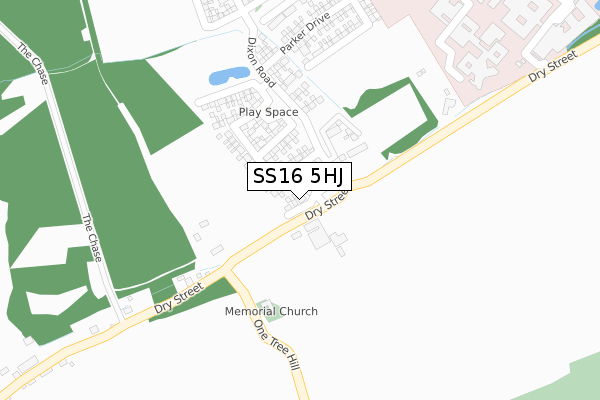
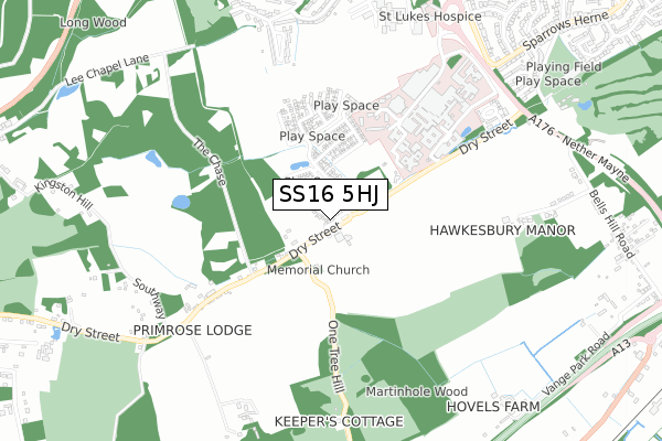
SS16 5HJ is located in the Nethermayne electoral ward, within the local authority district of Basildon and the English Parliamentary constituency of South Basildon and East Thurrock. The Sub Integrated Care Board (ICB) Location is NHS Mid and South Essex ICB - 99E and the police force is Essex. This postcode has been in use since December 2017.
SS16 5HJ maps


Licence: Open Government Licence (requires attribution)
Attribution: Contains OS data © Crown copyright and database right 2025
Source: Open Postcode Geo
Licence: Open Government Licence (requires attribution)
Attribution: Contains OS data © Crown copyright and database right 2025; Contains Royal Mail data © Royal Mail copyright and database right 2025; Source: Office for National Statistics licensed under the Open Government Licence v.3.0
SS16 5HJ geodata
| Easting | 569686 |
| Northing | 186806 |
| Latitude | 51.554622 |
| Longitude | 0.446254 |
Where is SS16 5HJ?
| Country | England |
| Postcode District | SS16 |
Politics
| Ward | Nethermayne |
|---|---|
| Constituency | South Basildon And East Thurrock |
House Prices
Sales of detached houses in SS16 5HJ
18, HAMMOND CLOSE, LANGDON HILLS, BASILDON, SS16 5HJ 2020 18 DEC £655,000 |
2, HAMMOND CLOSE, LANGDON HILLS, BASILDON, SS16 5HJ 2020 25 SEP £599,995 |
8, HAMMOND CLOSE, LANGDON HILLS, BASILDON, SS16 5HJ 2020 21 AUG £439,995 |
10, HAMMOND CLOSE, LANGDON HILLS, BASILDON, SS16 5HJ 2020 14 AUG £549,995 |
16, HAMMOND CLOSE, LANGDON HILLS, BASILDON, SS16 5HJ 2019 27 SEP £459,995 |
Licence: Contains HM Land Registry data © Crown copyright and database right 2025. This data is licensed under the Open Government Licence v3.0.
Transport
Nearest bus stops to SS16 5HJ
| Hospital (Hospital Forecourt) | Basildon | 632m |
| Hospital (Hospital Forecourt) | Basildon | 648m |
| Hospital Subway (Nether Mayne) | Basildon | 806m |
| Hospital Subway (Nether Mayne) | Basildon | 837m |
| Bells Hill Road (Nether Mayne) | Basildon | 897m |
Nearest railway stations to SS16 5HJ
| Basildon Station | 1.7km |
| Laindon Station | 2.1km |
| Pitsea Station | 4.2km |
Broadband
Broadband access in SS16 5HJ (2020 data)
| Percentage of properties with Next Generation Access | 100.0% |
| Percentage of properties with Superfast Broadband | 33.3% |
| Percentage of properties with Ultrafast Broadband | 33.3% |
| Percentage of properties with Full Fibre Broadband | 11.1% |
Superfast Broadband is between 30Mbps and 300Mbps
Ultrafast Broadband is > 300Mbps
Broadband limitations in SS16 5HJ (2020 data)
| Percentage of properties unable to receive 2Mbps | 0.0% |
| Percentage of properties unable to receive 5Mbps | 0.0% |
| Percentage of properties unable to receive 10Mbps | 66.7% |
| Percentage of properties unable to receive 30Mbps | 66.7% |
Deprivation
54.5% of English postcodes are less deprived than SS16 5HJ:Food Standards Agency
Three nearest food hygiene ratings to SS16 5HJ (metres)


➜ Get more ratings from the Food Standards Agency
Nearest post box to SS16 5HJ
| Last Collection | |||
|---|---|---|---|
| Location | Mon-Fri | Sat | Distance |
| Dry Street | 17:45 | 12:30 | 711m |
| Cherrydown | 17:30 | 11:30 | 1,346m |
| Kingswood Post Office | 17:30 | 11:30 | 1,543m |
SS16 5HJ ITL and SS16 5HJ LAU
The below table lists the International Territorial Level (ITL) codes (formerly Nomenclature of Territorial Units for Statistics (NUTS) codes) and Local Administrative Units (LAU) codes for SS16 5HJ:
| ITL 1 Code | Name |
|---|---|
| TLH | East |
| ITL 2 Code | Name |
| TLH3 | Essex |
| ITL 3 Code | Name |
| TLH37 | Essex Thames Gateway |
| LAU 1 Code | Name |
| E07000066 | Basildon |
SS16 5HJ census areas
The below table lists the Census Output Area (OA), Lower Layer Super Output Area (LSOA), and Middle Layer Super Output Area (MSOA) for SS16 5HJ:
| Code | Name | |
|---|---|---|
| OA | E00108165 | |
| LSOA | E01021297 | Basildon 020D |
| MSOA | E02004443 | Basildon 020 |
Nearest postcodes to SS16 5HJ
| SS16 5NF | Dry Street | 249m |
| SS16 5TU | Fletchers | 689m |
| SS16 5ND | Dry Street | 694m |
| SS16 5TS | Sporhams | 760m |
| SS16 5TR | Rantree Fold | 782m |
| SS16 5JS | Hawkesbury Bush Lane | 801m |
| SS16 5LZ | Southway | 803m |
| SS16 5NJ | Nether Mayne | 830m |
| SS16 5TX | Morrells | 852m |
| SS16 5TT | Sporhams | 856m |