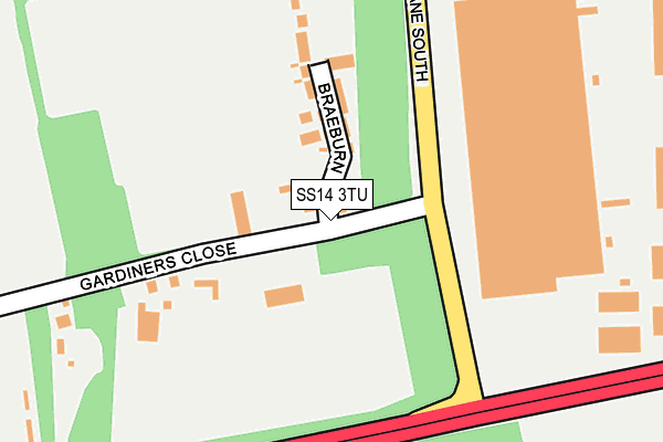
SS14 3TU is located in the Fryerns electoral ward, within the local authority district of Basildon and the English Parliamentary constituency of Basildon and Billericay. The Sub Integrated Care Board (ICB) Location is NHS Mid and South Essex ICB - 99E and the police force is Essex. This postcode has been in use since April 2017.


GetTheData
Source: OS OpenMap – Local (Ordnance Survey)
Source: OS VectorMap District (Ordnance Survey)
Licence: Open Government Licence (requires attribution)
| Easting | 572062 |
| Northing | 190536 |
| Latitude | 51.587410 |
| Longitude | 0.482315 |
GetTheData
Source: Open Postcode Geo
Licence: Open Government Licence
| Country | England |
| Postcode District | SS14 |
➜ See where SS14 is on a map ➜ Where is Basildon? | |
GetTheData
Source: Land Registry Price Paid Data
Licence: Open Government Licence
| Ward | Fryerns |
| Constituency | Basildon And Billericay |
GetTheData
Source: ONS Postcode Database
Licence: Open Government Licence
1, BRAEBURN WAY, BASILDON, SS14 3TU 2018 10 DEC £200,000 |
3, BRAEBURN WAY, BASILDON, SS14 3TU 2018 6 JUL £530,000 |
4, BRAEBURN WAY, BASILDON, SS14 3TU 2018 27 JUN £374,950 |
2, BRAEBURN WAY, BASILDON, SS14 3TU 2018 26 JUN £374,950 |
6, BRAEBURN WAY, BASILDON, SS14 3TU 2018 21 JUN £374,950 |
5, BRAEBURN WAY, BASILDON, SS14 3TU 2018 19 JUN £500,000 |
33, BRAEBURN WAY, BASILDON, SS14 3TU 2018 21 MAR £400,000 |
22, BRAEBURN WAY, BASILDON, SS14 3TU 2018 9 FEB £379,950 |
20, BRAEBURN WAY, BASILDON, SS14 3TU 2018 9 FEB £374,950 |
23, BRAEBURN WAY, BASILDON, SS14 3TU 2017 19 DEC £422,500 |
GetTheData
Source: HM Land Registry Price Paid Data
Licence: Contains HM Land Registry data © Crown copyright and database right 2025. This data is licensed under the Open Government Licence v3.0.
| York Factory (Gardiners Lane South) | Basildon | 186m |
| Gardiners Lane South (Paycocke Road) | Basildon | 252m |
| Gardiners Lane South (Paycocke Road) | Basildon | 264m |
| Matching Green (Whitmore Way) | Basildon | 586m |
| Matching Green (Whitmore Way) | Basildon | 609m |
| Basildon Station | 2.8km |
| Pitsea Station | 3.4km |
| Wickford Station | 4km |
GetTheData
Source: NaPTAN
Licence: Open Government Licence
| Percentage of properties with Next Generation Access | 100.0% |
| Percentage of properties with Superfast Broadband | 100.0% |
| Percentage of properties with Ultrafast Broadband | 100.0% |
| Percentage of properties with Full Fibre Broadband | 100.0% |
Superfast Broadband is between 30Mbps and 300Mbps
Ultrafast Broadband is > 300Mbps
| Percentage of properties unable to receive 2Mbps | 0.0% |
| Percentage of properties unable to receive 5Mbps | 0.0% |
| Percentage of properties unable to receive 10Mbps | 0.0% |
| Percentage of properties unable to receive 30Mbps | 0.0% |
GetTheData
Source: Ofcom
Licence: Ofcom Terms of Use (requires attribution)
GetTheData
Source: ONS Postcode Database
Licence: Open Government Licence


➜ Get more ratings from the Food Standards Agency
GetTheData
Source: Food Standards Agency
Licence: FSA terms & conditions
| Last Collection | |||
|---|---|---|---|
| Location | Mon-Fri | Sat | Distance |
| Festival Leisure Park | 18:30 | 11:30 | 1,240m |
| Festival Leisure Park | 1,252m | ||
| Chichester Close | 17:30 | 12:15 | 1,304m |
GetTheData
Source: Dracos
Licence: Creative Commons Attribution-ShareAlike
The below table lists the International Territorial Level (ITL) codes (formerly Nomenclature of Territorial Units for Statistics (NUTS) codes) and Local Administrative Units (LAU) codes for SS14 3TU:
| ITL 1 Code | Name |
|---|---|
| TLH | East |
| ITL 2 Code | Name |
| TLH3 | Essex |
| ITL 3 Code | Name |
| TLH37 | Essex Thames Gateway |
| LAU 1 Code | Name |
| E07000066 | Basildon |
GetTheData
Source: ONS Postcode Directory
Licence: Open Government Licence
The below table lists the Census Output Area (OA), Lower Layer Super Output Area (LSOA), and Middle Layer Super Output Area (MSOA) for SS14 3TU:
| Code | Name | |
|---|---|---|
| OA | E00108019 | |
| LSOA | E01021267 | Basildon 012B |
| MSOA | E02004435 | Basildon 012 |
GetTheData
Source: ONS Postcode Directory
Licence: Open Government Licence
| SS14 3AN | Gardiners Close | 132m |
| SS14 3AP | Gardiners Lane South | 156m |
| SS14 3DY | Enterprise Centre | 296m |
| SS14 3DW | Zenith | 313m |
| SS14 3AW | Gardiners Close | 409m |
| SS14 3EE | Bowlers Croft | 458m |
| SS14 3DZ | Bowlers Croft | 459m |
| SS14 3DX | Bowlers Croft | 506m |
| SS14 2PB | Matching Green | 512m |
| SS14 3LA | Battleswick | 535m |
GetTheData
Source: Open Postcode Geo; Land Registry Price Paid Data
Licence: Open Government Licence