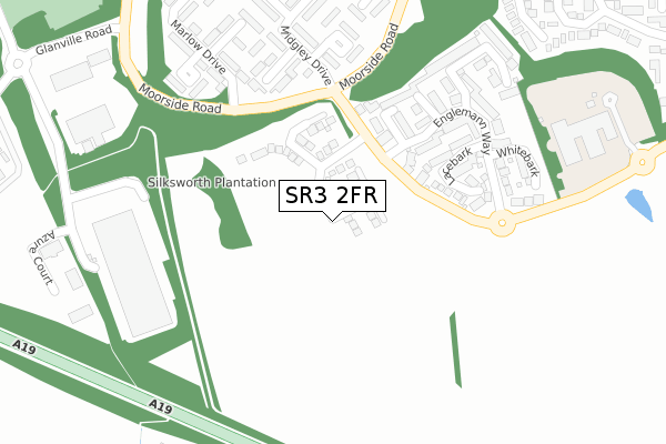
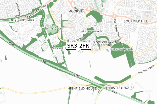
SR3 2FR is located in the Doxford electoral ward, within the metropolitan district of Sunderland and the English Parliamentary constituency of Houghton and Sunderland South. The Sub Integrated Care Board (ICB) Location is NHS North East and North Cumbria ICB - 00P and the police force is Northumbria. This postcode has been in use since November 2019.


GetTheData
Source: OS Open Zoomstack (Ordnance Survey)
Licence: Open Government Licence (requires attribution)
Attribution: Contains OS data © Crown copyright and database right 2025
Source: Open Postcode Geo
Licence: Open Government Licence (requires attribution)
Attribution: Contains OS data © Crown copyright and database right 2025; Contains Royal Mail data © Royal Mail copyright and database right 2025; Source: Office for National Statistics licensed under the Open Government Licence v.3.0
| Easting | 437123 |
| Northing | 551916 |
| Latitude | 54.860670 |
| Longitude | -1.423224 |
GetTheData
Source: Open Postcode Geo
Licence: Open Government Licence
| Country | England |
| Postcode District | SR3 |
➜ See where SR3 is on a map ➜ Where is Sunderland? | |
GetTheData
Source: Land Registry Price Paid Data
Licence: Open Government Licence
| Ward | Doxford |
| Constituency | Houghton And Sunderland South |
GetTheData
Source: ONS Postcode Database
Licence: Open Government Licence
15, BUCKTHORN GARDENS, SUNDERLAND, SR3 2FR 2020 27 MAR £329,950 |
14, BUCKTHORN GARDENS, SUNDERLAND, SR3 2FR 2020 27 MAR £292,950 |
16, BUCKTHORN GARDENS, SUNDERLAND, SR3 2FR 2020 20 MAR £294,950 |
11, BUCKTHORN GARDENS, SUNDERLAND, SR3 2FR 2020 28 FEB £359,950 |
10, BUCKTHORN GARDENS, SUNDERLAND, SR3 2FR 2020 28 FEB £327,950 |
12, BUCKTHORN GARDENS, SUNDERLAND, SR3 2FR 2020 14 FEB £289,950 |
9, BUCKTHORN GARDENS, SUNDERLAND, SR3 2FR 2020 31 JAN £244,950 |
8, BUCKTHORN GARDENS, SUNDERLAND, SR3 2FR 2019 20 DEC £229,950 |
2, BUCKTHORN GARDENS, SUNDERLAND, SR3 2FR 2019 31 OCT £242,950 |
1, BUCKTHORN GARDENS, SUNDERLAND, SR3 2FR 2019 31 OCT £226,950 |
GetTheData
Source: HM Land Registry Price Paid Data
Licence: Contains HM Land Registry data © Crown copyright and database right 2025. This data is licensed under the Open Government Licence v3.0.
| Weymouth Road-lacebark (Weymouth Road) | Doxford Park | 152m |
| Moorside Road-midgley Drive (Moorside Road) | Doxford Park | 174m |
| Moorside Road-midgley Drive (Moorside Road) | Doxford Park | 203m |
| Moorside Road-manningford Drive (Moorside Road) | Doxford Park | 323m |
| Moorside Road-manningford Drive (Moorside Road) | Doxford Park | 334m |
| Seaham Station | 5.5km |
| Sunderland Station | 5.6km |
GetTheData
Source: NaPTAN
Licence: Open Government Licence
GetTheData
Source: ONS Postcode Database
Licence: Open Government Licence


➜ Get more ratings from the Food Standards Agency
GetTheData
Source: Food Standards Agency
Licence: FSA terms & conditions
| Last Collection | |||
|---|---|---|---|
| Location | Mon-Fri | Sat | Distance |
| Marcross Drive | 17:30 | 12:00 | 521m |
| Monarch Avenue | 17:30 | 12:00 | 951m |
| Woodside | 17:00 | 10:30 | 1,218m |
GetTheData
Source: Dracos
Licence: Creative Commons Attribution-ShareAlike
The below table lists the International Territorial Level (ITL) codes (formerly Nomenclature of Territorial Units for Statistics (NUTS) codes) and Local Administrative Units (LAU) codes for SR3 2FR:
| ITL 1 Code | Name |
|---|---|
| TLC | North East (England) |
| ITL 2 Code | Name |
| TLC2 | Northumberland, and Tyne and Wear |
| ITL 3 Code | Name |
| TLC23 | Sunderland |
| LAU 1 Code | Name |
| E08000024 | Sunderland |
GetTheData
Source: ONS Postcode Directory
Licence: Open Government Licence
The below table lists the Census Output Area (OA), Lower Layer Super Output Area (LSOA), and Middle Layer Super Output Area (MSOA) for SR3 2FR:
| Code | Name | |
|---|---|---|
| OA | E00044505 | |
| LSOA | E01008770 | Sunderland 031C |
| MSOA | E02001821 | Sunderland 031 |
GetTheData
Source: ONS Postcode Directory
Licence: Open Government Licence
| SR3 2NS | Bristlecone | 143m |
| SR3 2NZ | Lacebark | 156m |
| SR3 2NY | Englemann Way | 176m |
| SR3 2NT | Monterey | 196m |
| SR3 2RH | Minskip Close | 241m |
| SR3 2RJ | Midgley Drive | 247m |
| SR3 2RQ | Milrig Close | 263m |
| SR3 2NX | Whitebark | 263m |
| SR3 2NU | Cottonwood | 274m |
| SR3 2RN | Midsomer Close | 295m |
GetTheData
Source: Open Postcode Geo; Land Registry Price Paid Data
Licence: Open Government Licence