SR3 1EB maps, stats, and open data
- Home
- Postcode
- SR
- SR3
- SR3 1
SR3 1EB is located in the Silksworth electoral ward, within the metropolitan district of Sunderland and the English Parliamentary constituency of Houghton and Sunderland South. The Sub Integrated Care Board (ICB) Location is NHS North East and North Cumbria ICB - 00P and the police force is Northumbria. This postcode has been in use since November 2017.
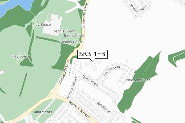
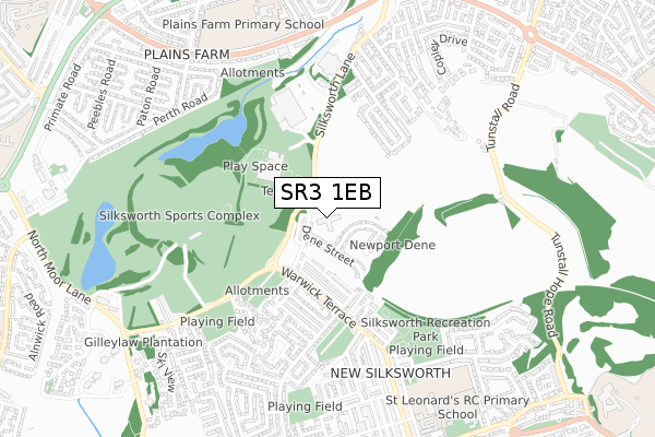
SR3 1EB maps


Source: OS Open Zoomstack (Ordnance Survey)
Licence: Open Government Licence (requires attribution)
Attribution: Contains OS data © Crown copyright and database right 2025
Source: Open Postcode GeoLicence: Open Government Licence (requires attribution)
Attribution: Contains OS data © Crown copyright and database right 2025; Contains Royal Mail data © Royal Mail copyright and database right 2025; Source: Office for National Statistics licensed under the Open Government Licence v.3.0
SR3 1EB geodata
| Easting | 438242 |
| Northing | 554181 |
| Latitude | 54.880938 |
| Longitude | -1.405494 |
Where is SR3 1EB?
| Country | England |
| Postcode District | SR3 |
Politics
| Ward | Silksworth |
|---|
| Constituency | Houghton And Sunderland South |
|---|
Transport
Nearest bus stops to SR3 1EB
| Dene Street (Durham Terrace) | Silksworth | 80m |
| Durham Terrace | Silksworth | 132m |
| Silksworth Lane-low Newport Farm (Silksworth Lane) | Silksworth | 216m |
| Warwick Terrace-durham Terrace (Warwick Terrace) | Silksworth | 247m |
| Silksworth Lane-low Newport Farm (Silksworth Lane) | Silksworth | 256m |
Nearest railway stations to SR3 1EB
| Sunderland Station | 3.1km |
| St Peters Station | 3.7km |
| Seaham Station | 6km |
Broadband
Broadband access in SR3 1EB (2020 data)
| Percentage of properties with Next Generation Access | 1.3% |
| Percentage of properties with Superfast Broadband | 1.3% |
| Percentage of properties with Ultrafast Broadband | 1.3% |
| Percentage of properties with Full Fibre Broadband | 1.3% |
Superfast Broadband is between 30Mbps and 300Mbps
Ultrafast Broadband is > 300Mbps
Broadband speed in SR3 1EB (2019 data)
Download
| Median download speed | 5.1Mbps |
| Average download speed | 7.6Mbps |
| Maximum download speed | 25.29Mbps |
Upload
| Median upload speed | 0.9Mbps |
| Average upload speed | 1.4Mbps |
| Maximum upload speed | 5.55Mbps |
Broadband limitations in SR3 1EB (2020 data)
| Percentage of properties unable to receive 2Mbps | 0.0% |
| Percentage of properties unable to receive 5Mbps | 0.0% |
| Percentage of properties unable to receive 10Mbps | 0.0% |
| Percentage of properties unable to receive 30Mbps | 98.7% |
Deprivation
71% of English postcodes are less deprived than
SR3 1EB:
Food Standards Agency
Three nearest food hygiene ratings to SR3 1EB (metres)
The Scullery
The Hut
Fausto Atletico
Silksworth Community Swimming Pool
301m
➜ Get more ratings from the Food Standards Agency
Nearest post box to SR3 1EB
| | Last Collection | |
|---|
| Location | Mon-Fri | Sat | Distance |
|---|
| New Silksworth Post Office | 17:00 | 11:30 | 445m |
| Elstob Place | 17:30 | 10:30 | 656m |
| Gilley Law Post Office | 16:45 | 10:30 | 1,061m |
SR3 1EB ITL and SR3 1EB LAU
The below table lists the International Territorial Level (ITL) codes (formerly Nomenclature of Territorial Units for Statistics (NUTS) codes) and Local Administrative Units (LAU) codes for SR3 1EB:
| ITL 1 Code | Name |
|---|
| TLC | North East (England) |
| ITL 2 Code | Name |
|---|
| TLC2 | Northumberland, and Tyne and Wear |
| ITL 3 Code | Name |
|---|
| TLC23 | Sunderland |
| LAU 1 Code | Name |
|---|
| E08000024 | Sunderland |
SR3 1EB census areas
The below table lists the Census Output Area (OA), Lower Layer Super Output Area (LSOA), and Middle Layer Super Output Area (MSOA) for SR3 1EB:
| Code | Name |
|---|
| OA | E00044699 | |
|---|
| LSOA | E01008809 | Sunderland 026E |
|---|
| MSOA | E02001816 | Sunderland 026 |
|---|
Nearest postcodes to SR3 1EB


