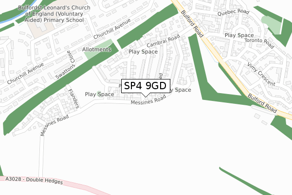
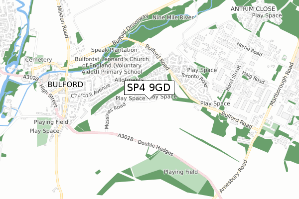
SP4 9GD is located in the Amesbury East & Bulford electoral ward, within the unitary authority of Wiltshire and the English Parliamentary constituency of Devizes. The Sub Integrated Care Board (ICB) Location is NHS Bath and North East Somerset, Swindon and Wiltshire ICB - 92 and the police force is Wiltshire. This postcode has been in use since May 2019.


GetTheData
Source: OS Open Zoomstack (Ordnance Survey)
Licence: Open Government Licence (requires attribution)
Attribution: Contains OS data © Crown copyright and database right 2025
Source: Open Postcode Geo
Licence: Open Government Licence (requires attribution)
Attribution: Contains OS data © Crown copyright and database right 2025; Contains Royal Mail data © Royal Mail copyright and database right 2025; Source: Office for National Statistics licensed under the Open Government Licence v.3.0
| Easting | 417579 |
| Northing | 143516 |
| Latitude | 51.190596 |
| Longitude | -1.749823 |
GetTheData
Source: Open Postcode Geo
Licence: Open Government Licence
| Country | England |
| Postcode District | SP4 |
➜ See where SP4 is on a map ➜ Where is Bulford? | |
GetTheData
Source: Land Registry Price Paid Data
Licence: Open Government Licence
| Ward | Amesbury East & Bulford |
| Constituency | Devizes |
GetTheData
Source: ONS Postcode Database
Licence: Open Government Licence
| Hampshire Close (Churchill Avenue) | Bulford | 265m |
| Hampshire Close (Churchill Avenue) | Bulford | 276m |
| Swattons Close (Churchill Avenue) | Bulford | 301m |
| Winnipeg Gardens (Bulford Road) | Bulford Camp | 304m |
| Swattons Close (Churchill Avenue) | Bulford | 310m |
GetTheData
Source: NaPTAN
Licence: Open Government Licence
| Percentage of properties with Next Generation Access | 100.0% |
| Percentage of properties with Superfast Broadband | 100.0% |
| Percentage of properties with Ultrafast Broadband | 100.0% |
| Percentage of properties with Full Fibre Broadband | 100.0% |
Superfast Broadband is between 30Mbps and 300Mbps
Ultrafast Broadband is > 300Mbps
| Percentage of properties unable to receive 2Mbps | 0.0% |
| Percentage of properties unable to receive 5Mbps | 0.0% |
| Percentage of properties unable to receive 10Mbps | 0.0% |
| Percentage of properties unable to receive 30Mbps | 0.0% |
GetTheData
Source: Ofcom
Licence: Ofcom Terms of Use (requires attribution)
GetTheData
Source: ONS Postcode Database
Licence: Open Government Licence


➜ Get more ratings from the Food Standards Agency
GetTheData
Source: Food Standards Agency
Licence: FSA terms & conditions
| Last Collection | |||
|---|---|---|---|
| Location | Mon-Fri | Sat | Distance |
| Churchill Avenue | 16:45 | 08:30 | 410m |
| Milston Road | 16:45 | 07:30 | 759m |
| Bulford Post Office | 16:00 | 11:00 | 821m |
GetTheData
Source: Dracos
Licence: Creative Commons Attribution-ShareAlike
The below table lists the International Territorial Level (ITL) codes (formerly Nomenclature of Territorial Units for Statistics (NUTS) codes) and Local Administrative Units (LAU) codes for SP4 9GD:
| ITL 1 Code | Name |
|---|---|
| TLK | South West (England) |
| ITL 2 Code | Name |
| TLK1 | Gloucestershire, Wiltshire and Bath/Bristol area |
| ITL 3 Code | Name |
| TLK15 | Wiltshire |
| LAU 1 Code | Name |
| E06000054 | Wiltshire |
GetTheData
Source: ONS Postcode Directory
Licence: Open Government Licence
The below table lists the Census Output Area (OA), Lower Layer Super Output Area (LSOA), and Middle Layer Super Output Area (MSOA) for SP4 9GD:
| Code | Name | |
|---|---|---|
| OA | E00163129 | |
| LSOA | E01031989 | Wiltshire 046A |
| MSOA | E02006662 | Wiltshire 046 |
GetTheData
Source: ONS Postcode Directory
Licence: Open Government Licence
| SP4 9HG | Churchill Avenue | 267m |
| SP4 9HQ | Churchill Avenue | 284m |
| SP4 9HS | Swattons Close | 299m |
| SP4 9HN | Dukes Way | 313m |
| SP4 9HH | Churchill Avenue | 324m |
| SP4 9HP | John French Way | 382m |
| SP4 9HE | Churchill Avenue | 413m |
| SP4 9HR | Clayton Road | 445m |
| SP4 9HT | Newmans Way | 448m |
| SP4 9HJ | Churchill Avenue | 465m |
GetTheData
Source: Open Postcode Geo; Land Registry Price Paid Data
Licence: Open Government Licence