SP11 6YX maps, stats, and open data
- Home
- Postcode
- SP
- SP11
- SP11 6
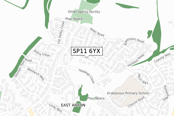
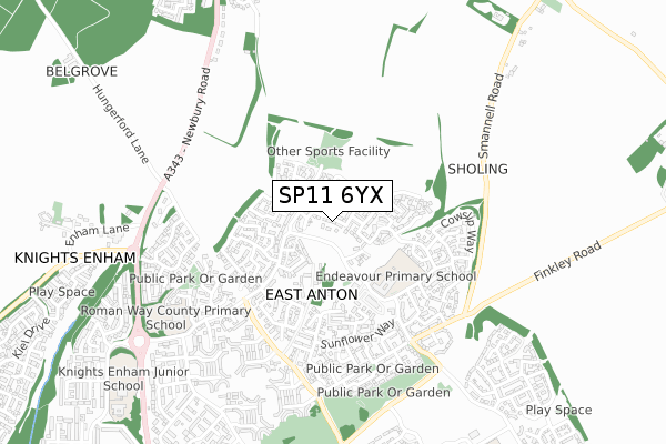
SP11 6YX is located in the Andover Romans electoral ward, within the local authority district of Test Valley and the English Parliamentary constituency of North West Hampshire. The Sub Integrated Care Board (ICB) Location is NHS Hampshire and Isle of Wight ICB - D9Y0V and the police force is Hampshire. This postcode has been in use since November 2018.
SP11 6YX maps


Source: OS Open Zoomstack (Ordnance Survey)
Licence: Open Government Licence (requires attribution)
Attribution: Contains OS data © Crown copyright and database right 2025
Source: Open Postcode GeoLicence: Open Government Licence (requires attribution)
Attribution: Contains OS data © Crown copyright and database right 2025; Contains Royal Mail data © Royal Mail copyright and database right 2025; Source: Office for National Statistics licensed under the Open Government Licence v.3.0
SP11 6YX geodata
| Easting | 437212 |
| Northing | 148078 |
| Latitude | 51.230679 |
| Longitude | -1.468421 |
Where is SP11 6YX?
| Country | England |
| Postcode District | SP11 |
Politics
| Ward | Andover Romans |
|---|
| Constituency | North West Hampshire |
|---|
Transport
Nearest bus stops to SP11 6YX
| Unknown (East Anton Farm Road) | East Anton | 137m |
| Unknown (East Anton Farm Road) | East Anton | 153m |
| Community Centre (East Anton Farm Road) | East Anton | 213m |
| Community Centre (East Anton Farm Road) | East Anton | 216m |
| Woolwich Way | East Anton | 288m |
Nearest railway stations to SP11 6YX
Broadband
Broadband access in SP11 6YX (2020 data)
| Percentage of properties with Next Generation Access | 100.0% |
| Percentage of properties with Superfast Broadband | 100.0% |
| Percentage of properties with Ultrafast Broadband | 100.0% |
| Percentage of properties with Full Fibre Broadband | 100.0% |
Superfast Broadband is between 30Mbps and 300Mbps
Ultrafast Broadband is > 300Mbps
Broadband limitations in SP11 6YX (2020 data)
| Percentage of properties unable to receive 2Mbps | 0.0% |
| Percentage of properties unable to receive 5Mbps | 0.0% |
| Percentage of properties unable to receive 10Mbps | 0.0% |
| Percentage of properties unable to receive 30Mbps | 0.0% |
Deprivation
49% of English postcodes are less deprived than
SP11 6YX:
Food Standards Agency
Three nearest food hygiene ratings to SP11 6YX (metres)
Choice Care Group At Ravenna Lodge
The Southern Co-operative Ltd
Smart Fish Bar
➜ Get more ratings from the Food Standards Agency
Nearest post box to SP11 6YX
| | Last Collection | |
|---|
| Location | Mon-Fri | Sat | Distance |
|---|
| Knights Enham | 17:15 | 11:15 | 706m |
| Smannel Road | 17:15 | 12:00 | 957m |
| King Arthurs Way Post Office | 18:30 | 12:00 | 1,246m |
SP11 6YX ITL and SP11 6YX LAU
The below table lists the International Territorial Level (ITL) codes (formerly Nomenclature of Territorial Units for Statistics (NUTS) codes) and Local Administrative Units (LAU) codes for SP11 6YX:
| ITL 1 Code | Name |
|---|
| TLJ | South East (England) |
| ITL 2 Code | Name |
|---|
| TLJ3 | Hampshire and Isle of Wight |
| ITL 3 Code | Name |
|---|
| TLJ36 | Central Hampshire |
| LAU 1 Code | Name |
|---|
| E07000093 | Test Valley |
SP11 6YX census areas
The below table lists the Census Output Area (OA), Lower Layer Super Output Area (LSOA), and Middle Layer Super Output Area (MSOA) for SP11 6YX:
| Code | Name |
|---|
| OA | E00117629 | |
|---|
| LSOA | E01023155 | Test Valley 003A |
|---|
| MSOA | E02004816 | Test Valley 003 |
|---|
Nearest postcodes to SP11 6YX


