Property/Postcode Data Search:
SP11 6YG maps, stats, and open data
SP11 6YG is located in the Andover Romans electoral ward, within the local authority district of Test Valley and the English Parliamentary constituency of North West Hampshire. The Sub Integrated Care Board (ICB) Location is NHS Hampshire and Isle of Wight ICB - D9Y0V and the police force is Hampshire. This postcode has been in use since August 2018.
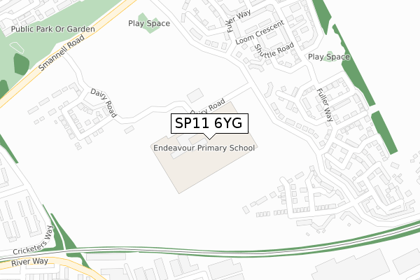
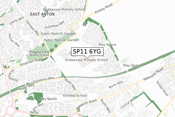
SP11 6YG maps


Source: OS Open Zoomstack (Ordnance Survey)
Licence: Open Government Licence (requires attribution)
Attribution: Contains OS data © Crown copyright and database right 2025
Source: Open Postcode Geo
Licence: Open Government Licence (requires attribution)
Attribution: Contains OS data © Crown copyright and database right 2025; Contains Royal Mail data © Royal Mail copyright and database right 2025; Source: Office for National Statistics licensed under the Open Government Licence v.3.0
Licence: Open Government Licence (requires attribution)
Attribution: Contains OS data © Crown copyright and database right 2025
Source: Open Postcode Geo
Licence: Open Government Licence (requires attribution)
Attribution: Contains OS data © Crown copyright and database right 2025; Contains Royal Mail data © Royal Mail copyright and database right 2025; Source: Office for National Statistics licensed under the Open Government Licence v.3.0
SP11 6YG geodata
| Easting | 437718 |
| Northing | 147165 |
| Latitude | 51.222436 |
| Longitude | -1.461270 |
Where is SP11 6YG?
| Country | England |
| Postcode District | SP11 |
Politics
| Ward | Andover Romans |
|---|---|
| Constituency | North West Hampshire |
Transport
Nearest bus stops to SP11 6YG
| Cricketers Way | Cricketers Way | 385m |
| Medway Court (River Way) | River Way | 396m |
| Cricketers Way | Cricketers Way | 396m |
| Pasture Walk (Smannell Road) | East Anton | 469m |
| Pasture Walk (Smannell Road) | East Anton | 473m |
Nearest railway stations to SP11 6YG
| Andover Station | 2.5km |
Deprivation
49% of English postcodes are less deprived than SP11 6YG:Food Standards Agency
Three nearest food hygiene ratings to SP11 6YG (metres)
YMCA East Anton (Andover)

YMCA East Anton
115m
Icknield School

River Way
518m
Finkley Down Farm Park

Finkley Down Farm
579m
➜ Get more ratings from the Food Standards Agency
Nearest post box to SP11 6YG
| Last Collection | |||
|---|---|---|---|
| Location | Mon-Fri | Sat | Distance |
| Walworth Industrial Estate | 18:30 | 12:00 | 644m |
| Smannel Road | 17:15 | 12:00 | 688m |
| King Arthurs Way Post Office | 18:30 | 12:00 | 1,311m |
SP11 6YG ITL and SP11 6YG LAU
The below table lists the International Territorial Level (ITL) codes (formerly Nomenclature of Territorial Units for Statistics (NUTS) codes) and Local Administrative Units (LAU) codes for SP11 6YG:
| ITL 1 Code | Name |
|---|---|
| TLJ | South East (England) |
| ITL 2 Code | Name |
| TLJ3 | Hampshire and Isle of Wight |
| ITL 3 Code | Name |
| TLJ36 | Central Hampshire |
| LAU 1 Code | Name |
| E07000093 | Test Valley |
SP11 6YG census areas
The below table lists the Census Output Area (OA), Lower Layer Super Output Area (LSOA), and Middle Layer Super Output Area (MSOA) for SP11 6YG:
| Code | Name | |
|---|---|---|
| OA | E00168065 | |
| LSOA | E01023155 | Test Valley 003A |
| MSOA | E02004816 | Test Valley 003 |
Nearest postcodes to SP11 6YG
| SP11 6UL | Roving Close | 295m |
| SP11 6US | Loom Crescent | 307m |
| SP11 6UN | Tailor Close | 333m |
| SP11 6UJ | Fuller Way | 338m |
| SP10 5DX | Rhodes Square | 398m |
| SP10 5HQ | Thames Court | 418m |
| SP10 5AZ | North Way | 420m |
| SP10 5DU | Marshall Square | 424m |
| SP11 6WT | Tapestry Road | 427m |
| SP10 5EZ | Nene Court | 439m |