SP11 6YF maps, stats, and open data
- Home
- Postcode
- SP
- SP11
- SP11 6
SP11 6YF is located in the Evingar electoral ward, within the local authority district of Basingstoke and Deane and the English Parliamentary constituency of North West Hampshire. The Sub Integrated Care Board (ICB) Location is NHS Hampshire and Isle of Wight ICB - D9Y0V and the police force is Hampshire. This postcode has been in use since October 2019.
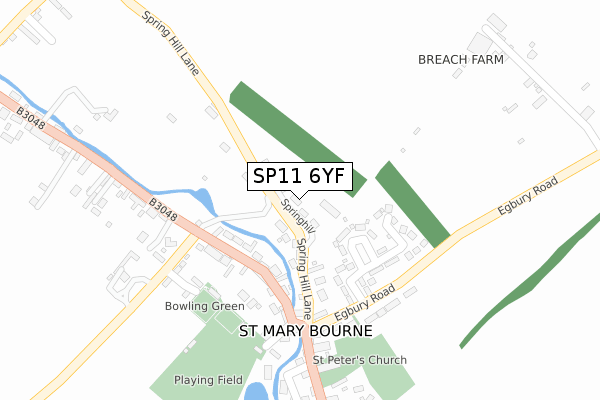
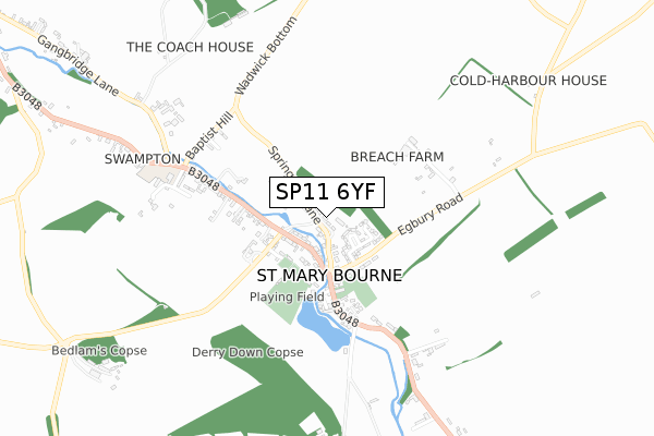
SP11 6YF maps


Source: OS Open Zoomstack (Ordnance Survey)
Licence: Open Government Licence (requires attribution)
Attribution: Contains OS data © Crown copyright and database right 2025
Source: Open Postcode GeoLicence: Open Government Licence (requires attribution)
Attribution: Contains OS data © Crown copyright and database right 2025; Contains Royal Mail data © Royal Mail copyright and database right 2025; Source: Office for National Statistics licensed under the Open Government Licence v.3.0
SP11 6YF geodata
| Easting | 442196 |
| Northing | 150596 |
| Latitude | 51.252974 |
| Longitude | -1.396747 |
Where is SP11 6YF?
| Country | England |
| Postcode District | SP11 |
Politics
| Ward | Evingar |
|---|
| Constituency | North West Hampshire |
|---|
Transport
Nearest bus stops to SP11 6YF
| The George Inn (B3048) | St Mary Bourne | 203m |
| The George Inn (B3048) | St Mary Bourne | 214m |
| St Mary Bourne Memorial (B3048) | Swampton | 298m |
| St Mary Bourne School (Gangbridge Lane) | Swampton | 617m |
| St Mary Bourne School (B3048) | Swampton | 620m |
Nearest railway stations to SP11 6YF
| Whitchurch (Hants) Station | 4.5km |
Broadband
Broadband access in SP11 6YF (2020 data)
| Percentage of properties with Next Generation Access | 0.0% |
| Percentage of properties with Superfast Broadband | 0.0% |
| Percentage of properties with Ultrafast Broadband | 0.0% |
| Percentage of properties with Full Fibre Broadband | 0.0% |
Superfast Broadband is between 30Mbps and 300Mbps
Ultrafast Broadband is > 300Mbps
Broadband limitations in SP11 6YF (2020 data)
| Percentage of properties unable to receive 2Mbps | 0.0% |
| Percentage of properties unable to receive 5Mbps | 0.0% |
| Percentage of properties unable to receive 10Mbps | 0.0% |
| Percentage of properties unable to receive 30Mbps | 0.0% |
Deprivation
31% of English postcodes are less deprived than
SP11 6YF:
Food Standards Agency
Three nearest food hygiene ratings to SP11 6YF (metres)
The George Inn
The Boundary Community Shop And Cafe
Ninny's House At St Mary Bourne Village Centre
St Mary Bourne Village Centre
258m
➜ Get more ratings from the Food Standards Agency
Nearest post box to SP11 6YF
| | Last Collection | |
|---|
| Location | Mon-Fri | Sat | Distance |
|---|
| Swampton | 16:15 | 10:00 | 213m |
| St Mary Bourne Post Office | 16:15 | 10:30 | 1,107m |
| Stoke | 16:15 | 09:45 | 2,323m |
SP11 6YF ITL and SP11 6YF LAU
The below table lists the International Territorial Level (ITL) codes (formerly Nomenclature of Territorial Units for Statistics (NUTS) codes) and Local Administrative Units (LAU) codes for SP11 6YF:
| ITL 1 Code | Name |
|---|
| TLJ | South East (England) |
| ITL 2 Code | Name |
|---|
| TLJ3 | Hampshire and Isle of Wight |
| ITL 3 Code | Name |
|---|
| TLJ37 | North Hampshire |
| LAU 1 Code | Name |
|---|
| E07000084 | Basingstoke and Deane |
SP11 6YF census areas
The below table lists the Census Output Area (OA), Lower Layer Super Output Area (LSOA), and Middle Layer Super Output Area (MSOA) for SP11 6YF:
| Code | Name |
|---|
| OA | E00114468 | |
|---|
| LSOA | E01022514 | Basingstoke and Deane 020A |
|---|
| MSOA | E02004694 | Basingstoke and Deane 020 |
|---|
Nearest postcodes to SP11 6YF


