SP11 6RP maps, stats, and open data
SP11 6RP is located in the Andover Downlands electoral ward, within the local authority district of Test Valley and the English Parliamentary constituency of North West Hampshire. The Sub Integrated Care Board (ICB) Location is NHS Hampshire and Isle of Wight ICB - D9Y0V and the police force is Hampshire. This postcode has been in use since November 2019.
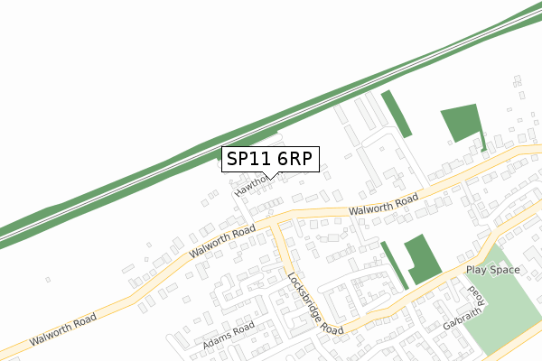
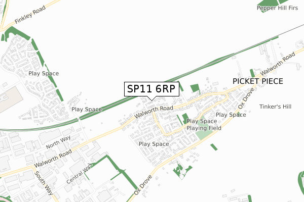
SP11 6RP maps


Licence: Open Government Licence (requires attribution)
Attribution: Contains OS data © Crown copyright and database right 2025
Source: Open Postcode Geo
Licence: Open Government Licence (requires attribution)
Attribution: Contains OS data © Crown copyright and database right 2025; Contains Royal Mail data © Royal Mail copyright and database right 2025; Source: Office for National Statistics licensed under the Open Government Licence v.3.0
SP11 6RP geodata
| Easting | 438952 |
| Northing | 147144 |
| Latitude | 51.222165 |
| Longitude | -1.443603 |
Where is SP11 6RP?
| Country | England |
| Postcode District | SP11 |
Politics
| Ward | Andover Downlands |
|---|---|
| Constituency | North West Hampshire |
House Prices
Sales of detached houses in SP11 6RP
2023 10 FEB £525,000 |
2023 25 JAN £520,000 |
2021 23 JUN £355,000 |
2020 27 NOV £460,000 |
9, MULBERRY ROAD, PICKET PIECE, ANDOVER, SP11 6RP 2020 6 NOV £392,500 |
4, MULBERRY ROAD, PICKET PIECE, ANDOVER, SP11 6RP 2020 30 OCT £342,750 |
10, MULBERRY ROAD, PICKET PIECE, ANDOVER, SP11 6RP 2020 20 JUL £450,000 |
15, MULBERRY ROAD, PICKET PIECE, ANDOVER, SP11 6RP 2020 3 JUL £314,995 |
12, MULBERRY ROAD, PICKET PIECE, ANDOVER, SP11 6RP 2020 19 JUN £449,995 |
11, MULBERRY ROAD, PICKET PIECE, ANDOVER, SP11 6RP 2020 26 MAR £312,495 |
Licence: Contains HM Land Registry data © Crown copyright and database right 2025. This data is licensed under the Open Government Licence v3.0.
Transport
Nearest bus stops to SP11 6RP
| Fluens Industrial Area (Walworth Road) | Picket Piece | 570m |
| Fluens Industrial Area (Walworth Road) | Picket Piece | 575m |
| Pinecroft (Walworth Road) | Picket Piece | 779m |
| Andover Bus Depot (Livingstone Road) | Picket Piece | 965m |
| Andover Bus Depot (Livingstone Road) | Picket Piece | 976m |
Nearest railway stations to SP11 6RP
| Andover Station | 3.6km |
Broadband
Broadband access in SP11 6RP (2020 data)
| Percentage of properties with Next Generation Access | 100.0% |
| Percentage of properties with Superfast Broadband | 100.0% |
| Percentage of properties with Ultrafast Broadband | 0.0% |
| Percentage of properties with Full Fibre Broadband | 0.0% |
Superfast Broadband is between 30Mbps and 300Mbps
Ultrafast Broadband is > 300Mbps
Broadband limitations in SP11 6RP (2020 data)
| Percentage of properties unable to receive 2Mbps | 0.0% |
| Percentage of properties unable to receive 5Mbps | 0.0% |
| Percentage of properties unable to receive 10Mbps | 0.0% |
| Percentage of properties unable to receive 30Mbps | 0.0% |
Deprivation
54% of English postcodes are less deprived than SP11 6RP:Food Standards Agency
Three nearest food hygiene ratings to SP11 6RP (metres)


➜ Get more ratings from the Food Standards Agency
Nearest post box to SP11 6RP
| Last Collection | |||
|---|---|---|---|
| Location | Mon-Fri | Sat | Distance |
| Picket Piece Post Office | 17:00 | 11:00 | 296m |
| Walworth Industrial Estate | 18:30 | 12:00 | 1,175m |
| Smannel Road | 17:15 | 12:00 | 1,921m |
SP11 6RP ITL and SP11 6RP LAU
The below table lists the International Territorial Level (ITL) codes (formerly Nomenclature of Territorial Units for Statistics (NUTS) codes) and Local Administrative Units (LAU) codes for SP11 6RP:
| ITL 1 Code | Name |
|---|---|
| TLJ | South East (England) |
| ITL 2 Code | Name |
| TLJ3 | Hampshire and Isle of Wight |
| ITL 3 Code | Name |
| TLJ36 | Central Hampshire |
| LAU 1 Code | Name |
| E07000093 | Test Valley |
SP11 6RP census areas
The below table lists the Census Output Area (OA), Lower Layer Super Output Area (LSOA), and Middle Layer Super Output Area (MSOA) for SP11 6RP:
| Code | Name | |
|---|---|---|
| OA | E00117883 | |
| LSOA | E01023201 | Test Valley 003B |
| MSOA | E02004816 | Test Valley 003 |
Nearest postcodes to SP11 6RP
| SP11 6GY | Painters Meadow | 151m |
| SP11 6LY | 174m | |
| SP11 6WJ | Locksbridge Road | 203m |
| SP11 6WF | Bailey Close | 216m |
| SP11 6SE | Kings Chapel Road | 226m |
| SP11 6LU | Walworth Road | 243m |
| SP11 6UY | Adams Road | 286m |
| SP11 6AL | The Bungalows | 400m |
| SP11 6WG | Lapstone Crescent | 439m |
| SP11 6WL | Locksbridge Road | 448m |