SP10 4FA maps, stats, and open data
SP10 4FA is located in the Charlton & the Pentons electoral ward, within the local authority district of Test Valley and the English Parliamentary constituency of North West Hampshire. The Sub Integrated Care Board (ICB) Location is NHS Hampshire and Isle of Wight ICB - D9Y0V and the police force is Hampshire. This postcode has been in use since July 2018.
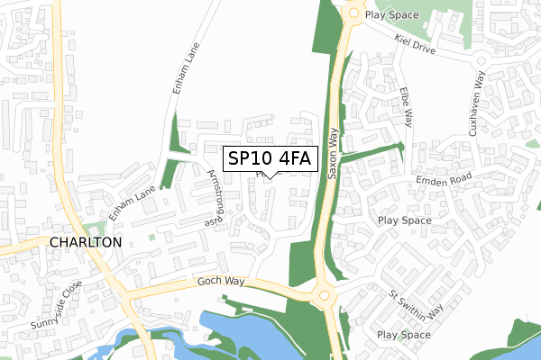
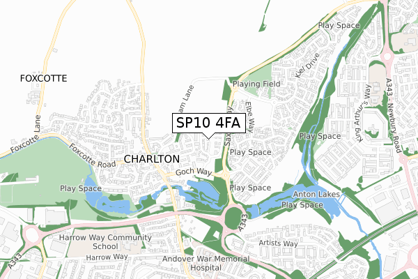
SP10 4FA maps


Licence: Open Government Licence (requires attribution)
Attribution: Contains OS data © Crown copyright and database right 2025
Source: Open Postcode Geo
Licence: Open Government Licence (requires attribution)
Attribution: Contains OS data © Crown copyright and database right 2025; Contains Royal Mail data © Royal Mail copyright and database right 2025; Source: Office for National Statistics licensed under the Open Government Licence v.3.0
SP10 4FA geodata
| Easting | 435416 |
| Northing | 147133 |
| Latitude | 51.222295 |
| Longitude | -1.494236 |
Where is SP10 4FA?
| Country | England |
| Postcode District | SP10 |
Politics
| Ward | Charlton & The Pentons |
|---|---|
| Constituency | North West Hampshire |
House Prices
Sales of detached houses in SP10 4FA
2021 6 AUG £317,000 |
2021 28 APR £451,475 |
91, PEAKE WAY, CHARLTON, ANDOVER, SP10 4FA 2019 20 DEC £375,000 |
89, PEAKE WAY, CHARLTON, ANDOVER, SP10 4FA 2019 20 DEC £410,000 |
87, PEAKE WAY, CHARLTON, ANDOVER, SP10 4FA 2019 13 DEC £365,000 |
67, PEAKE WAY, CHARLTON, ANDOVER, SP10 4FA 2019 5 SEP £415,000 |
69, PEAKE WAY, CHARLTON, ANDOVER, SP10 4FA 2019 9 AUG £425,000 |
83, PEAKE WAY, CHARLTON, ANDOVER, SP10 4FA 2019 26 JUL £387,000 |
85, PEAKE WAY, CHARLTON, ANDOVER, SP10 4FA 2019 17 MAY £365,000 |
79, PEAKE WAY, CHARLTON, ANDOVER, SP10 4FA 2019 3 APR £365,000 |
Licence: Contains HM Land Registry data © Crown copyright and database right 2025. This data is licensed under the Open Government Licence v3.0.
Transport
Nearest bus stops to SP10 4FA
| Saxon Way | Saxon Fields | 121m |
| Saxon Way | Saxon Fields | 128m |
| Wetherby Gardens | Charlton | 187m |
| Altona Gardens (Elbe Way) | Saxon Fields | 249m |
| Altona Gardens (Elbe Way) | Saxon Fields | 259m |
Nearest railway stations to SP10 4FA
| Andover Station | 1.2km |
Broadband
Broadband access in SP10 4FA (2020 data)
| Percentage of properties with Next Generation Access | 100.0% |
| Percentage of properties with Superfast Broadband | 100.0% |
| Percentage of properties with Ultrafast Broadband | 100.0% |
| Percentage of properties with Full Fibre Broadband | 0.0% |
Superfast Broadband is between 30Mbps and 300Mbps
Ultrafast Broadband is > 300Mbps
Broadband speed in SP10 4FA (2019 data)
Download
| Median download speed | 39.5Mbps |
| Average download speed | 39.4Mbps |
| Maximum download speed | 71.61Mbps |
Upload
| Median upload speed | 9.8Mbps |
| Average upload speed | 9.5Mbps |
| Maximum upload speed | 20.00Mbps |
Broadband limitations in SP10 4FA (2020 data)
| Percentage of properties unable to receive 2Mbps | 0.0% |
| Percentage of properties unable to receive 5Mbps | 0.0% |
| Percentage of properties unable to receive 10Mbps | 0.0% |
| Percentage of properties unable to receive 30Mbps | 0.0% |
Deprivation
4.8% of English postcodes are less deprived than SP10 4FA:Food Standards Agency
Three nearest food hygiene ratings to SP10 4FA (metres)


➜ Get more ratings from the Food Standards Agency
Nearest post box to SP10 4FA
| Last Collection | |||
|---|---|---|---|
| Location | Mon-Fri | Sat | Distance |
| Elbe Way | 17:00 | 12:30 | 289m |
| Charlton Post Office | 18:30 | 12:15 | 394m |
| Mylen Road | 17:30 | 12:15 | 930m |
SP10 4FA ITL and SP10 4FA LAU
The below table lists the International Territorial Level (ITL) codes (formerly Nomenclature of Territorial Units for Statistics (NUTS) codes) and Local Administrative Units (LAU) codes for SP10 4FA:
| ITL 1 Code | Name |
|---|---|
| TLJ | South East (England) |
| ITL 2 Code | Name |
| TLJ3 | Hampshire and Isle of Wight |
| ITL 3 Code | Name |
| TLJ36 | Central Hampshire |
| LAU 1 Code | Name |
| E07000093 | Test Valley |
SP10 4FA census areas
The below table lists the Census Output Area (OA), Lower Layer Super Output Area (LSOA), and Middle Layer Super Output Area (MSOA) for SP10 4FA:
| Code | Name | |
|---|---|---|
| OA | E00117725 | |
| LSOA | E01023169 | Test Valley 001B |
| MSOA | E02004814 | Test Valley 001 |
Nearest postcodes to SP10 4FA
| SP10 4EB | Armstrong Rise | 82m |
| SP10 4EA | Collins Close | 137m |
| SP10 4DZ | Aldrin Close | 160m |
| SP10 4ED | Armstrong Rise | 180m |
| SP10 4LG | Altona Gardens | 190m |
| SP10 4LQ | Bremen Gardens | 210m |
| SP10 4LE | Borkum Close | 227m |
| SP10 4DH | Wetherby Gardens | 236m |
| SP10 4LD | Elbe Way | 288m |
| SP10 4AZ | The Green | 289m |