Property/Postcode Data Search:
SP10 4EY maps, stats, and open data
SP10 4EY is located in the Andover Harroway electoral ward, within the local authority district of Test Valley and the English Parliamentary constituency of North West Hampshire. The Sub Integrated Care Board (ICB) Location is NHS Hampshire and Isle of Wight ICB - D9Y0V and the police force is Hampshire. This postcode has been in use since January 2018.
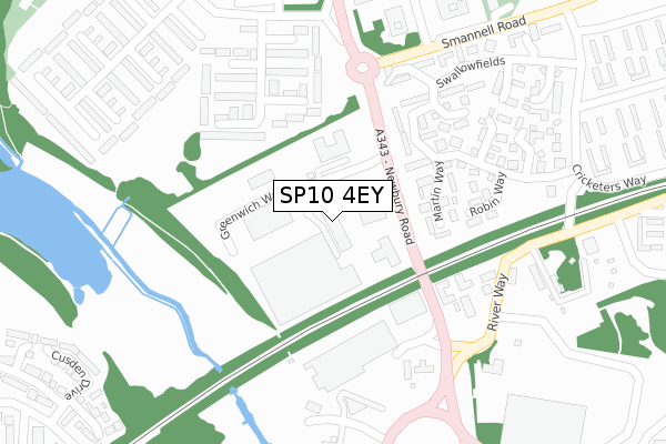
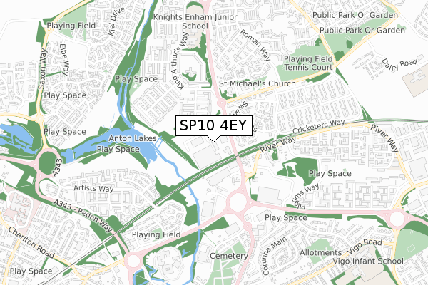
SP10 4EY maps


Source: OS Open Zoomstack (Ordnance Survey)
Licence: Open Government Licence (requires attribution)
Attribution: Contains OS data © Crown copyright and database right 2025
Source: Open Postcode Geo
Licence: Open Government Licence (requires attribution)
Attribution: Contains OS data © Crown copyright and database right 2025; Contains Royal Mail data © Royal Mail copyright and database right 2025; Source: Office for National Statistics licensed under the Open Government Licence v.3.0
Licence: Open Government Licence (requires attribution)
Attribution: Contains OS data © Crown copyright and database right 2025
Source: Open Postcode Geo
Licence: Open Government Licence (requires attribution)
Attribution: Contains OS data © Crown copyright and database right 2025; Contains Royal Mail data © Royal Mail copyright and database right 2025; Source: Office for National Statistics licensed under the Open Government Licence v.3.0
SP10 4EY geodata
| Easting | 436535 |
| Northing | 146781 |
| Latitude | 51.219060 |
| Longitude | -1.478249 |
Where is SP10 4EY?
| Country | England |
| Postcode District | SP10 |
Politics
| Ward | Andover Harroway |
|---|---|
| Constituency | North West Hampshire |
Transport
Nearest bus stops to SP10 4EY
| Enham Arch (A343 Newbury Road) | Andover | 95m |
| Enham Arch (A343 Newbury Road) | Andover | 127m |
| Tesco Superstore (River Way) | River Way | 282m |
| Tesco Superstore (River Way) | River Way | 288m |
| Spring Meadows (Smannell Road) | Cricketers Way | 314m |
Nearest railway stations to SP10 4EY
| Andover Station | 1.3km |
Deprivation
70.8% of English postcodes are less deprived than SP10 4EY:Food Standards Agency
Three nearest food hygiene ratings to SP10 4EY (metres)
Next
Unit 4
173m
Burger King

Unit 7
175m
B And M Retail Limited

Unit 1
175m
➜ Get more ratings from the Food Standards Agency
Nearest post box to SP10 4EY
| Last Collection | |||
|---|---|---|---|
| Location | Mon-Fri | Sat | Distance |
| King Arthurs Way Post Office | 18:30 | 12:00 | 368m |
| Smannel Road | 17:15 | 12:00 | 611m |
| St Johns Road | 17:45 | 12:15 | 872m |
SP10 4EY ITL and SP10 4EY LAU
The below table lists the International Territorial Level (ITL) codes (formerly Nomenclature of Territorial Units for Statistics (NUTS) codes) and Local Administrative Units (LAU) codes for SP10 4EY:
| ITL 1 Code | Name |
|---|---|
| TLJ | South East (England) |
| ITL 2 Code | Name |
| TLJ3 | Hampshire and Isle of Wight |
| ITL 3 Code | Name |
| TLJ36 | Central Hampshire |
| LAU 1 Code | Name |
| E07000093 | Test Valley |
SP10 4EY census areas
The below table lists the Census Output Area (OA), Lower Layer Super Output Area (LSOA), and Middle Layer Super Output Area (MSOA) for SP10 4EY:
| Code | Name | |
|---|---|---|
| OA | E00117650 | |
| LSOA | E01023153 | Test Valley 002A |
| MSOA | E02004815 | Test Valley 002 |
Nearest postcodes to SP10 4EY
| SP10 5PF | Martin Way | 167m |
| SP10 4DU | Greenwich Way | 175m |
| SP10 4BE | Camelot Close | 176m |
| SP10 5PH | Robin Way | 221m |
| SP10 5PN | Swallowfields | 225m |
| SP10 4BD | Camelot Close | 232m |
| SP10 5PA | Blackbird Court | 242m |
| SP10 5PG | Plover Close | 242m |
| SP10 4BG | Camelot Close | 252m |
| SP10 5PJ | Swift Close | 265m |