SO41 9PB open data databoard
- Home
- Postcode
- SO
- SO41
- SO41 9
SO41 9PB is located in the Lymington electoral ward, within the local authority district of New Forest and the English Parliamentary constituency of New Forest West. The Sub Integrated Care Board (ICB) Location is NHS Hampshire and Isle of Wight ICB - D9Y0V and the police force is Hampshire. This postcode has been in use since June 2018.
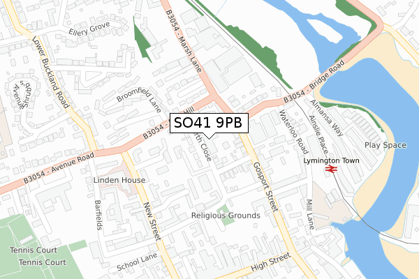
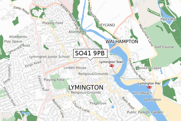
SO41 9PB maps


Source: OS Open Zoomstack (Ordnance Survey)
Licence: Open Government Licence (requires attribution)
Attribution: Contains OS data © Crown copyright and database right 2025
Source: Open Postcode GeoLicence: Open Government Licence (requires attribution)
Attribution: Contains OS data © Crown copyright and database right 2025; Contains Royal Mail data © Royal Mail copyright and database right 2025; Source: Office for National Statistics licensed under the Open Government Licence v.3.0
SO41 9PB geodata
| Easting | 432463 |
| Northing | 95880 |
| Latitude | 50.761600 |
| Longitude | -1.541088 |
Where is SO41 9PB?
| Country | England |
| Postcode District | SO41 |
Politics
| Ward | Lymington |
|---|
| Constituency | New Forest West |
|---|
Transport
Nearest bus stops to SO41 9PB
| Bridge Road (Gosport Street) | Lymington | 76m |
| Bridge Road (Gosport Street) | Lymington | 84m |
| Station Street (Gosport Street) | Lymington | 245m |
| Station Street (Gosport Street) | Lymington | 250m |
| Town Railway Station (Forecourt) | Lymington | 282m |
Nearest railway stations to SO41 9PB
| Lymington Town Station | 0.3km |
| Lymington Pier Station | 0.9km |
| Sway Station | 5.5km |
Broadband
Broadband access in SO41 9PB (2020 data)
| Percentage of properties with Next Generation Access | 100.0% |
| Percentage of properties with Superfast Broadband | 100.0% |
| Percentage of properties with Ultrafast Broadband | 100.0% |
| Percentage of properties with Full Fibre Broadband | 100.0% |
Superfast Broadband is between 30Mbps and 300Mbps
Ultrafast Broadband is > 300Mbps
Broadband limitations in SO41 9PB (2020 data)
| Percentage of properties unable to receive 2Mbps | 0.0% |
| Percentage of properties unable to receive 5Mbps | 0.0% |
| Percentage of properties unable to receive 10Mbps | 0.0% |
| Percentage of properties unable to receive 30Mbps | 0.0% |
Deprivation
41.2% of English postcodes are less deprived than
SO41 9PB:
Food Standards Agency
Three nearest food hygiene ratings to SO41 9PB (metres)
DURLSTON HOUSE B & B
CIAO BELLI
LYMINGTON COMMUNITY ASSOCIATION
➜ Get more ratings from the Food Standards Agency
Nearest post box to SO41 9PB
| | Last Collection | |
|---|
| Location | Mon-Fri | Sat | Distance |
|---|
| New Street | 17:15 | 11:45 | 213m |
| Railway Station | 17:00 | 11:30 | 292m |
| Emsworth Road | 17:00 | 12:00 | 330m |
SO41 9PB ITL and SO41 9PB LAU
The below table lists the International Territorial Level (ITL) codes (formerly Nomenclature of Territorial Units for Statistics (NUTS) codes) and Local Administrative Units (LAU) codes for SO41 9PB:
| ITL 1 Code | Name |
|---|
| TLJ | South East (England) |
| ITL 2 Code | Name |
|---|
| TLJ3 | Hampshire and Isle of Wight |
| ITL 3 Code | Name |
|---|
| TLJ36 | Central Hampshire |
| LAU 1 Code | Name |
|---|
| E07000091 | New Forest |
SO41 9PB census areas
The below table lists the Census Output Area (OA), Lower Layer Super Output Area (LSOA), and Middle Layer Super Output Area (MSOA) for SO41 9PB:
| Code | Name |
|---|
| OA | E00117094 | |
|---|
| LSOA | E01023042 | New Forest 017D |
|---|
| MSOA | E02004795 | New Forest 017 |
|---|
Nearest postcodes to SO41 9PB


